Area Overview for BN6 8UD
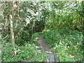
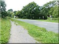
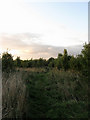
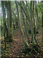
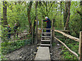
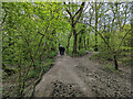
Photos of BN6 8UD
Area Information
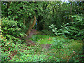
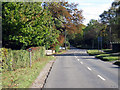
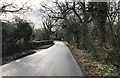
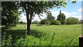
BN6 8UD is a small, tightly knit residential cluster nestled in the South Downs National Park, within the village of Ditchling in East Sussex. With a population of 2,554 spread across 23.4 hectares, this area retains a distinct rural character, shaped by its hilltop location and historic significance. The village is defined by its 13th-century flint and sandstone architecture, including St Margaret’s Church and over 40 listed buildings, reflecting centuries of settlement dating back to the Anglo-Saxon period. Daily life here is slow-paced, with a strong sense of community rooted in local traditions like the biennial Ditchling Fair. The area’s proximity to the Roman Greensand Way and its position on the watershed between the Adur and Ouse catchments make it a quiet, scenic spot, ideal for those seeking a balance between countryside tranquillity and access to nearby towns. Living in BN6 8UD means embracing a village with a creative legacy from the Arts and Crafts movement, where historic charm meets modern amenities within practical reach.
- Area Type
- Postcode
- Area Size
- 23.4 hectares
- Population
- 2554
- Population Density
- 107 people/km²
BN6 8UD is predominantly an owner-occupied area, with 83% of homes owned by residents rather than rented. The accommodation type is largely houses, which is typical of rural villages with limited high-density development. This suggests a housing stock that is both traditional and spacious, with properties likely offering garden space and a sense of privacy. Given the area’s small size and low population density, the property market here is likely to be niche, with limited turnover and strong local demand. Buyers should consider that the primary housing stock is not suited to short-term rental or investment strategies, but rather to those seeking a permanent, low-traffic home. The proximity to nearby towns like Burgess Hill may also influence property values, offering access to urban amenities without compromising on rural living.
House Prices in BN6 8UD
Showing 40 properties
| Address | Type | Beds | Baths | Last Sale Price | Last Sale Date | |
|---|---|---|---|---|---|---|
| 15 Shirleys, Ditchling, BN6 8UD | Detached | 3 | - | £1,080,000 | Dec 2024 | |
| 7 Shirleys, Ditchling, BN6 8UD | Detached | 3 | 1 | £950,000 | Jan 2024 | |
| 30 Shirleys, Ditchling, BN6 8UD | Detached | 5 | 2 | £1,390,000 | Sep 2023 | |
| 20 Shirleys, Ditchling, BN6 8UD | house | - | - | £745,000 | Sep 2020 | |
| 12 Shirleys, Ditchling, BN6 8UD | house | - | - | £1,150,000 | Oct 2019 | |
| 14 Shirleys, Ditchling, BN6 8UD | house | - | - | £875,000 | Sep 2019 | |
| 24 Shirleys, Ditchling, BN6 8UD | Detached | 5 | 3 | £725,000 | Aug 2017 | |
| 18 Shirleys, Ditchling, BN6 8UD | Detached | 3 | - | £650,000 | May 2015 | |
| 1 Shirleys, Ditchling, BN6 8UD | Detached | 4 | - | £940,000 | May 2015 | |
| 4 Shirleys, Ditchling, BN6 8UD | Detached | 5 | - | £1,195,000 | Sep 2014 |
Energy Efficiency in BN6 8UD
Living in BN6 8UD offers a blend of rural convenience and accessible amenities. The area is within practical reach of five retail venues, including Morrisons Daily Hassocks 44, Sainsburys Hassocks, and M&S Pyecombe BP, ensuring daily shopping needs are met without long journeys. The nearby rail stations connect residents to towns like Burgess Hill, expanding access to dining, entertainment, and cultural offerings. The village itself retains a historic character, with listed buildings, a 13th-century church, and the Ditchling Museum of Art + Craft, which showcases the legacy of the Arts and Crafts movement. This mix of heritage and practicality creates a lifestyle that balances quiet countryside living with the ease of nearby urban amenities.
Amenities
Schools
The nearest schools to BN6 8UD are Ditchling (St Margaret’s) Church of England Primary School and Ditchling St Margaret’s Church of England Primary School, both of which are primary institutions. While no Ofsted ratings are provided, the presence of two primary schools suggests a focus on early education within the village. Families with young children may benefit from the local availability of primary schooling, reducing the need for long commutes. However, the absence of secondary schools in the immediate area means students may need to travel to nearby towns for further education. The dual presence of Church of England schools reflects the area’s historical and religious heritage, though this does not necessarily indicate the quality of education. Parents should investigate further to understand the curriculum and facilities offered by these institutions.
| Rank | School | Type | Entry gender | Ages |
|---|
Explore more schools in this area
Go to Schools tabDemographics
The population of BN6 8UD has a median age of 47, with the elderly (65+ years) forming the most common age group. This suggests a community that is largely mature, with a focus on stability and long-term residency. Home ownership is high at 83%, indicating a predominance of owner-occupied properties rather than rental units. The accommodation type is primarily houses, reflecting a low-density, residential character. The predominant ethnic group is White, which aligns with broader trends in rural East Sussex. The relatively high proportion of elderly residents may influence local services and infrastructure, such as healthcare provision and community centres. The absence of specific data on deprivation means the quality of life here is likely shaped by the area’s low crime rates and access to natural landscapes, though further analysis would be needed to confirm this.
Household Size
Accommodation Type
Tenure
Ethnic Group
Religion
Household Composition
Age
Household Deprivation
NS-SEC
Explore more demographic insights in this area
Go to Demographics tabPlanning
Planning Constraints
- Flood RiskPremium
- Ramsar Wetland SitesPremium
- Area of Outstanding Natural BeautyPremium
- Protected Nature ReservePremium
- Protected WoodlandPremium