Area Overview for BN6 8XH
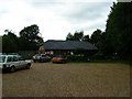
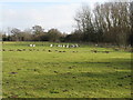
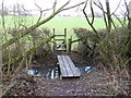
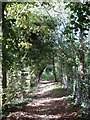
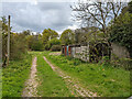
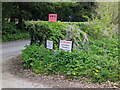
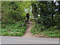
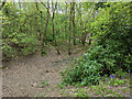
Photos of BN6 8XH
Area Information
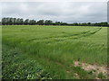
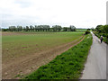
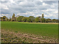
BN6 8XH is a small residential cluster in East Sussex, nestled within the South Downs National Park. With a population of 2,554 spread over 70.3 hectares, it maintains a low density of 107 people per square kilometre, offering a quiet, rural lifestyle. The area is part of Westmeston village, historically linked to ancient woodlands, the Bevern Stream, and Bronze Age wells. While it lies within the National Park’s southern half, it falls under Lewes District Council’s jurisdiction. Daily life here is shaped by proximity to Ditchling, which hosts key amenities, and the surrounding natural landscape. The village’s character is defined by its reliance on nearby towns for services, with a strong sense of community rooted in its historical ties to medieval settlements and Norman-era St Martin’s Church. For those seeking a peaceful, low-density environment with access to green spaces, BN6 8XH offers a blend of rural charm and practical connectivity.
- Area Type
- Postcode
- Area Size
- 70.3 hectares
- Population
- 2554
- Population Density
- 107 people/km²
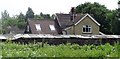
BN6 8XH is primarily an owner-occupied area, with 83% of homes owned by residents rather than rented. The accommodation type is exclusively houses, not flats, which aligns with the area’s rural character and low population density. This suggests a housing stock that is likely older, with traditional layouts suited to family living. The small size of the postcode area means the number of properties is limited, potentially reducing competition for buyers. However, the proximity to Ditchling and other nearby towns may offer more options for those seeking additional properties. For buyers, the focus would be on individual homes rather than larger developments, with a need to consider surrounding areas for broader choices.
House Prices in BN6 8XH
Showing 20 properties
| Address | Type | Beds | Baths | Last Sale Price | Last Sale Date | |
|---|---|---|---|---|---|---|
| Green Plat, Spatham Lane, Westmeston, BN6 8XH | house | - | - | £1,345,000 | Jan 2023 | |
| Larchfield, Spatham Lane, Westmeston, BN6 8XH | Bungalow | - | - | £688,000 | Jan 2022 | |
| Newtons, Spatham Lane, Westmeston, BN6 8XH | house | - | - | £648,750 | Sep 2016 | |
| The Bungalow, Little Spatham Farm, Spatham Lane, Westmeston, BN6 8XH | Detached | 7 | 4 | - | - | |
| Spatham Farm Cottage, Spatham Lane, Westmeston, BN6 8XH | Detached | - | - | - | - | |
| Caravan At, Green Plat, Spatham Lane, Westmeston, BN6 8XH | Mobile Home | - | - | - | - | |
| Flat At, Little Spatham Farm, Spatham Lane, Westmeston, BN6 8XH | Flat | 2 | 1 | - | - | |
| Sorrento, Spatham Lane, Westmeston, BN6 8XH | Semi-detached | - | - | - | - | |
| Lane End, Spatham Lane, Westmeston, BN6 8XH | house | - | - | - | - | |
| Ivinghoe, Spatham Lane, Westmeston, BN6 8XH | Detached | - | - | - | - |
Energy Efficiency in BN6 8XH
Living in BN6 8XH offers access to nearby rail stations, retail outlets, and the natural environment of the South Downs. The area’s proximity to Ditchling means residents can reach shops, schools, and services without long commutes. Specific retail points include Sainsburys and Co-op, providing grocery and daily essentials. The rural setting includes ancient woodlands and historical sites like the Village Well, offering recreational and cultural opportunities. While the area itself is small, its integration with surrounding towns ensures a balance between tranquillity and practical amenities. The low population density and natural surroundings contribute to a lifestyle prioritising peace and green space over urban convenience.
Amenities
Schools
The nearest schools to BN6 8XH are Ditchling (St Margaret’s) Church of England Primary School and Ditchling St Margaret’s Church of England Primary School. Both are primary schools, but no Ofsted ratings are provided in the data. The presence of two primary schools within the area suggests a focus on early education, though secondary schooling would require travel to nearby towns. Families with children may need to look beyond BN6 8XH for comprehensive educational options, as no secondary schools are listed. The duplication of school names may indicate a single institution with multiple references, but this remains unclear without further details.
| Rank | School | Type | Entry gender | Ages |
|---|
Explore more schools in this area
Go to Schools tabDemographics
BN6 8XH has a median age of 47, with the elderly (65+ years) forming the most common age range. Home ownership is high at 83%, reflecting a stable, long-term resident base. The area is predominantly composed of houses, not flats, and the majority of residents identify as White. This demographic profile suggests a mature, settled community with limited generational turnover. The absence of specific data on deprivation or diversity means the area’s social dynamics are not quantified beyond these figures. The high home ownership rate and older population indicate a neighbourhood where families may have lived for decades, with fewer transient residents.
Household Size
Accommodation Type
Tenure
Ethnic Group
Religion
Household Composition
Age
Household Deprivation
NS-SEC
Explore more demographic insights in this area
Go to Demographics tabPlanning
Planning Constraints
- Flood RiskPremium
- Ramsar Wetland SitesPremium
- Area of Outstanding Natural BeautyPremium
- Protected Nature ReservePremium
- Protected WoodlandPremium