Area Overview for BN6 8SA
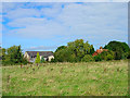
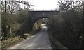
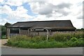
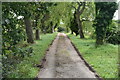
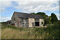
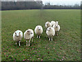
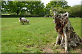
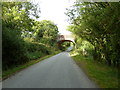
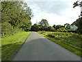
Photos of BN6 8SA
Area Information
BN6 8SA is a small, rural postcode area nestled within the South Downs National Park in East Sussex. Covering 62.3 hectares, it is home to just 1,163 residents, reflecting a low population density of 43 people per square kilometre. The area is part of the village of Streat, a historic settlement with evidence of human activity dating back 7,000 years. Positioned on the Greensand Ridge, it blends rural charm with proximity to nearby towns like Burgess Hill and Lewes, offering a quiet, low-density lifestyle. The village retains unimproved meadows, ancient droveways, and open commons, creating a landscape defined by natural beauty and historical significance. With a median age of 47 and a population skewed toward adults aged 30–64, the community is stable and mature, with 74% of homes owner-occupied. Living here means embracing a tranquil, self-contained environment, where the pace of life is slower and the sense of place is deeply rooted in the land and its heritage.
- Area Type
- Postcode
- Area Size
- 62.3 hectares
- Population
- 1163
- Population Density
- 43 people/km²
The property market in BN6 8SA is dominated by owner-occupied homes, with 74% of residents living in properties they own. This high rate of home ownership suggests a stable, long-term community with limited rental activity. The area is primarily composed of houses, indicating a focus on family-friendly, detached or semi-detached properties. Given the small size of the postcode area (62.3 hectares) and its low population density, the housing stock is likely limited, with few new developments. This scarcity could drive up property values, making the area appealing to buyers seeking a quiet, rural lifestyle. However, the small size also means the market is niche, with limited options for those prioritising proximity to urban amenities. Buyers should consider the area’s historical character and planning constraints, such as protected woodland, which may affect future development potential.
House Prices in BN6 8SA
Showing 12 properties
| Address | Type | Beds | Baths | Last Sale Price | Last Sale Date | |
|---|---|---|---|---|---|---|
| Stonehealed Farm, Streat Lane, Streat, BN6 8SA | Detached | 4 | 2 | £2,175,000 | Nov 2017 | |
| Roxborough Farm, Streat Lane, Streat, BN6 8SA | house | - | - | £840,000 | Jul 2016 | |
| Shangri La, Streat Lane, Streat, BN6 8SA | Bungalow | 3 | 1 | - | - | |
| Roxborough Stables, Streat Lane, Streat, BN6 8SA | Detached | 4 | 3 | - | - | |
| 2, Malthouse Barn, Streat Lane, Streat, BN6 8SA | house | - | - | - | - | |
| 1, Malthouse Barn, Streat Lane, Streat, BN6 8SA | house | - | - | - | - | |
| Stud Farm, Malthouse Farm, Streat Lane, Streat, BN6 8SA | Equestrian | - | - | - | - | |
| Annexe At, Stonehealed, Streat Lane, Streat, BN6 8SA | Semi-detached | - | - | - | - | |
| Riddens Yard, Streat Lane, Streat, BN6 8SA | Bungalow | - | - | - | - | |
| Meadowsweet Cottage, Streat Lane, Streat, BN6 8SA | Detached | - | - | - | - |
Energy Efficiency in BN6 8SA
Living in BN6 8SA offers a blend of rural tranquillity and small-town convenience. The area’s proximity to rail stations like Plumpton and Burgess Hill ensures easy access to nearby amenities, while local shops such as Co-op Burgess and Morrisons Daily provide essential retail services. The nearby Sheffield Park metro stop adds to the area’s connectivity. The village of Streat itself retains unimproved meadows, ancient droveways, and open commons like Streat Lane Green, offering residents opportunities for outdoor activities and a connection to the natural landscape. This mix of historical character and practical amenities creates a lifestyle that balances seclusion with accessibility, ideal for those seeking a slower pace of life without complete isolation from urban resources.
Amenities
Schools
The nearest school to BN6 8SA is Plumpton College, a sixth-form institution. This suggests that the area lacks primary or secondary schools, making it more suited for families with older children or those willing to commute to nearby towns for younger education. Plumpton College’s presence indicates a focus on post-16 education, which could be a draw for households with teenagers. However, the absence of primary or secondary schools in the immediate vicinity means families may need to rely on transport links to nearby settlements like Burgess Hill or Lewes. This limitation should be weighed against the area’s rural tranquillity and low population density, which may appeal to those prioritising a quiet environment over proximity to schools.
| Rank | School | Type | Entry gender | Ages |
|---|
Explore more schools in this area
Go to Schools tabDemographics
The population of BN6 8SA is predominantly adults aged 30–64, with a median age of 47. This suggests a community of established professionals, retirees, and families in their prime earning years. Home ownership is high, with 74% of residents owning their homes, indicating a stable, long-term demographic. The area is characterised by houses as the primary accommodation type, reflecting a preference for detached or semi-detached properties. The predominant ethnic group is White, with no specific data provided on other groups. The low population density of 43 people per square kilometre implies a spread-out, less congested living environment. This demographic profile aligns with a mature, low-mobility population, where family homes and long-term residency are the norm. The absence of detailed diversity metrics means the community’s social composition remains largely defined by its historical and geographic context.
Household Size
Accommodation Type
Tenure
Ethnic Group
Religion
Household Composition
Age
Household Deprivation
NS-SEC
Explore more demographic insights in this area
Go to Demographics tabPlanning
Planning Constraints
- Flood RiskPremium
- Ramsar Wetland SitesPremium
- Area of Outstanding Natural BeautyPremium
- Protected Nature ReservePremium
- Protected WoodlandPremium