Area Overview for BN6 8SB
Photos of BN6 8SB
Area Information
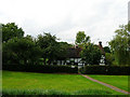
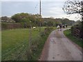
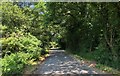
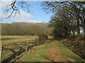
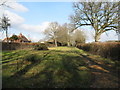
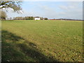
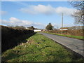
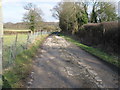
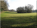
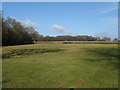
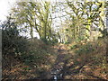
BN6 8SB is a small, rural postcode area in East Sussex, nestled within the South Downs National Park. Spanning 71.5 hectares, it is home to just 1163 people, giving it a low population density of 43 people per square kilometre. The area is part of the village of Streat, a historic settlement with roots dating back 7,000 years. Its location on the Greensand Ridge offers open landscapes, ancient meadows, and views over the South Downs. Daily life here is characterised by a quiet, rural rhythm, with access to nearby towns like Burgess Hill and Lewes for amenities. The village retains its traditional charm, with features like the 11th-century Streat Parish Church and Grade II* listed Streat Place manor house. While the area is small, it is well-connected to rail networks, including Plumpton and Burgess Hill stations, and lies near the Sheffield Park Metro station. This balance of natural beauty and practical connectivity makes BN6 8SB appealing to those seeking a peaceful yet accessible lifestyle.
- Area Type
- Postcode
- Area Size
- 71.5 hectares
- Population
- 1163
- Population Density
- 43 people/km²
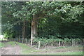
BN6 8SB is predominantly an owner-occupied area, with 74% of homes owned by their residents. The housing stock is largely composed of houses, reflecting the rural character of the village. This contrasts with areas dominated by flats or rental properties, making BN6 8SB a niche market for buyers seeking traditional, spacious homes. The small size of the postcode area means the housing stock is limited, with few properties available for purchase. Buyers should consider nearby towns like Burgess Hill or Lewes for a broader range of options. The high home ownership rate suggests a stable market, but the limited supply could lead to competitive bidding. The presence of protected woodland within the area may also influence planning permissions, requiring buyers to conduct thorough checks on any property’s compliance with environmental constraints.
House Prices in BN6 8SB
Showing 12 properties
| Address | Type | Beds | Baths | Last Sale Price | Last Sale Date | |
|---|---|---|---|---|---|---|
| Gallops Farm, Streat Lane, Westmeston, BN6 8SB | Detached | - | - | £195,000 | Jan 2023 | |
| Rumpus Cottage, Streat Lane, Streat, BN6 8SB | house | - | - | £480,000 | Apr 2022 | |
| Old Barns Farm, Streat Lane, Westmeston, BN6 8SB | Detached | - | - | £1,165,000 | Sep 2021 | |
| Glebe Farm, Streat Lane, Streat, BN6 8SB | Detached | - | - | £360,000 | Aug 2003 | |
| Captains Farm, Streat Lane, Streat, BN6 8SB | Farm | - | - | - | - | |
| Deans Farmhouse, Deans Farm, Hemsleys Lane, Streat, BN6 8SB | Detached | - | - | - | - | |
| Blair Court, Streat Lane, Streat, BN6 8SB | house | - | - | - | - | |
| Captains House, Streat Lane, Streat, BN6 8SB | Detached | - | - | - | - | |
| Hortons, Hemsleys Lane, Streat, BN6 8SB | house | - | - | - | - | |
| Deans Farm, Hemsleys Lane, Streat, BN6 8SB | house | - | - | - | - |
Energy Efficiency in BN6 8SB
BN6 8SB offers a blend of rural tranquillity and practical amenities. Nearby retail options include Morrisons Daily, Co-op Burgess, and The Southern Co-operative, providing essential shopping within easy reach. The proximity to rail stations and Sheffield Park Metro station ensures convenient access to public transport, facilitating travel to nearby towns. The area’s natural surroundings, including open commons and ancient meadows, offer opportunities for walking, cycling, and outdoor recreation. The village’s historic character, with landmarks like Streat Parish Church, adds cultural value to daily life. While the area is small, its connectivity to nearby services and green spaces creates a lifestyle that balances seclusion with accessibility.
Amenities
Schools
The nearest school to BN6 8SB is Plumpton College, a sixth-form institution. This suggests that the area is more suited to families with older children or those seeking post-16 education. For younger students, the lack of primary or secondary schools within the postcode means parents would need to look to nearby towns like Burgess Hill or Lewes for schooling options. Plumpton College’s presence highlights the area’s role as a commuter hub for students attending higher education. Families with younger children may need to factor in travel time to schools in adjacent areas. The absence of local primary schools could be a consideration for those prioritising proximity to education for younger children.
| Rank | School | Type | Entry gender | Ages |
|---|
Explore more schools in this area
Go to Schools tabDemographics
The population of BN6 8SB is predominantly middle-aged, with a median age of 47 and the most common age range being adults aged 30–64. This suggests a community of established residents, many of whom may be homeowners. Home ownership is high at 74%, indicating a stable, long-term population. The area is primarily composed of houses, reflecting a traditional, low-density housing stock. The predominant ethnic group is White, aligning with broader regional demographics. With a population of 1163, the area is small enough to foster a close-knit community but large enough to support essential services. The absence of specific data on deprivation means the quality of life is inferred from the area’s safety, amenities, and natural surroundings. The low crime risk and proximity to green spaces suggest a lifestyle that prioritises tranquillity and environmental connection.
Household Size
Accommodation Type
Tenure
Ethnic Group
Religion
Household Composition
Age
Household Deprivation
NS-SEC
Explore more demographic insights in this area
Go to Demographics tabPlanning
Planning Constraints
- Flood RiskPremium
- Ramsar Wetland SitesPremium
- Area of Outstanding Natural BeautyPremium
- Protected Nature ReservePremium
- Protected WoodlandPremium