Area Overview for BN6 8RH
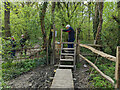
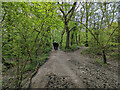
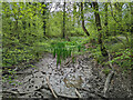
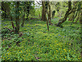
Photos of BN6 8RH
Area Information
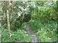
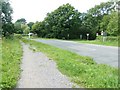
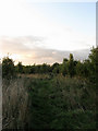
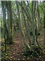
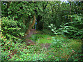
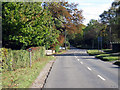
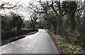
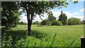
BN6 8RH is a small, residential postcode area nestled in East Sussex, within the South Downs National Park. Covering 84.7 hectares, it is home to 2,554 people, with a population density of 107 people per square kilometre. This village is part of the broader Westmeston parish, historically linked to ancient woodlands, the Bevern Stream, and early settlements. Its location between Ditchling and the South Downs escarpment offers a rural character, though residents rely on nearby Ditchling for daily amenities. The area is marked by low crime rates and minimal flood risk, with a safety score of 85. Its proximity to rail stations like Plumpton and Burgess Hill, combined with a mix of retail options, makes it accessible yet tranquil. The community is predominantly elderly, with a median age of 47, and 83% of homes are owner-occupied. This small cluster of houses reflects a stable, long-term resident base, shaped by its historical ties to the region’s agricultural past and protected landscapes.
- Area Type
- Postcode
- Area Size
- 84.7 hectares
- Population
- 2554
- Population Density
- 107 people/km²
BN6 8RH is primarily an owner-occupied area, with 83% of homes owned by residents rather than rented. The accommodation type is houses, suggesting a mix of older, traditional properties typical of rural villages. Given the area’s small size and low population density, the housing stock is limited, with little scope for new developments. This makes the market competitive for buyers seeking a home in this specific postcode. Proximity to Ditchling, which hosts more amenities, may influence property values, as residents often rely on nearby towns for services. The high home ownership rate also indicates a stable community with long-term residents. For buyers, this means a focus on existing properties, though the presence of protected woodland could introduce constraints on renovations or extensions. The area’s character—blending rural tranquillity with accessible transport—appeals to those prioritising safety and a slower pace of life.
House Prices in BN6 8RH
Showing 26 properties
| Address | Type | Beds | Baths | Last Sale Price | Last Sale Date | |
|---|---|---|---|---|---|---|
| Charters, Lewes Road, Westmeston, BN6 8RH | Detached | 4 | 2 | £1,600,000 | Oct 2022 | |
| Barncroft, Lewes Road, Westmeston, BN6 8RH | house | - | - | £1,175,000 | Jun 2021 | |
| South Bank Cottage, Lewes Road, Westmeston, BN6 8RH | Semi-detached | 3 | 2 | £625,000 | Jun 2021 | |
| Rectory Cottage, Lewes Road, Westmeston, BN6 8RH | Detached | 3 | 3 | £1,390,000 | May 2021 | |
| Cripps Cottage, Lewes Road, Westmeston, BN6 8RH | house | - | - | £920,000 | Sep 2017 | |
| April Cottage, Lewes Road, Westmeston, BN6 8RH | Detached | 4 | 3 | £1,000,000 | Dec 2016 | |
| Lily Bank, Lewes Road, Westmeston, BN6 8RH | Semi-detached | 3 | 1 | £400,000 | Oct 2012 | |
| Church Cottage, Lewes Road, Westmeston, BN6 8RH | Detached | 4 | 2 | £790,000 | Aug 2010 | |
| Michelbornes, Lewes Road, Westmeston, BN6 8RH | Terraced | - | - | £350,000 | Sep 2005 | |
| Foxwell, Lewes Road, Westmeston, BN6 8RH | Detached | - | - | £589,000 | Jun 2003 |
Energy Efficiency in BN6 8RH
Living in BN6 8RH offers a blend of rural tranquillity and accessible amenities. Within practical reach are five retail outlets, including Morrisons Daily Hassocks 44 and Sainsburys Hassocks, providing everyday shopping needs. The area’s proximity to rail stations like Plumpton and Burgess Hill enhances mobility, connecting residents to nearby towns for dining, leisure, and services. The village itself is characterised by ancient woodlands and historical sites, such as the Bevern Stream and St Martin’s Church, offering a sense of heritage. While the immediate area lacks large-scale leisure facilities, the surrounding South Downs National Park provides opportunities for outdoor activities. The lifestyle here is suited to those who value a peaceful environment, with a focus on community and natural landscapes. However, residents may need to travel further for specialist amenities, reflecting the village’s small-scale, self-contained nature.
Amenities
Schools
Residents of BN6 8RH have access to two primary schools within practical reach: Ditchling (St Margaret’s) Church of England Primary School and Ditchling St Margaret’s Church of England Primary School. Both are primary institutions, though specific Ofsted ratings are not provided in the data. The availability of two primary schools suggests a focus on early education, which is crucial for families with young children. However, the absence of secondary schools in the immediate area means students may need to travel to nearby towns like Ditchling or Burgess Hill for further education. This could be a consideration for families planning long-term in the area. The schools’ proximity to the village reflects the community’s emphasis on local services, though parents should factor in the need for additional transport for older children.
| Rank | School | Type | Entry gender | Ages |
|---|
Explore more schools in this area
Go to Schools tabDemographics
BN6 8RH has a median age of 47, with the most common age range being elderly (65+ years). This suggests a community skewed towards older residents, likely living in family homes or long-standing properties. Home ownership is high at 83%, indicating a stable population with limited rental activity. The accommodation type is predominantly houses, reflecting a traditional, low-density housing stock. The predominant ethnic group is White, aligning with broader trends in rural East Sussex. While specific data on deprivation is not provided, the high home ownership rate and low crime risk imply a relatively affluent and secure environment. The presence of protected woodland, however, may influence planning regulations, affecting property development. For residents, this means a quiet, established neighbourhood with minimal turnover, though potential buyers should consider the area’s limited growth prospects.
Household Size
Accommodation Type
Tenure
Ethnic Group
Religion
Household Composition
Age
Household Deprivation
NS-SEC
Explore more demographic insights in this area
Go to Demographics tabPlanning
Planning Constraints
- Flood RiskPremium
- Ramsar Wetland SitesPremium
- Area of Outstanding Natural BeautyPremium
- Protected Nature ReservePremium
- Protected WoodlandPremium