Area Overview for SK5 6QG
Photos of SK5 6QG
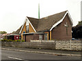
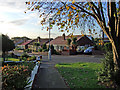
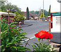
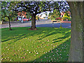
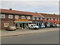

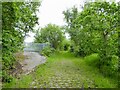
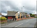
53 photos from this area
Area Information
Key information about the SK5 6QG including its size, population, and administrative classification.
- Area Type
- Postcode
- Area Size
- 2.2 hectares
- Population
- 1518
- Population Density
- 3992 people/km²
House Prices in SK5 6QG
38
Properties
£125,300
Average Sold Price
£36,500
Lowest Price
£270,000
Highest Price
Showing 38 properties
| Address | Type | Beds | Baths | Last Sale Price | Last Sale Date | |
|---|---|---|---|---|---|---|
| 195 Thornley Lane South, North Reddish, Stockport, SK5 6QG | Semi-detached | 3 | 1 | £270,000 | Oct 2023 | |
| 205 Thornley Lane South, North Reddish, Stockport, SK5 6QG | Retail | 3 | 1 | £230,000 | May 2022 | |
| 180 Thornley Lane South, North Reddish, Stockport, SK5 6QG | house | - | - | £220,000 | Jan 2022 | |
| 206 Thornley Lane South, North Reddish, Stockport, SK5 6QG | house | - | - | £228,300 | Feb 2021 | |
| 192 Thornley Lane South, North Reddish, Stockport, SK5 6QG | Terraced | 3 | 1 | £160,000 | Nov 2018 | |
| 187 Thornley Lane South, North Reddish, Stockport, SK5 6QG | Semi-detached | 3 | 1 | £160,000 | Apr 2018 | |
| 197 Thornley Lane South, North Reddish, Stockport, SK5 6QG | house | 3 | 1 | £176,000 | Feb 2016 | |
| 191 Thornley Lane South, North Reddish, Stockport, SK5 6QG | house | 3 | - | £120,000 | Oct 2010 | |
| 188 Thornley Lane South, North Reddish, Stockport, SK5 6QG | house | - | - | £124,000 | Mar 2008 | |
| 200 Thornley Lane South, North Reddish, Stockport, SK5 6QG | house | - | - | £100,000 | Mar 2007 |
Page 1 of 4
Energy Efficiency in SK5 6QG
Amenities
Schools
| Rank | School | Type | Entry gender | Ages |
|---|
Explore more schools in this area
Go to Schools tabDemographics
Household Size
Two person
most common
Accommodation Type
Houses
most common
Tenure
90
majority
Ethnic Group
White
most common
Religion
N/A
most common
Household Composition
N/A
most common
Age
47
median
Adults (30-64 years)
most common
Household Deprivation
N/A
with no deprivation
NS-SEC
34
in Lower managerial occupations
Explore more demographic insights in this area
Go to Demographics tabPlanning
Planning Constraints
- Flood RiskPremium
- Ramsar Wetland SitesPremium
- Area of Outstanding Natural BeautyPremium
- Protected Nature ReservePremium
- Protected WoodlandPremium