Area Overview for SK5 6QE
Photos of SK5 6QE
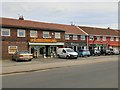
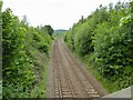
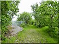
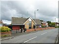
53 photos from this area
Area Information
Key information about the SK5 6QE including its size, population, and administrative classification.
- Area Type
- Postcode
- Area Size
- 1.5 hectares
- Population
- 1530
- Population Density
- 8169 people/km²
House Prices in SK5 6QE
40
Properties
£114,826
Average Sold Price
£36,950
Lowest Price
£235,000
Highest Price
Showing 40 properties
| Address | Type | Beds | Baths | Last Sale Price | Last Sale Date | |
|---|---|---|---|---|---|---|
| 74 Somerford Road, North Reddish, Stockport, SK5 6QE | Terraced | 2 | 1 | £150,000 | Dec 2023 | |
| 82 Somerford Road, North Reddish, Stockport, SK5 6QE | house | - | - | £165,000 | Jul 2023 | |
| 78 Somerford Road, North Reddish, Stockport, SK5 6QE | Terraced | 2 | 1 | £220,000 | Nov 2022 | |
| 100 Somerford Road, North Reddish, Stockport, SK5 6QE | Semi-detached | 3 | 1 | £235,000 | Sep 2022 | |
| 102 Somerford Road, North Reddish, Stockport, SK5 6QE | house | 2 | 1 | £168,000 | Feb 2022 | |
| 118 Somerford Road, North Reddish, Stockport, SK5 6QE | house | 3 | 1 | £183,500 | Sep 2020 | |
| 76 Somerford Road, North Reddish, Stockport, SK5 6QE | house | - | - | £140,000 | Apr 2020 | |
| 140 Somerford Road, North Reddish, Stockport, SK5 6QE | Terraced | 3 | 1 | £148,000 | Aug 2018 | |
| 104 Somerford Road, North Reddish, Stockport, SK5 6QE | Terraced | 2 | - | £98,000 | May 2015 | |
| 88 Somerford Road, North Reddish, Stockport, SK5 6QE | house | 3 | 1 | £93,000 | Feb 2015 |
Page 1 of 4
Energy Efficiency in SK5 6QE
Amenities
Schools
| Rank | School | Type | Entry gender | Ages |
|---|
Explore more schools in this area
Go to Schools tabDemographics
Household Size
Family (3-5 people)
most common
Accommodation Type
Houses
most common
Tenure
73
majority
Ethnic Group
White
most common
Religion
N/A
most common
Household Composition
N/A
most common
Age
47
median
Adults (30-64 years)
most common
Household Deprivation
N/A
with no deprivation
NS-SEC
27
in Lower managerial occupations
Explore more demographic insights in this area
Go to Demographics tabPlanning
Planning Constraints
- Flood RiskPremium
- Ramsar Wetland SitesPremium
- Area of Outstanding Natural BeautyPremium
- Protected Nature ReservePremium
- Protected WoodlandPremium