Area Overview for M34 2HY
Photos of M34 2HY

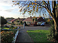
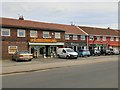
53 photos from this area
Area Information
Key information about the M34 2HY including its size, population, and administrative classification.
- Area Type
- Postcode
- Area Size
- 1.1 hectares
- Population
- 1518
- Population Density
- 3992 people/km²
House Prices in M34 2HY
27
Properties
£177,769
Average Sold Price
£50,000
Lowest Price
£417,500
Highest Price
Showing 27 properties
| Address | Type | Beds | Baths | Last Sale Price | Last Sale Date | |
|---|---|---|---|---|---|---|
| 83 Dane Road, Denton, M34 2HY | house | 5 | 2 | £417,500 | Mar 2025 | |
| 93 Dane Road, Denton, M34 2HY | Semi-detached | 3 | 1 | £310,000 | Oct 2024 | |
| 79 Dane Road, Denton, M34 2HY | Semi-detached | 2 | 1 | £250,000 | Sep 2024 | |
| 97 Dane Road, Denton, M34 2HY | house | - | - | £226,000 | Jan 2022 | |
| 53 Dane Road, Denton, M34 2HY | Semi-detached | 4 | 1 | £315,000 | Sep 2021 | |
| 103 Dane Road, Denton, M34 2HY | house | - | - | £250,000 | Jan 2021 | |
| 77 Dane Road, Denton, M34 2HY | Semi-detached | 2 | 1 | £168,500 | Aug 2020 | |
| 81 Dane Road, Denton, M34 2HY | Semi-detached | 3 | - | £175,000 | Jun 2017 | |
| 55 Dane Road, Denton, M34 2HY | Semi-detached | 4 | 2 | £218,500 | Apr 2017 | |
| 61 Dane Road, Denton, M34 2HY | house | - | - | £97,500 | Mar 2016 |
Page 1 of 3
Energy Efficiency in M34 2HY
Amenities
Schools
| Rank | School | Type | Entry gender | Ages |
|---|
Explore more schools in this area
Go to Schools tabDemographics
Household Size
Two person
most common
Accommodation Type
Houses
most common
Tenure
90
majority
Ethnic Group
White
most common
Religion
N/A
most common
Household Composition
N/A
most common
Age
47
median
Adults (30-64 years)
most common
Household Deprivation
N/A
with no deprivation
NS-SEC
34
in Lower managerial occupations
Explore more demographic insights in this area
Go to Demographics tabPlanning
Planning Constraints
- Flood RiskPremium
- Ramsar Wetland SitesPremium
- Area of Outstanding Natural BeautyPremium
- Protected Nature ReservePremium
- Protected WoodlandPremium