Area Overview for M34 2HZ
Photos of M34 2HZ

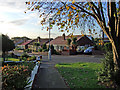
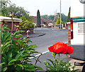
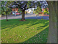
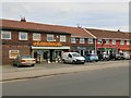

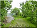
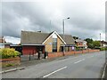
53 photos from this area
Area Information
Key information about the M34 2HZ including its size, population, and administrative classification.
- Area Type
- Postcode
- Area Size
- 8262 m²
- Population
- 1518
- Population Density
- 3992 people/km²
House Prices in M34 2HZ
25
Properties
£146,553
Average Sold Price
£39,000
Lowest Price
£300,000
Highest Price
Showing 25 properties
| Address | Type | Beds | Baths | Last Sale Price | Last Sale Date | |
|---|---|---|---|---|---|---|
| 9 Dane Road, Denton, M34 2HZ | Semi-detached | 3 | 1 | £300,000 | May 2023 | |
| 37 Dane Road, Denton, M34 2HZ | Semi-detached | 2 | 1 | £150,000 | Oct 2018 | |
| 51 Dane Road, Denton, M34 2HZ | Semi-detached | 3 | 1 | £168,000 | Jun 2018 | |
| 15 Dane Road, Denton, M34 2HZ | Semi-detached | 2 | 1 | £163,000 | May 2018 | |
| 31 Dane Road, Denton, M34 2HZ | Semi-detached | 3 | 2 | £278,500 | Feb 2018 | |
| 23 Dane Road, Denton, M34 2HZ | house | - | - | £132,000 | May 2017 | |
| 47 Dane Road, Denton, M34 2HZ | Terraced | - | - | £164,000 | Jan 2017 | |
| 39 Dane Road, Denton, M34 2HZ | Semi-detached | 3 | - | £200,000 | Jul 2016 | |
| 7 Dane Road, Denton, M34 2HZ | house | - | - | £144,000 | May 2012 | |
| 5 Dane Road, Denton, M34 2HZ | house | - | - | £118,000 | Aug 2010 |
Page 1 of 3
Energy Efficiency in M34 2HZ
Amenities
Schools
| Rank | School | Type | Entry gender | Ages |
|---|
Explore more schools in this area
Go to Schools tabDemographics
Household Size
Two person
most common
Accommodation Type
Houses
most common
Tenure
90
majority
Ethnic Group
White
most common
Religion
N/A
most common
Household Composition
N/A
most common
Age
47
median
Adults (30-64 years)
most common
Household Deprivation
N/A
with no deprivation
NS-SEC
34
in Lower managerial occupations
Explore more demographic insights in this area
Go to Demographics tabPlanning
Planning Constraints
- Flood RiskPremium
- Ramsar Wetland SitesPremium
- Area of Outstanding Natural BeautyPremium
- Protected Nature ReservePremium
- Protected WoodlandPremium