Area Overview for M5 4ST
Photos of M5 4ST


Area Information
M5 4ST is a compact residential postcode in England, covering 8,439 square metres and home to 1,398 residents. Its high population density of 165,651 people per square kilometre reflects a tightly knit community, though the area remains small enough to feel intimate. The postcode is characterised by a young demographic, with a median age of 22 and the majority of residents aged between 15 and 29. This suggests a dynamic, possibly student or young professional-oriented environment. The area’s proximity to Salford’s transport networks, including multiple railway stations and metro stops, positions it as a convenient location for those working in nearby urban centres. While the housing stock is predominantly flats, the low flood risk and absence of environmental constraints like protected woodlands or wetlands make it a practical choice for buyers. However, the high crime risk reported here necessitates careful consideration of safety measures. For those prioritising connectivity and affordability, M5 4ST offers a blend of accessibility and compact living, though its small size means the immediate surroundings are key to daily life.
- Area Type
- Postcode
- Area Size
- 8439 m²
- Population
- 1398
- Population Density
- 7093 people/km²
The property market in M5 4ST is dominated by rental flats, with only 25% of residents owning their homes. This suggests a strong tenant-focused market, likely driven by the area’s appeal to young professionals and students who prioritise affordability and proximity to transport. The limited home ownership rate means the housing stock is largely occupied by renters, which can impact the long-term investment potential for buyers. Flats are the primary accommodation type, reflecting the area’s compact nature and the need for space-efficient living. For those considering purchasing, the small size of M5 4ST means the immediate surrounding areas are crucial to assess, as the local housing supply is constrained. Buyers should also factor in the high crime risk when evaluating the area’s suitability for long-term residence.
House Prices in M5 4ST
No properties found in this postcode.
Energy Efficiency in M5 4ST
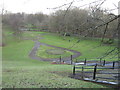
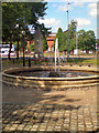
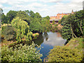
The lifestyle in M5 4ST is shaped by its proximity to essential amenities, including five retail outlets such as Co-op Salford and Sainsburys Salford. These stores provide convenient access to groceries and daily necessities, reducing the need for long commutes. The area’s transport links, including rail, metro, and bus options, connect residents to broader urban networks, enabling easy access to cultural, professional, and leisure opportunities in Salford and Manchester. While the data does not specify parks or recreational spaces, the absence of environmental constraints like protected woodlands or nature reserves suggests that green spaces may be limited. Nonetheless, the area’s compact size and transport accessibility mean residents can quickly reach larger urban amenities, balancing convenience with the need for community-based facilities.
Amenities
Schools
The only school explicitly listed near M5 4ST is Hulme Street Nursery School, which provides early education for young children. No primary or secondary schools are mentioned in the data, which may be a concern for families requiring a broader range of educational options. The absence of higher-level schools suggests that residents may need to look beyond the immediate area for comprehensive schooling, potentially increasing commuting times. For parents prioritising proximity to schools, this limitation could influence their decision to consider neighbouring postcodes with more extensive educational facilities. The nursery’s presence, however, supports families with young children, offering a foundational step in their children’s education.
| Rank | School | Type | Entry gender | Ages |
|---|
Explore more schools in this area
Go to Schools tabDemographics
The population of M5 4ST is overwhelmingly young, with a median age of 22 and 75% of residents falling within the 15–29 age range. This indicates a community skewed towards students, recent graduates, or young professionals, which shapes the area’s social dynamics and local amenities. Home ownership is low, at just 25%, suggesting that most residents rent their flats, which are the predominant type of accommodation. The ethnic composition is predominantly White, reflecting broader regional trends. The high population density of 165,651 people per square kilometre means the area is intensely populated for its size, which can influence the character of public spaces and the demand for local services. While this density may contribute to a lively, communal atmosphere, it also underscores the need for well-managed infrastructure and amenities to support the young, transient population.
Household Size
Accommodation Type
Tenure
Ethnic Group
Religion
Household Composition
Age
Household Deprivation
NS-SEC
Explore more demographic insights in this area
Go to Demographics tabPlanning
Planning Constraints
- Flood RiskPremium
- Ramsar Wetland SitesPremium
- Area of Outstanding Natural BeautyPremium
- Protected Nature ReservePremium
- Protected WoodlandPremium