Area Overview for M5 4EF
Photos of M5 4EF


Area Information
M5 4EF is a compact residential postcode in England, covering 3499 square metres and home to 1398 residents. Its high population density of 399,490 people per square kilometre reflects a tightly knit community. This area is defined by its proximity to urban infrastructure, with a mix of retail, transport, and leisure options within reach. Daily life here is shaped by its youthful demographic, with a median age of 22 and the majority of residents aged 15–29. The area’s small size means it is closely integrated with surrounding districts, offering easy access to amenities such as Sainsburys Salford, rail networks, and the nearby City Airport Manchester. While the housing stock is predominantly flats, the area’s appeal lies in its connectivity and convenience for young professionals and students. However, its compact nature means residents must navigate shared spaces and limited green areas, which may impact those seeking more private or spacious living arrangements.
- Area Type
- Postcode
- Area Size
- 3499 m²
- Population
- 1398
- Population Density
- 7093 people/km²
The property market in M5 4EF is characterised by a low home ownership rate of 25%, indicating that the area functions more as a rental market than an owner-occupied one. The predominant accommodation type is flats, which is typical for high-density urban areas. This suggests limited availability of larger, detached properties, making the area more suitable for individuals or small households. Buyers should consider the small footprint of the postcode and its integration with surrounding districts, as housing options may be constrained by the area’s size. The focus on flats also implies shared walls and communal spaces, which could be a consideration for those prioritising privacy or space. For investors, the rental demand may be stable due to the young, transient population, but property values are unlikely to be driven by long-term capital growth.
House Prices in M5 4EF
Showing 4 properties
| Address | Type | Beds | Baths | Last Sale Price | Last Sale Date | |
|---|---|---|---|---|---|---|
| 5 Craven Street, Salford, M5 4EF | Maisonette | - | - | £249,664 | Oct 2021 | |
| 9 Craven Street, Salford, M5 4EF | Maisonette | 2 | 2 | £244,960 | Jul 2021 | |
| 7 Craven Street, Salford, M5 4EF | Maisonette | - | - | - | - | |
| 1 Craven Street, Salford, M5 4EF | Flat | 2 | 2 | - | - |
Energy Efficiency in M5 4EF
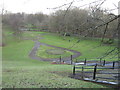
Living in M5 4EF offers access to a range of practical amenities within walking or short transit distance. Retail options include Sainsburys Salford, Co-op Salford, and Waitrose Little, providing everyday shopping needs. The area’s proximity to rail, metro, and bus networks ensures ease of movement, while the nearby City Airport Manchester caters to those requiring travel connections. Though the data does not mention parks or leisure facilities, the presence of multiple transport hubs and retail outlets suggests a focus on convenience over expansive recreational spaces. The compact nature of the area means residents are likely to rely on shared or nearby facilities, making it ideal for those prioritising accessibility over private outdoor space.
Amenities
Schools
The only school explicitly listed near M5 4EF is Hulme Street Nursery School, which provides early years education. No primary or secondary schools are noted in the data, meaning families may need to look beyond the immediate area for comprehensive schooling. The absence of higher-tier educational institutions could be a drawback for households with children requiring a full range of school options. However, the presence of a nursery suggests some local provision for young children, though it may not suffice for older students. Parents considering M5 4EF should investigate nearby districts for secondary schools, as the area’s small size limits its standalone educational infrastructure.
| Rank | School | Type | Entry gender | Ages |
|---|
Explore more schools in this area
Go to Schools tabDemographics
The community in M5 4EF is overwhelmingly young, with a median age of 22 and 75% of residents falling within the 15–29 age range. Home ownership is low, at just 25%, indicating that the majority of residents are renters. The accommodation type is primarily flats, reflecting the area’s density and urban character. The predominant ethnic group is White, though specific data on diversity or deprivation is not provided. The high proportion of young adults suggests a dynamic, transient population, possibly linked to student or workforce mobility. This age profile may influence local services and amenities, with a focus on affordability and accessibility rather than long-term family-oriented infrastructure. The area’s demographics align with its role as a node in a larger urban network, catering to those requiring short-term housing or proximity to transport hubs.
Household Size
Accommodation Type
Tenure
Ethnic Group
Religion
Household Composition
Age
Household Deprivation
NS-SEC
Explore more demographic insights in this area
Go to Demographics tabPlanning
Planning Constraints
- Flood RiskPremium
- Ramsar Wetland SitesPremium
- Area of Outstanding Natural BeautyPremium
- Protected Nature ReservePremium
- Protected WoodlandPremium