Area Overview for M5 4NB
Photos of M5 4NB


Area Information
Living in M5 4NB means being part of a densely populated residential cluster in Salford, England. The area covers just 2.3 hectares, yet it houses 1,398 people, resulting in a population density of 61,803 people per square kilometre. This compact postcode is defined by its proximity to Salford’s urban core, with easy access to rail, metro, and bus networks. The community is predominantly young, with a median age of 22 and most residents aged 15–29. Daily life here is shaped by its high connectivity: residents can reach Salford Central Railway Station, multiple metro stops, and nearby retail hubs within minutes. The area’s flat-dominated housing stock reflects its rental-oriented market, with only 25% of homes owner-occupied. Despite its small size, M5 4NB offers a mix of practical amenities, from supermarkets to transport links, though its high density may mean limited private outdoor space. For those prioritising convenience over space, this postcode provides a compact, connected urban lifestyle.
- Area Type
- Postcode
- Area Size
- 2.3 hectares
- Population
- 1398
- Population Density
- 7093 people/km²
The property market in M5 4NB is heavily rental-focused, with only 25% of homes owner-occupied. The area’s housing stock is almost entirely composed of flats, which aligns with its high population density and compact size. This suggests a market where landlords dominate, and prospective buyers may find limited opportunities for purchase within the postcode itself. The small area size means that property options are constrained, and the surrounding neighbourhoods may offer more variety. For those seeking to buy, the challenge lies in competing for a small number of owner-occupied flats, which are likely to be in high demand. The rental market, however, is robust, reflecting the area’s appeal to young professionals and students who prioritise proximity to transport and amenities over long-term ownership.
House Prices in M5 4NB
Showing 6 properties
| Address | Type | Beds | Baths | Last Sale Price | Last Sale Date | |
|---|---|---|---|---|---|---|
| 1 Cow Lane, Salford, M5 4NB | Maisonette | 3 | 2 | - | - | |
| Part First Floor, Cow Lane, Salford, M5 4NB | Industrial | - | - | - | - | |
| First Floor Part, Cow Lane, Salford, M5 4NB | Industrial | - | - | - | - | |
| 3 Cow Lane, Salford, M5 4NB | Maisonette | - | - | - | - | |
| 5 Cow Lane, Salford, M5 4NB | Maisonette | - | - | - | - | |
| 7 Cow Lane, Salford, M5 4NB | Flat | 2 | 3 | - | - |
Energy Efficiency in M5 4NB
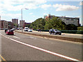
Daily life in M5 4NB is shaped by its proximity to retail and transport hubs. The area has five notable retail venues, including Co-op Salford and Sainsburys, providing easy access to grocery and daily essentials. Residents can reach multiple rail, metro, and bus stops within walking distance, ensuring seamless travel to work, leisure, or social events. The nearby City Airport Manchester adds to the area’s connectivity, though no parks or leisure facilities are listed in the data. The compact nature of the postcode means that amenities are concentrated, offering convenience for those who prioritise accessibility over expansive green spaces. For a small area, the mix of retail and transport options supports a practical, urban lifestyle.
Amenities
Schools
The only school explicitly listed near M5 4NB is Hulme Street Nursery School, which provides early years education. No further details about its Ofsted rating or curriculum are available, so its quality remains unspecified. The absence of primary or secondary schools in the data suggests that families may need to look beyond the immediate area for comprehensive education. For those prioritising proximity to schools, this postcode offers limited options, requiring a commute to nearby Salford schools. The nursery’s presence indicates some support for young families, but the lack of broader educational infrastructure may be a consideration for those planning for long-term schooling needs.
| Rank | School | Type | Entry gender | Ages |
|---|
Explore more schools in this area
Go to Schools tabDemographics
The population of M5 4NB is overwhelmingly young, with a median age of 22 and 75% of residents falling within the 15–29 age range. This demographic profile suggests a community skewed towards students, young professionals, or those in early careers. Home ownership is low, at just 25%, indicating that most residents rent their accommodation. The area is dominated by flats, reflecting its high population density and urban character. The predominant ethnic group is White, though no further breakdown of diversity is provided. The age range and housing type imply a transient population, with limited long-term family households. The high density, while facilitating connectivity, may also contribute to a sense of shared living rather than private, standalone homes. For buyers, this suggests a market where rental demand is strong, but owner-occupied properties are rare.
Household Size
Accommodation Type
Tenure
Ethnic Group
Religion
Household Composition
Age
Household Deprivation
NS-SEC
Explore more demographic insights in this area
Go to Demographics tabPlanning
Planning Constraints
- Flood RiskPremium
- Ramsar Wetland SitesPremium
- Area of Outstanding Natural BeautyPremium
- Protected Nature ReservePremium
- Protected WoodlandPremium