Area Overview for M5 4WB
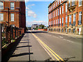
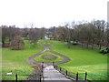
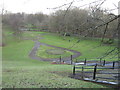
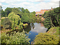
Photos of M5 4WB


Area Information
Living in M5 4WB means being part of a tightly packed residential cluster in England’s north-west. The area covers just 3,918 square metres, yet it houses 1,398 people, resulting in a population density of 356,834 people per square kilometre. This compactness shapes daily life, with residents accustomed to close proximity to neighbours and local amenities. The area’s youthful demographic—median age 22—suggests a community of students, young professionals, and families starting out. While the postcode’s small size limits expansion, it offers a focused environment where essential services are within walking distance. The high density also means a strong sense of community, though it may feel crowded for those used to more spacious living. M5 4WB is not a sprawling suburb but a concentrated hub, ideal for those prioritising connectivity over open space. Its proximity to transport networks and retail options makes it a practical choice for commuters and those needing easy access to urban centres.
- Area Type
- Postcode
- Area Size
- 3918 m²
- Population
- 1398
- Population Density
- 7093 people/km²
The property market in M5 4WB is characterised by a low rate of home ownership—just 25% of households are owner-occupied—suggesting a strong rental market. The accommodation type is predominantly flats, likely due to the area’s small size and high density. This makes M5 4WB a niche market for buyers, as the limited space restricts the availability of larger properties or family homes. The small postcode area means the housing stock is tightly concentrated, with little scope for new development. For buyers, this presents challenges: competition for flats may be fierce, and the area’s compact nature limits options for those seeking more space. However, the proximity to transport links and amenities could appeal to investors or first-time buyers prioritising location over property size. The rental market, meanwhile, may offer stability for those seeking short-term or flexible housing solutions.
House Prices in M5 4WB
Showing 3 properties
| Address | Type | Beds | Baths | Last Sale Price | Last Sale Date | |
|---|---|---|---|---|---|---|
| Spinners Arms, 4 Oldfield Road, Salford, M5 4WB | undefined | - | - | - | - | |
| Kings Arms, 85 Oldfield Road, Salford, M5 4WB | Flat | 1 | 1 | - | - | |
| Manchester And Cheshire Construction, 6 Oldfield Road, Salford, M5 4WB | Office | - | - | - | - |
Energy Efficiency in M5 4WB
Life in M5 4WB revolves around its compact but well-serviced amenities. Retail options include five nearby shops, such as Co-op Salford and Sainsburys, providing daily essentials within easy reach. The area’s transport links—rail, metro, and bus—offer seamless access to nearby cities and attractions, while the proximity to Manchester’s City Airport makes travel to other regions straightforward. Though the data does not list parks or leisure facilities, the presence of multiple transport hubs suggests the area is part of a larger urban fabric with recreational options nearby. The density of services means residents can access shopping, dining, and transport without long commutes. However, the absence of specific details on green spaces or cultural amenities means buyers should explore the surrounding area for a fuller picture of lifestyle possibilities.
Amenities
Schools
The only school listed near M5 4WB is Hulme Street Nursery School, which provides early education for young children. No primary or secondary schools are mentioned in the data, meaning families with older children may need to look beyond the immediate area for schooling options. The presence of a nursery suggests the area caters to young families, though the lack of higher-level educational institutions could be a limitation. Parents seeking a full range of school types—such as primary, secondary, or specialist provision—will need to consider nearby districts. For those prioritising nursery care, Hulme Street Nursery School offers a local solution, but the absence of other schools highlights the need for broader research into educational opportunities in the surrounding region.
| Rank | School | Type | Entry gender | Ages |
|---|
Explore more schools in this area
Go to Schools tabDemographics
The community in M5 4WB is overwhelmingly young, with 22 as the median age and the majority of residents falling within the 15–29 age range. Only 25% of homes are owner-occupied, indicating a rental-dominated market. Flats are the predominant accommodation type, reflecting the area’s compact footprint and likely development history. The dominant ethnic group is White, though no specific data on diversity or deprivation is provided. The high population density—356,834 people per square kilometre—suggests a mix of transient and long-term residents, possibly including students or workers in nearby urban areas. For young adults, this area offers affordability and proximity to transport, but the lack of data on income levels or deprivation means the quality of life for lower-income households remains unclear. The demographic profile hints at a dynamic, possibly student-heavy population, but the absence of detailed socioeconomic metrics limits deeper analysis.
Household Size
Accommodation Type
Tenure
Ethnic Group
Religion
Household Composition
Age
Household Deprivation
NS-SEC
Explore more demographic insights in this area
Go to Demographics tabPlanning
Planning Constraints
- Flood RiskPremium
- Ramsar Wetland SitesPremium
- Area of Outstanding Natural BeautyPremium
- Protected Nature ReservePremium
- Protected WoodlandPremium