Area Overview for M5 3LR
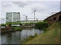
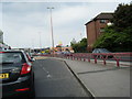
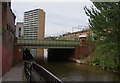
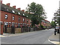
Photos of M5 3LR


Area Information
Living in M5 3LR means being part of a compact residential cluster in England, where 2,138 people reside across 1,618 square metres. The area’s density is striking, with 1,321,423 people per square kilometre, creating a tightly knit community. This postcode is defined by its small scale, offering a blend of proximity and intimacy. Daily life here is shaped by its proximity to urban infrastructure, with easy access to retail, transport, and leisure. The area’s character is influenced by its demographic profile: a young population, with 16% owning their homes and the rest likely renting. While the population is small, the concentration of amenities nearby means residents can access shops, public transport, and schools without venturing far. The area’s compactness makes it ideal for those seeking convenience, though its limited size means the housing stock is finite. For buyers, this is a niche market with a distinct local identity, shaped by its immediate surroundings and the needs of its youthful, transient population.
- Area Type
- Postcode
- Area Size
- 1618 m²
- Population
- 2138
- Population Density
- 8329 people/km²
The property market in M5 3LR is characterised by a low home ownership rate, with only 16% of residents owning their homes. This suggests the area is primarily a rental market, likely catering to students, young professionals, or those in temporary employment. The accommodation type is predominantly houses, though the small population and high density imply these are modest properties, possibly shared or converted. Given the area’s size, the housing stock is limited, making it a niche market with little scope for expansion. Buyers should consider that the small footprint means competition for properties is likely, and the rental demand may keep prices stable. For those seeking a long-term investment, the area’s transient demographic and limited housing options may present challenges, though the proximity to amenities could offset this.
House Prices in M5 3LR
Showing 15 properties
| Address | Type | Beds | Baths | Last Sale Price | Last Sale Date | |
|---|---|---|---|---|---|---|
| 1 Carmel Avenue, Salford, M5 3LR | Flat | - | - | £47,000 | Nov 2016 | |
| 3 Carmel Avenue, Salford, M5 3LR | Flat | - | - | £79,740 | Jun 2015 | |
| 5 Carmel Avenue, Salford, M5 3LR | Flat | - | - | £79,740 | Jun 2015 | |
| 31 Carmel Avenue, Salford, M5 3LR | Flat | - | - | - | - | |
| 29 Carmel Avenue, Salford, M5 3LR | Flat | - | - | - | - | |
| 15 Carmel Avenue, Salford, M5 3LR | Flat | - | - | - | - | |
| 37 Carmel Avenue, Salford, M5 3LR | Flat | - | - | - | - | |
| 23 Carmel Avenue, Salford, M5 3LR | Flat | - | - | - | - | |
| 25 Carmel Avenue, Salford, M5 3LR | Flat | - | - | - | - | |
| 17 Carmel Avenue, Salford, M5 3LR | Flat | - | - | - | - |
Energy Efficiency in M5 3LR
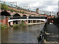
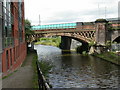
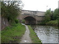
Residents of M5 3LR enjoy access to a range of amenities within practical reach. Retail options include five shops such as Co-op Salford, Waitrose Little, and Sainsburys Salford, offering everyday essentials. Public transport is well-served by five metro stations, including Cornbrook and Salford Quays, as well as three rail stations like Salford Crescent and Deansgate. The area’s proximity to City Airport Manchester adds to its convenience for travel. While the data does not mention parks or leisure facilities, the presence of multiple transport hubs and retail outlets suggests a focus on practicality over green spaces. The compact nature of the area means amenities are closely clustered, making daily errands efficient. However, the lack of specific details on leisure options means residents may need to travel further for recreational activities.
Amenities
Schools
Residents of M5 3LR have access to two nearby schools: Ordsall Community Nursery Centre, a nursery, and St Clement’s Egerton CofE Primary School, a primary school. These institutions serve the needs of young families in the area, though the absence of secondary schools means students may need to travel further for higher education. The presence of a nursery and primary school indicates a focus on early years education, which is crucial for families with young children. However, the data does not provide Ofsted ratings or performance metrics, so prospective parents should conduct their own research. The mix of school types suggests a basic educational infrastructure, but the lack of secondary options may be a limitation for those requiring a full range of schooling within the area.
| Rank | School | Type | Entry gender | Ages |
|---|
Explore more schools in this area
Go to Schools tabDemographics
The community in M5 3LR is predominantly young, with a median age of 22 and the most common age range being 15–29 years. This suggests a population skewed toward students, young professionals, or those starting families. Only 16% of residents own their homes, indicating a rental-heavy market, which may reflect the area’s transient nature. The accommodation type is primarily houses, though the small population and high density imply these are likely small or shared properties. The predominant ethnic group is White, with no data provided on other demographics. The low home ownership rate and young age profile suggest a community focused on short-term stays, possibly linked to nearby educational or employment hubs. While the data does not specify deprivation levels, the high population density and limited housing ownership could point to economic pressures, though this remains unquantified.
Household Size
Accommodation Type
Tenure
Ethnic Group
Religion
Household Composition
Age
Household Deprivation
NS-SEC
Explore more demographic insights in this area
Go to Demographics tabPlanning
Planning Constraints
- Flood RiskPremium
- Ramsar Wetland SitesPremium
- Area of Outstanding Natural BeautyPremium
- Protected Nature ReservePremium
- Protected WoodlandPremium