Area Overview for M5 3PT
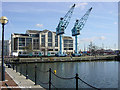
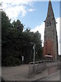
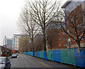
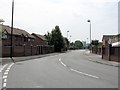
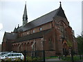
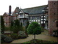
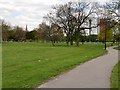
Photos of M5 3PT


Area Information
Living in M5 3PT means inhabiting a compact, densely populated postcode in England’s urban fabric. The area covers 7,285 square metres, housing 2,138 residents in a tightly packed cluster. Its small size creates a distinct microcosm of daily life, where proximity to amenities and transport hubs defines convenience. The population density of 293,480 people per square kilometre reflects a community that thrives on proximity to services and infrastructure. This area is shaped by its immediate surroundings—its proximity to retail, public transport, and educational institutions makes it appealing to those prioritising accessibility. While the demographic profile skews young, with a median age of 22 and a majority of residents aged 15–29, the area’s character is defined by its practicality. It is not a place for sprawling estates but a tightly woven network of homes, shops, and transit points. For buyers, M5 3PT offers a snapshot of urban living: compact, efficient, and deeply interconnected with the broader cityscape.
- Area Type
- Postcode
- Area Size
- 7285 m²
- Population
- 2138
- Population Density
- 8329 people/km²
The property market in M5 3PT is characterised by low home ownership and a focus on houses, despite the area’s high population density. With only 16% of residents owning their homes, the market is largely rental-driven, catering to students, young professionals, or those in temporary employment. The predominance of houses—rather than flats or apartments—suggests a mix of semi-detached or terraced properties, which may be shared among multiple occupants to accommodate the area’s high density. This dynamic creates a competitive rental market, where availability is limited and demand is high. For buyers, the small size of M5 3PT means the housing stock is finite, with limited scope for new developments. Those seeking ownership may need to look beyond the immediate postcode to find properties that align with the area’s compact layout. The market reflects a balance between affordability for renters and limited opportunities for long-term buyers.
House Prices in M5 3PT
Showing 33 properties
| Address | Type | Beds | Baths | Last Sale Price | Last Sale Date | |
|---|---|---|---|---|---|---|
| 20 Cloughfield Avenue, Salford, M5 3PT | Terraced | 3 | 1 | £260,000 | Aug 2023 | |
| 27 Cloughfield Avenue, Salford, M5 3PT | Terraced | 3 | 1 | £79,000 | Sep 2013 | |
| 23 Cloughfield Avenue, Salford, M5 3PT | house | - | - | £79,000 | Aug 2013 | |
| 19 Cloughfield Avenue, Salford, M5 3PT | Terraced | 3 | - | - | - | |
| 3 Cloughfield Avenue, Salford, M5 3PT | house | - | - | - | - | |
| 8 Cloughfield Avenue, Salford, M5 3PT | house | - | - | - | - | |
| 7 Cloughfield Avenue, Salford, M5 3PT | house | - | - | - | - | |
| 1 Cloughfield Avenue, Salford, M5 3PT | house | - | - | - | - | |
| 26 Cloughfield Avenue, Salford, M5 3PT | house | - | - | - | - | |
| 14 Cloughfield Avenue, Salford, M5 3PT | house | - | - | - | - |
Energy Efficiency in M5 3PT
Life in M5 3PT is shaped by its proximity to retail, transport, and public spaces. The area has five retail outlets, including Co-op Salford, Waitrose Little, and Morrisons Daily, offering everyday shopping needs within easy reach. Nearby metro stations like Cornbrook and Anchorage provide access to larger retail hubs, while Salford Quays offers leisure and dining options. The railway stations—Salford Crescent, Deansgate, and Salford Central—connect residents to the broader city, facilitating work and social opportunities. A bus station at Chorlton Street adds flexibility for local travel. The nearby City Airport Manchester is a further draw for those requiring air travel. These amenities create a lifestyle that balances convenience with urban vibrancy, where residents can access shops, transport, and leisure without long commutes. The compact nature of the area ensures that essential services are never far, supporting a practical, efficient daily routine.
Amenities
Schools
Residents of M5 3PT have access to two nearby schools: Ordsall Community Nursery Centre, a nursery, and St Clement’s Egerton CofE Primary School, a primary institution. These schools serve the area’s young population, particularly those aged 15–29, though the absence of secondary schools may require families to seek options further afield. The nursery provides early education, while the primary school offers foundational learning. The mix of school types suggests a focus on early years education, which aligns with the area’s demographic profile. However, the lack of secondary schooling could pose a challenge for families with older children, necessitating daily commutes or reliance on nearby districts. The quality of these schools, while not specified in the data, is critical for families prioritising education. Parents should investigate Ofsted ratings and catchment areas to determine whether these institutions meet their needs.
| Rank | School | Type | Entry gender | Ages |
|---|
Explore more schools in this area
Go to Schools tabDemographics
The community in M5 3PT is overwhelmingly young, with a median age of 22 and 84% of residents falling within the 15–29 age range. This demographic skew suggests a population focused on education, entry-level careers, or transitional living. Home ownership is low, at just 16%, indicating that most residents rent their accommodation. The predominant housing type is houses, though the high population density implies these are likely smaller, shared, or multi-occupancy units. The area’s ethnic composition is predominantly White, with no data provided on other groups. The high proportion of young adults may correlate with a transient population, influenced by student numbers or short-term employment. While no specific deprivation data is available, the low home ownership rate and high density suggest a reliance on rental markets and shared living arrangements. This profile shapes a community that is dynamic but potentially less stable, with needs centred around affordability and proximity to services.
Household Size
Accommodation Type
Tenure
Ethnic Group
Religion
Household Composition
Age
Household Deprivation
NS-SEC
Explore more demographic insights in this area
Go to Demographics tabPlanning
Planning Constraints
- Flood RiskPremium
- Ramsar Wetland SitesPremium
- Area of Outstanding Natural BeautyPremium
- Protected Nature ReservePremium
- Protected WoodlandPremium