Area Overview for M5 3WL
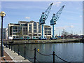
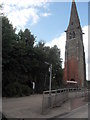
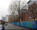
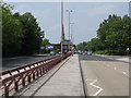
Photos of M5 3WL


Area Information
Living in M5 3WL means being part of a compact, densely populated residential cluster in England. The area covers just 1.8 hectares, housing 2,138 people in a space where population density reaches 120,266 people per square kilometre. This makes it one of the most densely populated postcode areas in the UK. Despite its small size, it offers proximity to key amenities, including five retail outlets like Co-op Salford and Morrisons Daily, and multiple transport hubs such as Cornbrook Metro station and Deansgate Railway Station. The area’s young demographic—median age 22—suggests a community skewed towards students and early-career professionals. Daily life here is shaped by its urban setting, with easy access to Salford Quays and Manchester’s broader infrastructure. However, the high population density means living spaces are closely packed, and the area’s character is defined by its practical, functional layout rather than expansive green spaces. For those prioritising connectivity and convenience over open space, M5 3WL offers a compact, fast-paced environment.
- Area Type
- Postcode
- Area Size
- 1.8 hectares
- Population
- 2138
- Population Density
- 8329 people/km²
The property market in M5 3WL is characterised by a low home ownership rate of 16%, suggesting that the area is primarily a rental market rather than one dominated by owner-occupied homes. The accommodation type listed as “houses” may indicate that properties are larger or designed for multi-occupancy, though the area’s tiny size of 1.8 hectares implies limited housing stock. This combination of low ownership and house-based accommodation suggests that the market caters to students, young professionals, or those requiring short-term rental solutions. Buyers considering the area should note that the small footprint and high density mean there is little scope for expansion or development. The immediate surroundings likely offer similar housing options, making M5 3WL a niche market for those prioritising proximity to transport and amenities over spacious living conditions. Prospective buyers should also consider the area’s transient nature, given the young demographic and rental focus.
House Prices in M5 3WL
Showing 45 properties
| Address | Type | Beds | Baths | Last Sale Price | Last Sale Date | |
|---|---|---|---|---|---|---|
| 38 Whimberry Close, Salford, M5 3WL | Semi-detached | 3 | 1 | £260,000 | Jun 2025 | |
| 33 Whimberry Close, Salford, M5 3WL | Semi-detached | 2 | 1 | £220,000 | Nov 2024 | |
| 17 Whimberry Close, Salford, M5 3WL | Semi-detached | 3 | 1 | £190,000 | Jan 2024 | |
| 8 Whimberry Close, Salford, M5 3WL | Semi-detached | 2 | 1 | £226,500 | Oct 2023 | |
| 35 Whimberry Close, Salford, M5 3WL | Semi-detached | 3 | 2 | £277,000 | Jul 2023 | |
| 41 Whimberry Close, Salford, M5 3WL | Semi-detached | 2 | - | £215,000 | Jan 2023 | |
| 12 Whimberry Close, Salford, M5 3WL | house | - | - | £277,000 | Nov 2021 | |
| 34 Whimberry Close, Salford, M5 3WL | Semi-detached | 3 | 1 | £178,500 | Oct 2020 | |
| 6 Whimberry Close, Salford, M5 3WL | Semi-detached | 2 | - | £152,000 | Jul 2019 | |
| 27 Whimberry Close, Salford, M5 3WL | Semi-detached | 3 | 1 | £190,000 | Feb 2019 |
Energy Efficiency in M5 3WL
Residents of M5 3WL enjoy a range of amenities within practical reach. The area’s retail offerings include five shops, such as Co-op Salford, Morrisons Daily, and Waitrose Little, providing everyday essentials. For transport, five metro stations—Cornbrook, Salford Quays, and Anchorage—offer frequent services, while five rail stations, including Deansgate and Salford Crescent, connect to broader networks. A single bus stop at Chorlton Street Coach Station and proximity to City Airport Manchester enhance mobility. The area’s compact nature means amenities are closely clustered, reducing travel times. While there is no mention of parks or leisure facilities in the data, the density of retail and transport options suggests a lifestyle focused on convenience and connectivity. This makes M5 3WL ideal for those prioritising accessibility over expansive recreational spaces.
Amenities
Schools
Residents of M5 3WL have access to two nearby schools: Ordsall Community Nursery Centre, which provides early years education, and St Clement’s Egerton CofE Primary School, catering to primary-aged children. Both institutions are within practical reach, offering a mix of nursery and primary education. The presence of a nursery suggests the area supports families with young children, while the primary school provides continuity for local students. However, the data does not include Ofsted ratings or academic performance metrics for these schools. Families seeking secondary education will need to look beyond the immediate area, as no secondary schools are listed in the data. The combination of early years and primary provision is a practical advantage for parents, but the lack of secondary options may require careful planning for long-term schooling.
| Rank | School | Type | Entry gender | Ages |
|---|
Explore more schools in this area
Go to Schools tabDemographics
The community in M5 3WL is overwhelmingly young, with the most common age range being 15–29 years. This reflects a population skewed towards students, recent graduates, and young professionals, with a median age of 22. Home ownership is low at 16%, indicating that the majority of residents are likely renting, which aligns with the area’s high population density. The accommodation type is predominantly houses, though the limited space suggests these are likely smaller, multi-occupancy properties. The predominant ethnic group is White, with no data provided on other ethnicities. The low home ownership rate and young age profile suggest a transient community, where residents may move frequently for work or study. This dynamic environment can foster a sense of shared purpose among young professionals but may also mean a lack of long-term community ties. The area’s demographics make it a hub for those seeking short-term housing near transport and amenities rather than a place for long-term settlement.
Household Size
Accommodation Type
Tenure
Ethnic Group
Religion
Household Composition
Age
Household Deprivation
NS-SEC
Explore more demographic insights in this area
Go to Demographics tabPlanning
Planning Constraints
- Flood RiskPremium
- Ramsar Wetland SitesPremium
- Area of Outstanding Natural BeautyPremium
- Protected Nature ReservePremium
- Protected WoodlandPremium