Area Overview for M28 3SE
Photos of M28 3SE

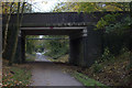
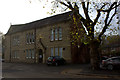
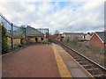
45 photos from this area
Area Information
Key information about the M28 3SE including its size, population, and administrative classification.
- Area Type
- Postcode
- Area Size
- 3.4 hectares
- Population
- 2143
- Population Density
- 2839 people/km²
House Prices in M28 3SE
29
Properties
£159,650
Average Sold Price
£59,500
Lowest Price
£290,000
Highest Price
Showing 29 properties
| Address | Type | Beds | Baths | Last Sale Price | Last Sale Date | |
|---|---|---|---|---|---|---|
| 19 Hyde Road, Worsley, M28 3SE | Semi-detached | 3 | 2 | £290,000 | Mar 2025 | |
| 15 Hyde Road, Worsley, M28 3SE | Bungalow | - | - | £180,000 | Sep 2021 | |
| 4 Hyde Road, Worsley, M28 3SE | Bungalow | - | - | £185,000 | Dec 2020 | |
| 14 Hyde Road, Worsley, M28 3SE | Semi-detached | 3 | 2 | £195,000 | Feb 2020 | |
| 25 Hyde Road, Worsley, M28 3SE | Semi-detached | 2 | 1 | £170,000 | Jun 2019 | |
| 22 Hyde Road, Worsley, M28 3SE | Semi-detached | 3 | 1 | £190,000 | Mar 2019 | |
| 8 Hyde Road, Worsley, M28 3SE | Bungalow | 3 | 3 | £235,000 | Aug 2017 | |
| 4A Hyde Road, Worsley, M28 3SE | Semi-detached | 2 | 1 | £146,250 | Nov 2015 | |
| 27 Hyde Road, Worsley, M28 3SE | Detached | 3 | 1 | £105,000 | Apr 2011 | |
| 2 Hyde Road, Worsley, M28 3SE | Detached | - | - | £220,000 | Apr 2007 |
Page 1 of 3
Energy Efficiency in M28 3SE
Amenities
Schools
| Rank | School | Type | Entry gender | Ages |
|---|
Explore more schools in this area
Go to Schools tabDemographics
Household Size
Family (3-5 people)
most common
Accommodation Type
Houses
most common
Tenure
80
majority
Ethnic Group
White
most common
Religion
N/A
most common
Household Composition
N/A
most common
Age
47
median
Adults (30-64 years)
most common
Household Deprivation
N/A
with no deprivation
NS-SEC
41
in Lower managerial occupations
Explore more demographic insights in this area
Go to Demographics tabPlanning
Planning Constraints
- Flood RiskPremium
- Ramsar Wetland SitesPremium
- Area of Outstanding Natural BeautyPremium
- Protected Nature ReservePremium
- Protected WoodlandPremium