Area Overview for M28 3SD
Photos of M28 3SD
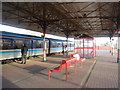

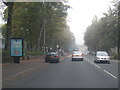
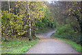
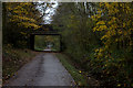
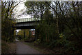
45 photos from this area
Area Information
Key information about the M28 3SD including its size, population, and administrative classification.
- Area Type
- Postcode
- Area Size
- 1.7 hectares
- Population
- 1601
- Population Density
- 4477 people/km²
House Prices in M28 3SD
44
Properties
£124,259
Average Sold Price
£34,950
Lowest Price
£206,000
Highest Price
Showing 44 properties
| Address | Type | Beds | Baths | Last Sale Price | Last Sale Date | |
|---|---|---|---|---|---|---|
| 18 Parsonage Road, Worsley, M28 3SD | Semi-detached | 2 | 1 | £169,950 | Mar 2020 | |
| 17 Parsonage Road, Worsley, M28 3SD | Bungalow | 2 | 1 | £201,000 | Apr 2018 | |
| 5 Parsonage Road, Worsley, M28 3SD | Terraced | 2 | 1 | £128,000 | Mar 2018 | |
| 15 Parsonage Road, Worsley, M28 3SD | Detached | 4 | - | £206,000 | Jul 2015 | |
| 16 Parsonage Road, Worsley, M28 3SD | Semi-detached | 2 | - | £170,000 | Feb 2014 | |
| 20 Parsonage Road, Worsley, M28 3SD | Semi-detached | 2 | 1 | £127,500 | Dec 2013 | |
| 14 Parsonage Road, Worsley, M28 3SD | Bungalow | - | - | £120,000 | Aug 2009 | |
| 7 Parsonage Road, Worsley, M28 3SD | Terraced | - | - | £117,000 | Apr 2007 | |
| 13 Parsonage Road, Worsley, M28 3SD | Terraced | - | - | £42,500 | Jul 2002 | |
| 3 Parsonage Road, Worsley, M28 3SD | Terraced | - | - | £49,950 | Jun 2002 |
Page 1 of 5
Energy Efficiency in M28 3SD
Amenities
Schools
| Rank | School | Type | Entry gender | Ages |
|---|
Explore more schools in this area
Go to Schools tabDemographics
Household Size
One person
most common
Accommodation Type
Houses
most common
Tenure
62
majority
Ethnic Group
White
most common
Religion
N/A
most common
Household Composition
N/A
most common
Age
47
median
Adults (30-64 years)
most common
Household Deprivation
N/A
with no deprivation
NS-SEC
32
in Lower managerial occupations
Explore more demographic insights in this area
Go to Demographics tabPlanning
Planning Constraints
- Flood RiskPremium
- Ramsar Wetland SitesPremium
- Area of Outstanding Natural BeautyPremium
- Protected Nature ReservePremium
- Protected WoodlandPremium