Area Overview for M28 3TL
Photos of M28 3TL

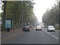
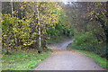
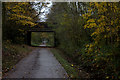
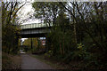
45 photos from this area
Area Information
Key information about the M28 3TL including its size, population, and administrative classification.
- Area Type
- Postcode
- Area Size
- 1.7 hectares
- Population
- 2143
- Population Density
- 2839 people/km²
House Prices in M28 3TL
25
Properties
£205,542
Average Sold Price
£45,000
Lowest Price
£527,500
Highest Price
Showing 25 properties
| Address | Type | Beds | Baths | Last Sale Price | Last Sale Date | |
|---|---|---|---|---|---|---|
| 438 Hilton Lane, Worsley, M28 3TL | Detached | 4 | 2 | £527,500 | Oct 2024 | |
| 426 Hilton Lane, Worsley, M28 3TL | Bungalow | 3 | 1 | £205,000 | Feb 2021 | |
| 430 Hilton Lane, Worsley, M28 3TL | Detached | 3 | 2 | £280,000 | Sep 2019 | |
| 404 Hilton Lane, Worsley, M28 3TL | Detached | 4 | 1 | £246,000 | Apr 2019 | |
| 410 Hilton Lane, Worsley, M28 3TL | Retail | 3 | 1 | £247,500 | Mar 2019 | |
| 424 Hilton Lane, Worsley, M28 3TL | Bungalow | 3 | 2 | £198,000 | Oct 2017 | |
| 406 Hilton Lane, Worsley, M28 3TL | Semi-detached | 3 | 1 | £190,000 | May 2017 | |
| 428 Hilton Lane, Worsley, M28 3TL | Bungalow | - | - | £150,000 | Jul 2013 | |
| 412 Hilton Lane, Worsley, M28 3TL | Bungalow | - | - | £150,000 | Apr 2010 | |
| 432 Hilton Lane, Worsley, M28 3TL | Detached | 3 | 2 | £175,000 | Nov 2003 |
Page 1 of 3
Energy Efficiency in M28 3TL
Amenities
Schools
| Rank | School | Type | Entry gender | Ages |
|---|
Explore more schools in this area
Go to Schools tabDemographics
Household Size
Family (3-5 people)
most common
Accommodation Type
Houses
most common
Tenure
80
majority
Ethnic Group
White
most common
Religion
N/A
most common
Household Composition
N/A
most common
Age
47
median
Adults (30-64 years)
most common
Household Deprivation
N/A
with no deprivation
NS-SEC
41
in Lower managerial occupations
Explore more demographic insights in this area
Go to Demographics tabPlanning
Planning Constraints
- Flood RiskPremium
- Ramsar Wetland SitesPremium
- Area of Outstanding Natural BeautyPremium
- Protected Nature ReservePremium
- Protected WoodlandPremium