Area Overview for M28 0SY
Photos of M28 0SY


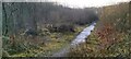

45 photos from this area
Area Information
Key information about the M28 0SY including its size, population, and administrative classification.
- Area Type
- Postcode
- Area Size
- 4.6 hectares
- Population
- 2143
- Population Density
- 2839 people/km²
House Prices in M28 0SY
11
Properties
£195,111
Average Sold Price
£125,000
Lowest Price
£315,000
Highest Price
Showing 11 properties
| Address | Type | Beds | Baths | Last Sale Price | Last Sale Date | |
|---|---|---|---|---|---|---|
| 53 Hilton Lane, Worsley, M28 0SY | Bungalow | 3 | 1 | £245,000 | May 2021 | |
| 55 Hilton Lane, Worsley, M28 0SY | Bungalow | 5 | 2 | £315,000 | May 2020 | |
| 65 Hilton Lane, Worsley, M28 0SY | Semi-detached | 3 | 1 | £180,000 | Mar 2019 | |
| 61 Hilton Lane, Worsley, M28 0SY | house | - | - | £225,000 | Nov 2016 | |
| 63 Hilton Lane, Worsley, M28 0SY | Semi-detached | 3 | 1 | £203,500 | Sep 2015 | |
| 71 Hilton Lane, Worsley, M28 0SY | Semi-detached | 4 | 3 | £125,000 | Jun 2012 | |
| 55A Hilton Lane, Worsley, M28 0SY | house | - | - | £160,000 | Dec 2009 | |
| 57 Hilton Lane, Worsley, M28 0SY | Semi-detached | - | - | £145,000 | Oct 2006 | |
| 69 Hilton Lane, Worsley, M28 0SY | Semi-detached | - | - | £157,500 | Feb 2004 | |
| 59 Hilton Lane, Worsley, M28 0SY | house | - | - | - | - |
Page 1 of 2
Energy Efficiency in M28 0SY
Amenities
Schools
| Rank | School | Type | Entry gender | Ages |
|---|
Explore more schools in this area
Go to Schools tabDemographics
Household Size
Family (3-5 people)
most common
Accommodation Type
Houses
most common
Tenure
80
majority
Ethnic Group
White
most common
Religion
N/A
most common
Household Composition
N/A
most common
Age
47
median
Adults (30-64 years)
most common
Household Deprivation
N/A
with no deprivation
NS-SEC
41
in Lower managerial occupations
Explore more demographic insights in this area
Go to Demographics tabPlanning
Planning Constraints
- Flood RiskPremium
- Ramsar Wetland SitesPremium
- Area of Outstanding Natural BeautyPremium
- Protected Nature ReservePremium
- Protected WoodlandPremium