Area Overview for Fylde District (B)
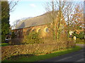
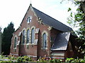
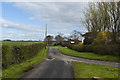
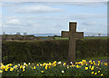
Photos of Fylde District (B)
Area Information
Living in Fylde District (B) means residing within a local authority district that has borough status, located in the North West region of Lancashire, England. Covering an area of 181.8 km², the district was formed on 1 April 1974 under the Local Government Act 1974 by combining three former local government areas. These were the Fylde Rural District, the Kirkham Urban District, and the Lytham St Annes Municipal Borough. The name derives from the coastal plain of the Fylde, a designation that has existed from time immemorial. This region encompasses parishes including Bispham, Lytham, Poulton, and St Michael's, as well as part of Kirkham parish. The district was awarded borough status from its creation, which entitles the chair of the council to use the title of mayor. Historically, the area developed from ancient roots where Romano-British inhabitants known as the Setantii lived there before the Roman invasion in A.D. 43. The region grew into a maritime zone during the 17th and 18th centuries, with ports like Freckleton and Lytham gaining significant importance by the mid-19th century. Today, the district maintains its identity as a residential coastal area. You will find a community shaped by centuries of maritime trade and later by its role as a residential retreat for textile mill owners from eastern Lancashire. Understanding this history provides context for the character of homes in Fylde District (B) and the daily life of residents across the borough.
- Area Type
- District/Borough
- Area Size
- 181.8 km²
- Population
- Not available
- Population Density
- Not available
Demographics
The community profile of Fylde District (B) is defined by an older population structure, with a median age of 70 years. This indicates that the area attracts and retains a significantly older demographic compared to the national average. The most common age range reported covers the total population age, reflecting this mature population mix. Such an age profile often correlates with specific lifestyle needs and leisure preferences within the district. Home ownership stands at 72%, suggesting that the majority of residents have purchased their properties rather than renting. You will encounter a neighbourhood where long-term settlement is common, as three-quarters of households own their homes. The data suggests a stable community where residents are likely invested in the area over extended periods. While specific details on household composition and predominant ethnic groups are contained within the total demographic breakdown, the high ownership rate points to residents who view Fylde District (B) as a permanent home. This level of home ownership usually supports local stability and engagement in community affairs as residents settle deeply into the lifestyle offered by the borough.
Household Size
Accommodation Type
Tenure
Ethnic Group
Religion
Household Composition
Age
Household Deprivation
NS-SEC
Explore more demographic insights in this area
Go to Demographics tabPlanning
Planning Constraints
- Flood RiskPremium
- Ramsar Wetland SitesPremium
- Area of Outstanding Natural BeautyPremium
- Protected Nature ReservePremium
- Protected WoodlandPremium