Area Overview for South Ribble District (B)
Photos of South Ribble District (B)
Area Information
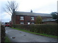
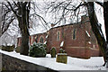
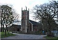
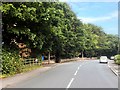
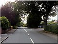
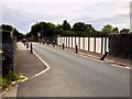
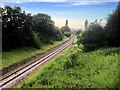
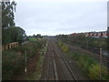
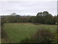
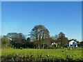
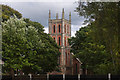
Living in South Ribble District (B) means everyday life unfolds across an expansive local authority district covering 114.7 square kilometres. This is a place defined by its scale and specific demographic character rather than conventional urban density. You will find a community where a significant portion of residents are residents over the age of 70, making the area distinct from many younger, faster-paced locations. Homeownership is the norm here, with 77 per cent of households owning their property outright or with a mortgage. This high level of ownership suggests stability within the neighbourhoods you are considering. Daily life in South Ribble District (B) is shaped by these demographics and the physical space of the district. Poverty levels, derived from the index of multiple deprivation, sit at the first decile when ranked from most deprived to least deprived. This indicates that living here involves a specific economic landscape compared to the national average. The area does not contain Areas of Outstanding Natural Beauty or major protected nature reserves, meaning development constraints differ from the rural landscape elsewhere in Lancashire or nationally. Instead, planning considerations focus on Ramsar wetland sites and protected woodland which occupy a small fraction of the total area. You are navigating a district where environmental planning is present but limited by the sheer size of the land.
- Area Type
- District/Borough
- Area Size
- 114.7 km²
- Population
- Not available
- Population Density
- Not available
Demographics
The community profile in South Ribble District (B) is heavily weighted towards older demographics. The median age across the district is 70 years, indicating that a large proportion of the population consists of retirees or those in later life stages. This age distribution influences the local services, social groups, and general rhythm of life in settlements within the district. Households here tend to be established, reflected in a home ownership rate of 77 per cent. This figure is markedly higher than the national average, signifying that most residents have lived in their current properties for extended periods rather than being transient renters. Diversity figures show the predominant ethnic group data as total without specific breakdown, suggesting a need to understand the local social fabric through other indicators like age and ownership. The household composition and accommodation type data is recorded as total, which implies a standard distribution of housing types without an exceptional skew towards single-occupancy or large-family homes specifically noted in this dataset. For those considering living in South Ribble District (B), you must understand that the area caters primarily to an older, property-owning demographic. The index of multiple deprivation places the district at the first decile when ranked from most deprived to least deprived. This ranking suggests a lower concentration of severe deprivation relative to the rest of the country, though it remains a factor to weigh against the high age profile when assessing community vibrancy or peer group interactions.
Household Size
Accommodation Type
Tenure
Ethnic Group
Religion
Household Composition
Age
Household Deprivation
NS-SEC
Explore more demographic insights in this area
Go to Demographics tabPlanning
Planning Constraints
- Flood RiskPremium
- Ramsar Wetland SitesPremium
- Area of Outstanding Natural BeautyPremium
- Protected Nature ReservePremium
- Protected WoodlandPremium