Area Overview for West Lancashire District (B)
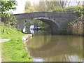
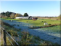
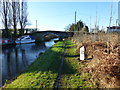
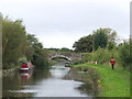
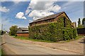
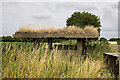
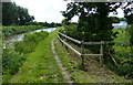
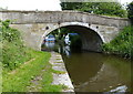
Photos of West Lancashire District (B)


Area Information
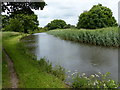
Living in West Lancashire District (B) means inhabiting a distinct local authority district that spans 381.3 km² across England. The area presents a specific living environment where residents navigate a considerable physical footprint. You will find that the district is defined by its scale rather than dense urban density. This geographical spread influences the daily rhythm of life significantly. The sheer size of the territory means distances between locations carry weight. Planning developments must account for the vast open spaces that characterise this region. The community within West Lancashire District (B) operates with a unique rhythm shaped by its rural nature. Residents here adapt their lifestyles to the expansive landscape they call home. The district does not conform to typical city centre living patterns. Instead, life unfolds across a wide expanse of land. This configuration dictates how people commute, shop, and socialise within West Lancashire District (B). Understanding the space is essential to grasping the lifestyle on offer. The area demands resilience and an appreciation for open country living. Prospective buyers should consider how this vastness fits their personal requirements before committing.
- Area Type
- District/Borough
- Area Size
- 381.3 km²
- Population
- Not available
- Population Density
- Not available
Demographics
The community in West Lancashire District (B) reflects a specific demographic profile that shapes local society. The median age stands at 70, indicating a population heavily skewed towards older residents. This age distribution paints a clear picture of who calls West Lancashire District (B) home. You will encounter a generation that has lived through significant historical shifts. The household composition aligns closely with this older median age figure. Most residents have settled their lives within this expansive district unitary authority. Home ownership reaches 72% across the area. This high rate suggests stability and long-term roots within West Lancashire District (B). The majority of households own their properties outright or have a mortgage. Rental percentages remain low compared to metropolitan areas. Accommodation types vary but reflect the needs of a mature population. The relationship between residents and their homes is fundamentally different here. You are more likely to find people who have bridged their entire adult lives in West Lancashire District (B). This permanence influences community engagement and local services available. The area is not a transient marketplace but a home to established families and retirees.
Household Size
Accommodation Type
Tenure
Ethnic Group
Religion
Household Composition
Age
Household Deprivation
NS-SEC
Explore more demographic insights in this area
Go to Demographics tabPlanning
Planning Constraints
- Flood RiskPremium
- Ramsar Wetland SitesPremium
- Area of Outstanding Natural BeautyPremium
- Protected Nature ReservePremium
- Protected WoodlandPremium