Area Overview for Blackburn with Darwen (B)
Photos of Blackburn with Darwen (B)

Area Information
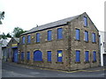
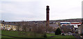
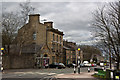
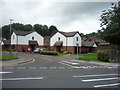
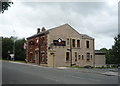
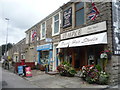
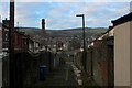
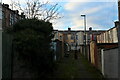
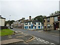
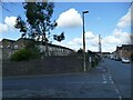
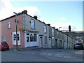
Living in Blackburn with Darwen means residing in a unitary authority area with borough status located in east Lancashire. This district encompasses the historic towns of Blackburn and Darwen alongside surrounding rural areas, including villages such as Lower Darwen, Feniscowles, Brownhill and Hoddlesden. The borough covers a total land area of 137.1 square kilometres, spanning from the border areas of Bury and Bolton to the north where it meets Ribble Valley. You will find a settlement pattern defined by compact urban centres encircled by countryside and small hamlets. The area features a high population density, which is approximately three times the average for England and Wales. This density reflects a community where urban and rural lifestyles exist within a 137 square kilometre footprint. The town halls in both Blackburn and Darwen serve as key civic landmarks, marking the administrative centre of this local authority district. Established as a unitary authority in 1998, the borough has a complex history tracing back to governance changes in the mid-19th century. You can explore open moorland and forest areas to the south of Darwen, or consider visiting Turton Tower, a 16th-century mansion nearby. The landscape includes significant Green Belt designation covering 38.2% of land, ensuring that green spaces remain integrated with residential zones. Daily life here balances historic town centres with accessible rural surroundings, offering distinct neighbourhoods within a single administrative boundary.
- Area Type
- District/Borough
- Area Size
- 137.1 km²
- Population
- Not available
- Population Density
- Not available
Demographics
The community profile of Blackburn with Darwen reveals a distinct age demographic that differs significantly from national averages. The median age for residents is 70 years old, indicating a population skewed heavily towards older age groups. This statistical reality suggests that many homes in the area cater to retirees or those in later life stages. The data notes the most common age range category as 'Total', confirming that age distribution is a primary characteristic of the borough. With a population spanning 137 square kilometres, this age profile influences local demand for housing and amenities tailored to older residents. Household stability appears high within this unitary authority area. Home ownership stands at 61%, meaning the majority of individuals living here own their accommodation outright or via a mortgage. This figure contrasts with areas where renting dominates the housing market. The data outlines household composition and accommodation type totals without specifying individual breakdowns, focusing instead on the overarching ownership rate. This high level of tenure stability often correlates with deeper community roots and longer-term residency patterns. While specific details on ethnic groups, religion, and precise household structures are not detailed in the provided figures, the 61% ownership rate provides a clear picture of the area's social fabric. Residents benefit from a neighbourhood where the majority have a permanent stake in their local community.
Household Size
Accommodation Type
Tenure
Ethnic Group
Religion
Household Composition
Age
Household Deprivation
NS-SEC
Explore more demographic insights in this area
Go to Demographics tabPlanning
Planning Constraints
- Flood RiskPremium
- Ramsar Wetland SitesPremium
- Area of Outstanding Natural BeautyPremium
- Protected Nature ReservePremium
- Protected WoodlandPremium