Area Overview for Rossendale District (B)
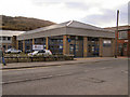
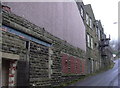
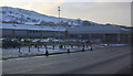
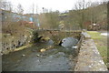
Photos of Rossendale District (B)
Area Information
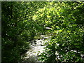
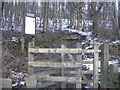
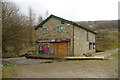
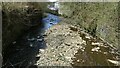
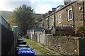
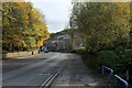
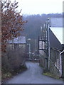
Rossendale District (B) covers a substantial 138.1 square kilometres and serves as a distinct local authority area within England. You will find a community defined by specific demographics and clear boundaries where everyday life moves at a measured pace. The district functions as a recognised administrative unit, providing the framework for local governance and services for residents. Life here centres on the established village and town network that characterises this rural borough. Prospective buyers should note that this is not a densely packed urban zone but a sparsely populated district with a significant landmass. The area size allows for generous green space and a lower pressure on infrastructure compared to major cities. You are looking at a region where the pace of life is dictated by rural rhythms rather than city traffic lights. The district name appears frequently on maps, official documents, and local signage throughout the valley. This location offers a specific subset of the English countryside experience, distinct from neighbouring districts. The mix of open land and settlement patterns creates a unique living environment. Whether you are commuting from here or seeking a quieter retirement base, the district provides a defined setting. The area size ensures that you are not cramped, though services may be spread over that 138.1 square kilometre footprint. You gain space at the cost of proximity to some major amenities.
- Area Type
- District/Borough
- Area Size
- 138.1 km²
- Population
- Not available
- Population Density
- Not available
Demographics
The community profile in Rossendale District (B) reflects a settled population with a median age of 70 years. This figure indicates that the area skews heavily towards older adults and retirees rather than young families or students. Most households are likely managed by pensioners or empty nesters, creating a demographic landscape where stability often predisminary change. The data shows that age is the primary driver of the population structure, with the total age cohort averaging significantly higher than the national mean. Home ownership stands at 68 per cent, meaning a majority of residents own their property outright or with a mortgage. This high rate of ownership suggests fiscal stability within the community and a lower volume of short-term rentals. The remaining households include tenants who contribute to the local economy but represent a minority in this district. There are no specific breakdowns provided for household composition or accommodation types, but the ownership figure remains a key indicator of the area's character. You should understand that living here involves adapting to an older demographic. The 70-year median age means local shops and services cater primarily to established homes and older citizens. Noise levels and party culture will likely be different in Rossendale District (B) compared to younger urban enclaves. The community feel is rooted in long-standing residency rather than transient populations. This demographic reality shapes everything from available leisure activities to the pace of local decision-making.
Household Size
Accommodation Type
Tenure
Ethnic Group
Religion
Household Composition
Age
Household Deprivation
NS-SEC
Explore more demographic insights in this area
Go to Demographics tabPlanning
Planning Constraints
- Flood RiskPremium
- Ramsar Wetland SitesPremium
- Area of Outstanding Natural BeautyPremium
- Protected Nature ReservePremium