Area Overview for Hyndburn District (B)
Photos of Hyndburn District (B)
Area Information
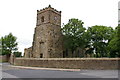
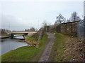
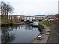
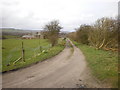
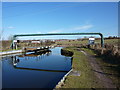
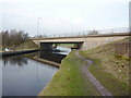
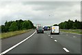
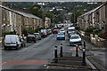
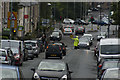
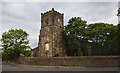
Hyndburn District is a local authority district with borough status situated in Lancashire, North West England. The area spans 73 square kilometres and centres on the town of Accrington, which serves as its primary administrative hub. Beyond Accrington, the district encompasses the smaller towns of Clayton-le-Moors, Great Harwood, Oswaldtwistle, and Rishton. It lies physically between the urban centres of Blackburn and Burnley, stretching from the moorlands of the Forest of Rossendale to the south down into the Ribble Valley to the north. The River Hyndburn flows through the district, defining the valley in which the towns developed over centuries. Life in this location offers residents direct access to a polycentric urban environment framed by Pennine hills, numerous reservoirs, and scenic valleys. The district features a dense network of green spaces, canal routes, and heritage trails that connect to historic mills reflecting its industrial past. You can find living in Hyndburn District within a setting that balances urban amenities with significant natural landscape elements. The area recorded a population of 82,234 in the 2021 census, creating a community that is compact yet diverse in its working-class and industrial heritage. Daily life involves proximity to the market town of Accrington and engagement with local trades that evolved from the cotton textile industry to modern engineering sectors.
- Area Type
- District/Borough
- Area Size
- 73.0 km²
- Population
- Not available
- Population Density
- Not available
Demographics
The community living in Hyndburn District displays a distinct age profile, with a median age of 70 years old. This demographic profile indicates a population skewed significantly towards older adults compared to the national average. The area does not provide specific breakdowns for the most common age range beyond the total, but the high median age suggests a mature neighbourhood where many residents have settled for life rather than young families moving in. This population structure often accompanies changes in local services and community needs over time. Home ownership stands at 63 per cent across the district. This figure indicates that nearly two-thirds of the 82,234 residents own their homes outright or with a mortgage. The remaining households consist mostly of renters or other tenure types not specified in the current data. The district does not report specific figures on household composition structures such as single-parent families or couple households without children. You will find that the majority of housing is privately owned, which usually stabilises local values and encourages long-term investment in property maintenance. Census data from 2021 reveals a predominantly White community representing 67,984 individuals out of the total population. Asians make up the second largest group with 12,401 residents. The district does not release data on predominant ethnic groups as a qualifying statement for the whole area, but these totals show a clear majority White population with a visible Asian minority presence. There is no available information on religious affiliations within Hyndburn District. The lack of detailed racial or religious breakdowns limits the ability to describe specific cultural enclaves, but the overall picture remains one of a largely White community with pockets of other ethnicities.
Household Size
Accommodation Type
Tenure
Ethnic Group
Religion
Household Composition
Age
Household Deprivation
NS-SEC
Explore more demographic insights in this area
Go to Demographics tabPlanning
Planning Constraints
- Flood RiskPremium
- Ramsar Wetland SitesPremium
- Area of Outstanding Natural BeautyPremium
- Protected Nature ReservePremium
- Protected WoodlandPremium