Area Overview for L20 8EL
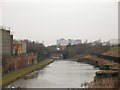
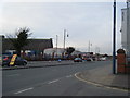
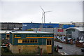
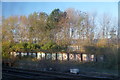
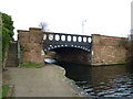
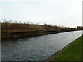
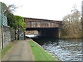
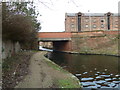
Photos of L20 8EL

Area Information
Living in L20 8EL means residing within a compact residential cluster spanning just 2.2 hectares. This specific postcode area accommodates a population of 2,176 people, resulting in a density of 1,448 people per square kilometre. You are moving into a small, concentrated neighbourhood where daily interactions with neighbours are frequent due to the high population density. The community is situated in England and represents a tightly knit environment rather than a sprawling suburb. Every aspect of life here revolves around the immediate surroundings, from commuting to local shopping trips. The scale of the area ensures that major facilities are within practical reach, yet the residential nature remains the primary focus. You will find that life in this postcode is defined by its proximity to others, creating a setting where local matters resonate quickly. The distinct identity of L20 8EL comes from its sheer size; it is a defined pocket of urban life rather than a district with varied landscapes. Prospective buyers should recognise that living here means accepting a high-density lifestyle within a geographically small footprint.
- Area Type
- Postcode
- Area Size
- 2.2 hectares
- Population
- 2176
- Population Density
- 1448 people/km²
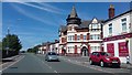
The property market in L20 8EL is defined by a strong rental sector and a specific housing type. With only 21% of households owning their homes, you will predominantly find tenants occupying the local properties. The data confirms that houses are the predominant accommodation type within this postcode. This combination suggests an area where leaseholders may outnumber owner-occupiers, offering flexibility but also potential challenges regarding long-term stability. Since the area covers just 2.2 hectares, the total volume of available homes is limited compared to larger districts. Buyers looking at L20 8EL should expect a market driven by investment and rental demand rather than speculative buying. The presence of houses rather than flats indicates a residential character suitable for those seeking traditional UK housing structures. However, the low ownership percentage means competition may be fierce for purchase opportunities, as many sellers are landlords or investors. You need to act quickly if you spot a sale, as the small size of the cluster restricts the supply pipeline.
House Prices in L20 8EL
Showing 4 properties
| Address | Type | Beds | Baths | Last Sale Price | Last Sale Date | |
|---|---|---|---|---|---|---|
| Hss, 4 Juniper Street, Liverpool, L20 8EL | Industrial | - | - | - | - | |
| Johnstones, 2 Juniper Street, Liverpool, L20 8EL | storage_distribution | - | - | - | - | |
| 4B Juniper Street, Liverpool, L20 8EL | Industrial | - | - | - | - | |
| Envoy Property Services, Juniper Street, Liverpool, L20 8EL | Office | - | - | - | - |
Energy Efficiency in L20 8EL
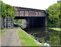
Your daily lifestyle in L20 8EL revolves around a convenient network of amenities within practical reach. You have five railway stations to choose from, including Bank Hall and Sandhills Railway Station, offering excellent links into the wider city. For shopping needs, Lidl LIV, Spar Brewster, and Iceland County provide essential retail options close by. The area also offers ferry connectivity, with terminals available for routes to Belfast, the Isle of Man, and Dublin. This transport diversity means you can easily commute to work or plan future holidays without leaving the region. Five retail outlets ensure you do not need to drive far for groceries and daily necessities. The combination of rail, ferry, and shop accessibility makes living in L20 8EL highly practical. You will find that essential services are clustered efficiently, saving you time during busy weekdays. Whether you need to catch a train for a business trip or pick up supplies from a local supermarket, the infrastructure supports a busy yet manageable daily routine.
Amenities
Schools
Families considering homes in L20 8EL have access to two primary schools located nearby. St Alexander's RC Junior Mixed and Infant School serves as one of the options for younger children. Nearby, you will also find St Alban's RC Junior Mixed and Infant School. The presence of both institutions indicates a dedicated provision for primary education in the vicinity of this residential cluster. As these are both Catholic (RC) schools, they cater to specific religious communities while providing mixed education for boys and girls. Living in this area gives you practical access to these facilities without needing to travel far for Early Years and Junior levels. The mix of primary institutions ensures that families with young children can access schooling within the L20 8EL neighbourhood boundaries or immediate surroundings. No secondary schools are listed in the immediate data for this specific postcode, meaning older pupils may need to travel further for their education. These schools form the core educational infrastructure for children growing up in this high-density zone.
| Rank | School | Type | Entry gender | Ages |
|---|
Explore more schools in this area
Go to Schools tabDemographics
The community within L20 8EL reflects a mature and established resident base. The median age for the population is 47 years, indicating that many households include adults or families with older children. The most common age range consists of adults between 30 and 64 years, suggesting a workforce population that may rely heavily on transport links to their jobs. Home ownership stands at 21%, meaning the vast majority of homes are likely rented rather than owned by the occupants. This low ownership rate defines the local market dynamics and influences the stability of the neighbourhood over time. The predominant ethnic group is White, which shapes the cultural character of the streets. Accommodation types in the area consist primarily of houses, offering a specific housing stock distinct from council estates or high-rise blocks. These figures paint a picture of a practical, age-diverse community where rental tenants form the backbone of the population. Understanding these demographics helps you grasp who currently calls L20 8EL home and what their daily needs entail.
Household Size
Accommodation Type
Tenure
Ethnic Group
Religion
Household Composition
Age
Household Deprivation
NS-SEC
Explore more demographic insights in this area
Go to Demographics tabPlanning
Planning Constraints
- Flood RiskPremium
- Ramsar Wetland SitesPremium
- Area of Outstanding Natural BeautyPremium
- Protected Nature ReservePremium
- Protected WoodlandPremium