Area Overview for L20 8EW
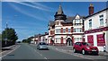
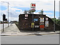
Photos of L20 8EW


Area Information
L20 8EW is a compact residential cluster situated in North West England, occupying just 1.4 hectares. This postcode area is compact, holding a population of 2,176 people within a limited footprint. Living in L20 8EW means residing in a dense environment where local amenities and daily services are often within immediate reach. The area functions as a small neighbourhood rather than a sprawling district, creating a tight-knit living space for its residents. Daily life here is defined by proximity, with housing concentrated across a small landmass. The limited size of the postcode suggests a community-focused environment where neighbours are likely well acquainted. You will find that the scale of L20 8EW creates a distinct atmosphere compared to larger, more diffuse urban districts. This specific configuration supports a lifestyle where the distance between home and local facilities remains minimal. The area represents a focused区块 of residential living within the broader Liverpool region. Prospective buyers seeking a defined, small-scale environment will recognise the character of this postcode. The concentration of population per hectare is notable, reflecting an established residential pattern.
- Area Type
- Postcode
- Area Size
- 1.4 hectares
- Population
- 2176
- Population Density
- 1448 people/km²
The property market in L20 8EW is characterised by a housing stock that consists primarily of houses. Accommodation type data confirms that the postcodes in this area are dominated by houses rather than flats or apartments. Only 21 per cent of residents own their homes, which places this area within a higher proportion of rental accommodation compared to owner-occupied neighbourhoods. This market dynamic suggests that investments here cater to both renters seeking flexible housing and buyers looking for properties they can purchase. The prevalence of houses means that buyers will not find the dense, high-rise environments typical of some larger cities. Instead, the housing availability focuses on standalone or semi-detached dwellings. For those considering homes in L20 8EW, the lower ownership percentage indicates a competitive rental sector alongside potential purchase opportunities. The small area size of 1.4 hectares limits the total volume of properties available, adding a layer of exclusivity to available stock. Buyers should anticipate a market where the number of properties for sale or rent is constrained by the physical size of the neighbourhood.
House Prices in L20 8EW
Showing 15 properties
| Address | Type | Beds | Baths | Last Sale Price | Last Sale Date | |
|---|---|---|---|---|---|---|
| Unit F, 8-12 Bankhall Lane, Liverpool, L20 8EW | warehouse | - | - | - | - | |
| Unit E, 8-12 Bankhall Lane, Liverpool, L20 8EW | warehouse | - | - | - | - | |
| Unit B, 8-12 Bankhall Lane, Liverpool, L20 8EW | warehouse | - | - | - | - | |
| 8-12 Bankhall Lane, Liverpool, L20 8EW | warehouse | - | - | - | - | |
| Unit C, 8-12 Bankhall Lane, Liverpool, L20 8EW | warehouse | - | - | - | - | |
| Unit D, 8-12 Bankhall Lane, Liverpool, L20 8EW | warehouse | - | - | - | - | |
| Unit 1, 10 Bankhall Lane, Liverpool, L20 8EW | shop | - | - | - | - | |
| Unit 4, Westport Business Complex, Bankhall Lane, Liverpool, L20 8EW | warehouse | - | - | - | - | |
| Unit 8 10 12, Warehouses, Bankhall Lane, Liverpool, L20 8EW | warehouse | - | - | - | - | |
| Unit G, Westport Business Complex, Bankhall Lane, Liverpool, L20 8EW | storage_distribution | - | - | - | - |
Energy Efficiency in L20 8EW
Residents of L20 8EW enjoy access to a range of amenities within practical reach, though they must travel slightly beyond the 1.4-hectare boundary. For travel, five railway stations are nearby, including Sandhills Railway Station, Bank Hall Railway Station, and Kirkdale Railway Station. Commuters can utilise these hubs to access broader networks. Retail needs are met by five local shopping venues, with notable options including Lidl LIV, Sainsburys Liverpool Great, and Iceland County. These supermarkets provide essential groceries and household items at your doorstep. Transport links also include five ferry terminals, such as the Liverpool Belfast Ferry Terminal Bootle and the Liverpool Isle of Man & Dublin Terminal. Banking on these connections offers flexible travel options beyond standard rail services. The combination of rail and ferry access makes L20 8EW a convenient base for both local and inter-city travel. You will find that daily errands are manageable, supported by the abundance of local shops and major retail chains.
Amenities
Schools
Families living in L20 8EW have access to two primary schools in their immediate vicinity. St Alexander's RC Junior Mixed and Infant School operates as a local educational facility for younger children. St Alban's RC Junior Mixed and Infant School serves as the second primary option nearby. Both institutions are listed as primary schools, offering Catholic education within the reach of residents. For prospective families, this mix of junior and infant provisions allows children to receive early education within a faith-based setting. The proximity of these two schools ensures that families do not need to commute far for basic primary education. While specific Ofsted ratings are not listed in the available data, the presence of two named primary schools indicates a committed local education infrastructure. The focus on RC schools suggests a community with a significant religious influence in its educational choices. Parents can expect these schools to provide a local environment for children before they transition to secondary education further away. The availability of these schools supports the demographic reality of an area with many adults in the 30 to 64 age group.
| Rank | School | Type | Entry gender | Ages |
|---|
Explore more schools in this area
Go to Schools tabDemographics
The community in L20 8EW is defined by a mature demographic profile. The average age of the population is 47 years, with adults aged between 30 and 64 years constituting the most common age range. This indicates a settled neighbourhood where families and mid-career professionals are the primary demographic. Home ownership stands at 21 per cent, suggesting that a significant portion of the 2,176 residents rent their homes. The predominant accommodation type consists of houses, which aligns with an area suited for families or individuals seeking detached or semi-detached living. The ethnic makeup of L20 8EW is predominantly White, reflecting a traditional residential composition. These figures present a clear picture of a stable, family-oriented community with a moderate level of owner-occupancy. The high concentration of adults in middle age pairs with the prevalence of houses, reinforcing the perception of a residential zone focused on long-term dwelling rather than transient living. You can expect a community where the majority of households comprise adults in their working years. The 21 per cent ownership rate highlights a market where renting remains a common arrangement alongside private homeownership.
Household Size
Accommodation Type
Tenure
Ethnic Group
Religion
Household Composition
Age
Household Deprivation
NS-SEC
Explore more demographic insights in this area
Go to Demographics tabPlanning
Planning Constraints
- Flood RiskPremium
- Ramsar Wetland SitesPremium
- Area of Outstanding Natural BeautyPremium
- Protected Nature ReservePremium
- Protected WoodlandPremium