Area Overview for CH3 7AS
Photos of CH3 7AS
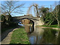
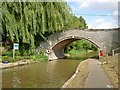
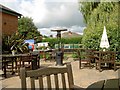
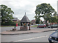
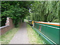
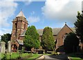
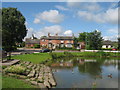

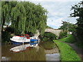
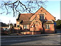
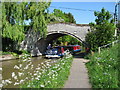
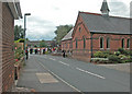
53 photos from this area
Area Information
Key information about the CH3 7AS including its size, population, and administrative classification.
- Area Type
- Postcode
- Area Size
- 8.3 hectares
- Population
- 1377
- Population Density
- 279 people/km²
House Prices in CH3 7AS
38
Properties
£391,969
Average Sold Price
£86,500
Lowest Price
£1,037,500
Highest Price
Showing 38 properties
| Address | Type | Beds | Baths | Last Sale Price | Last Sale Date | |
|---|---|---|---|---|---|---|
| Village House, Village Road, Christleton, Chester, CH3 7AS | house | 4 | 3 | £500,000 | Feb 2025 | |
| Bluebell Lodge, Village Road, Christleton, Chester, CH3 7AS | Detached | 4 | 3 | £1,037,500 | Nov 2023 | |
| The Old Farm, Village Road, Christleton, Chester, CH3 7AS | Detached | 4 | 3 | £715,000 | May 2021 | |
| Rose Cottage, Village Road, Christleton, Chester, CH3 7AS | Cottage | 4 | 2 | £510,000 | Sep 2019 | |
| Holly Cottage, Village Road, Christleton, Chester, CH3 7AS | house | - | - | £325,000 | Oct 2018 | |
| Fairhaven, Village Road, Christleton, Chester, CH3 7AS | Semi-detached | 3 | 1 | £249,950 | Dec 2014 | |
| Clematis Cottage, Village Road, Christleton, Chester, CH3 7AS | house | - | - | £222,500 | Dec 2013 | |
| Grange House, Village Road, Christleton, Chester, CH3 7AS | house | - | - | £615,000 | Mar 2013 | |
| The Stable House, Village Road, Christleton, Chester, CH3 7AS | house | 3 | - | £632,500 | Dec 2010 | |
| May Cottage, Village Road, Christleton, Chester, CH3 7AS | Semi-detached | - | - | £175,000 | Apr 2009 |
Page 1 of 4
Energy Efficiency in CH3 7AS
Amenities
Schools
| Rank | School | Type | Entry gender | Ages |
|---|
Explore more schools in this area
Go to Schools tabDemographics
Household Size
Family (3-5 people)
most common
Accommodation Type
Houses
most common
Tenure
87
majority
Ethnic Group
White
most common
Religion
N/A
most common
Household Composition
N/A
most common
Age
47
median
Adults (30-64 years)
most common
Household Deprivation
N/A
with no deprivation
NS-SEC
53
in Lower managerial occupations
Explore more demographic insights in this area
Go to Demographics tabPlanning
Planning Constraints
- Flood RiskPremium
- Ramsar Wetland SitesPremium
- Area of Outstanding Natural BeautyPremium
- Protected Nature ReservePremium
- Protected WoodlandPremium