Area Overview for SW12 9LF
Photos of SW12 9LF


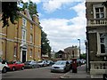
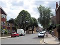
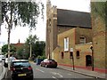

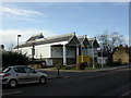
100 photos from this area
Area Information
Key information about the SW12 9LF including its size, population, and administrative classification.
- Area Type
- Postcode
- Area Size
- 3461 m²
- Population
- 1721
- Population Density
- 21812 people/km²
House Prices in SW12 9LF
28
Properties
£888,009
Average Sold Price
£430,000
Lowest Price
£1,850,000
Highest Price
Showing 28 properties
| Address | Type | Beds | Baths | Last Sale Price | Last Sale Date | |
|---|---|---|---|---|---|---|
| 69 Cathles Road, London, SW12 9LF | Terraced | 3 | 4 | £1,850,000 | Feb 2023 | |
| 75 Cathles Road, London, SW12 9LF | Terraced | 4 | 3 | £1,350,000 | Feb 2023 | |
| 73 Cathles Road, London, SW12 9LF | house | - | - | £1,060,000 | Aug 2021 | |
| 95 Cathles Road, London, SW12 9LF | Terraced | 3 | 2 | £900,000 | Apr 2018 | |
| 81 Cathles Road, London, SW12 9LF | house | 4 | - | £980,000 | Jun 2015 | |
| 83 Cathles Road, London, SW12 9LF | Terraced | 4 | 2 | £950,000 | May 2013 | |
| 111 Cathles Road, London, SW12 9LF | Terraced | - | - | £809,000 | Apr 2012 | |
| 85 Cathles Road, London, SW12 9LF | Terraced | 3 | 1 | £539,100 | Jul 2006 | |
| 89 Cathles Road, London, SW12 9LF | Terraced | 2 | 2 | £452,000 | Jan 2004 | |
| 87 Cathles Road, London, SW12 9LF | Terraced | 5 | 2 | £430,000 | Dec 2002 |
Page 1 of 3
Energy Efficiency in SW12 9LF
Amenities
Schools
| Rank | School | Type | Entry gender | Ages |
|---|
Explore more schools in this area
Go to Schools tabDemographics
Household Size
Family (3-5 people)
most common
Accommodation Type
Flats
most common
Tenure
51
majority
Ethnic Group
White
most common
Religion
N/A
most common
Household Composition
N/A
most common
Age
22
median
Young Adults (15-29 years)
most common
Household Deprivation
N/A
with no deprivation
NS-SEC
72
in Lower managerial occupations
Explore more demographic insights in this area
Go to Demographics tabPlanning
Planning Constraints
- Flood RiskPremium
- Ramsar Wetland SitesPremium
- Area of Outstanding Natural BeautyPremium
- Protected Nature ReservePremium
- Protected WoodlandPremium