Area Overview for SW12 9LE
Photos of SW12 9LE

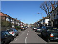
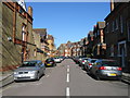
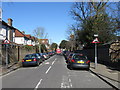
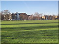
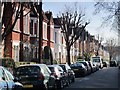

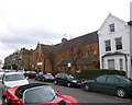
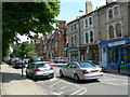
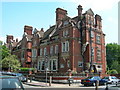
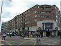
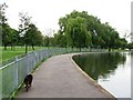
100 photos from this area
Area Information
Key information about the SW12 9LE including its size, population, and administrative classification.
- Area Type
- Postcode
- Area Size
- 4929 m²
- Population
- 1721
- Population Density
- 21812 people/km²
House Prices in SW12 9LE
50
Properties
£935,096
Average Sold Price
£117,500
Lowest Price
£1,500,000
Highest Price
Showing 50 properties
| Address | Type | Beds | Baths | Last Sale Price | Last Sale Date | |
|---|---|---|---|---|---|---|
| 49 Cathles Road, London, SW12 9LE | Terraced | 3 | 1 | £1,300,000 | Jun 2025 | |
| 21 Cathles Road, London, SW12 9LE | Terraced | 5 | 3 | £1,455,000 | Dec 2024 | |
| 27 Cathles Road, London, SW12 9LE | Terraced | 4 | 3 | £1,400,000 | Jun 2023 | |
| 33 Cathles Road, London, SW12 9LE | Terraced | 4 | 2 | £1,040,099 | Mar 2023 | |
| 43 Cathles Road, London, SW12 9LE | Flat | 3 | 2 | £1,381,514 | Jun 2022 | |
| 61 Cathles Road, London, SW12 9LE | Terraced | 4 | 3 | £1,400,000 | Jun 2021 | |
| 55 Cathles Road, London, SW12 9LE | Terraced | 4 | 2 | £1,140,000 | Jan 2021 | |
| 29 Cathles Road, London, SW12 9LE | Terraced | 4 | 3 | £845,000 | Aug 2020 | |
| 31 Cathles Road, London, SW12 9LE | Terraced | 4 | 1 | £805,000 | Aug 2020 | |
| 5 Cathles Road, London, SW12 9LE | Terraced | 4 | 2 | £1,080,000 | Jan 2017 |
Page 1 of 5
Energy Efficiency in SW12 9LE
Amenities
Schools
| Rank | School | Type | Entry gender | Ages |
|---|
Explore more schools in this area
Go to Schools tabDemographics
Household Size
Family (3-5 people)
most common
Accommodation Type
Flats
most common
Tenure
51
majority
Ethnic Group
White
most common
Religion
N/A
most common
Household Composition
N/A
most common
Age
22
median
Young Adults (15-29 years)
most common
Household Deprivation
N/A
with no deprivation
NS-SEC
72
in Lower managerial occupations
Explore more demographic insights in this area
Go to Demographics tabPlanning
Planning Constraints
- Flood RiskPremium
- Ramsar Wetland SitesPremium
- Area of Outstanding Natural BeautyPremium
- Protected Nature ReservePremium
- Protected WoodlandPremium