Area Overview for SE25 6QY
Photos of SE25 6QY

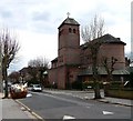
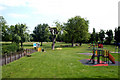

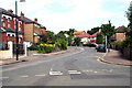
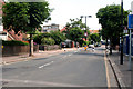
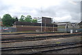

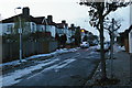
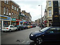
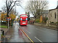

100 photos from this area
Area Information
Key information about the SE25 6QY including its size, population, and administrative classification.
- Area Type
- Postcode
- Area Size
- 1.0 hectares
- Population
- 1758
- Population Density
- 14626 people/km²
House Prices in SE25 6QY
58
Properties
£339,187
Average Sold Price
£42,000
Lowest Price
£595,000
Highest Price
Showing 58 properties
| Address | Type | Beds | Baths | Last Sale Price | Last Sale Date | |
|---|---|---|---|---|---|---|
| 51 Huntly Road, South Norwood, London, SE25 6QY | Terraced | 2 | 1 | £468,000 | Aug 2025 | |
| 5 Huntly Road, South Norwood, London, SE25 6QY | Terraced | 3 | 1 | £590,000 | Sep 2024 | |
| 16 Huntly Road, South Norwood, London, SE25 6QY | house | - | - | £350,000 | Mar 2021 | |
| 40 Huntly Road, South Norwood, London, SE25 6QY | house | - | - | £417,237 | Nov 2020 | |
| 18 Huntly Road, South Norwood, London, SE25 6QY | Terraced | 4 | 1 | £500,000 | Sep 2020 | |
| 31 Huntly Road, South Norwood, London, SE25 6QY | Terraced | 3 | - | £475,000 | Jul 2020 | |
| 15 Huntly Road, South Norwood, London, SE25 6QY | Terraced | 3 | 1 | £425,000 | May 2019 | |
| 13 Huntly Road, South Norwood, London, SE25 6QY | Terraced | 3 | 2 | £400,000 | Apr 2019 | |
| 9 Huntly Road, South Norwood, London, SE25 6QY | Terraced | 3 | 1 | £485,000 | Mar 2019 | |
| 41 Huntly Road, South Norwood, London, SE25 6QY | house | - | - | £356,500 | Aug 2018 |
Page 1 of 6
Energy Efficiency in SE25 6QY
Amenities
Schools
| Rank | School | Type | Entry gender | Ages |
|---|
Explore more schools in this area
Go to Schools tabDemographics
Household Size
One person
most common
Accommodation Type
Flats
most common
Tenure
37
majority
Ethnic Group
White
most common
Religion
N/A
most common
Household Composition
N/A
most common
Age
47
median
Adults (30-64 years)
most common
Household Deprivation
N/A
with no deprivation
NS-SEC
37
in Lower managerial occupations
Explore more demographic insights in this area
Go to Demographics tabPlanning
Planning Constraints
- Flood RiskPremium
- Ramsar Wetland SitesPremium
- Area of Outstanding Natural BeautyPremium
- Protected Nature ReservePremium
- Protected WoodlandPremium