Area Overview for SE25 6UY
Photos of SE25 6UY

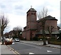
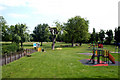
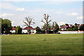
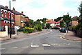
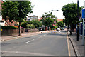
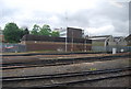
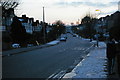
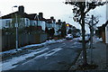
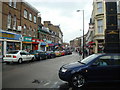
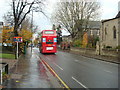

100 photos from this area
Area Information
Key information about the SE25 6UY including its size, population, and administrative classification.
- Area Type
- Postcode
- Area Size
- 3725 m²
- Population
- 1699
- Population Density
- 9214 people/km²
House Prices in SE25 6UY
22
Properties
£245,208
Average Sold Price
£47,000
Lowest Price
£642,000
Highest Price
Showing 22 properties
| Address | Type | Beds | Baths | Last Sale Price | Last Sale Date | |
|---|---|---|---|---|---|---|
| 28 Holmewood Road, South Norwood, London, SE25 6UY | Terraced | 3 | 1 | £642,000 | Mar 2021 | |
| Ground Floor Flat, 2 Holmewood Road, South Norwood, London, SE25 6UY | Flat | - | - | £252,500 | Mar 2020 | |
| 6 Holmewood Road, South Norwood, London, SE25 6UY | Terraced | 4 | 1 | £370,000 | Sep 2017 | |
| 12 Holmewood Road, South Norwood, London, SE25 6UY | house | - | - | £525,000 | Jun 2017 | |
| 8 Holmewood Road, South Norwood, London, SE25 6UY | Terraced | 3 | 1 | £210,000 | Sep 2011 | |
| 16 Holmewood Road, South Norwood, London, SE25 6UY | house | 3 | - | £215,000 | Apr 2011 | |
| 14 Holmewood Road, South Norwood, London, SE25 6UY | Flat | 1 | 1 | £135,000 | Oct 2008 | |
| 26 Holmewood Road, South Norwood, London, SE25 6UY | Terraced | - | - | £221,000 | Jun 2006 | |
| 18 Holmewood Road, South Norwood, London, SE25 6UY | Flat | - | - | £132,000 | Oct 2005 | |
| First Floor Flat, 2 Holmewood Road, South Norwood, London, SE25 6UY | Flat | - | - | £47,000 | Oct 1999 |
Page 1 of 3
Energy Efficiency in SE25 6UY
Amenities
Schools
| Rank | School | Type | Entry gender | Ages |
|---|
Explore more schools in this area
Go to Schools tabDemographics
Household Size
Family (3-5 people)
most common
Accommodation Type
Houses
most common
Tenure
66
majority
Ethnic Group
White
most common
Religion
N/A
most common
Household Composition
N/A
most common
Age
47
median
Adults (30-64 years)
most common
Household Deprivation
N/A
with no deprivation
NS-SEC
42
in Lower managerial occupations
Explore more demographic insights in this area
Go to Demographics tabPlanning
Planning Constraints
- Flood RiskPremium
- Ramsar Wetland SitesPremium
- Area of Outstanding Natural BeautyPremium
- Protected Nature ReservePremium
- Protected WoodlandPremium