Area Overview for SE25 6QX
Photos of SE25 6QX

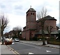
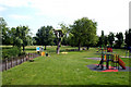
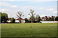
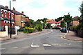
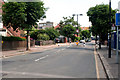
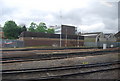

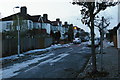
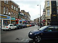
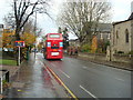

100 photos from this area
Area Information
Key information about the SE25 6QX including its size, population, and administrative classification.
- Area Type
- Postcode
- Area Size
- 6610 m²
- Population
- 1758
- Population Density
- 14626 people/km²
House Prices in SE25 6QX
64
Properties
£271,711
Average Sold Price
£72,000
Lowest Price
£517,000
Highest Price
Showing 64 properties
| Address | Type | Beds | Baths | Last Sale Price | Last Sale Date | |
|---|---|---|---|---|---|---|
| 52 Sangley Road, South Norwood, London, SE25 6QX | Terraced | 3 | - | £517,000 | Feb 2021 | |
| 71 Sangley Road, South Norwood, London, SE25 6QX | house | 2 | - | £325,000 | Aug 2018 | |
| 44 Sangley Road, South Norwood, London, SE25 6QX | Terraced | 4 | 2 | £340,000 | Mar 2018 | |
| 38 Sangley Road, South Norwood, London, SE25 6QX | Terraced | 3 | 1 | £417,000 | Dec 2017 | |
| 67 Sangley Road, South Norwood, London, SE25 6QX | Terraced | 2 | 1 | £385,000 | Sep 2017 | |
| 69 Sangley Road, South Norwood, London, SE25 6QX | Terraced | 2 | 1 | £392,000 | Jul 2017 | |
| 48 Sangley Road, South Norwood, London, SE25 6QX | house | 3 | - | £237,500 | Jul 2010 | |
| 42 Sangley Road, South Norwood, London, SE25 6QX | house | - | - | £220,000 | Apr 2009 | |
| 63 Sangley Road, South Norwood, London, SE25 6QX | Terraced | - | - | £205,000 | May 2007 | |
| 70A Sangley Road, South Norwood, London, SE25 6QX | Flat | - | - | £150,000 | Jan 2007 |
Page 1 of 7
Energy Efficiency in SE25 6QX
Amenities
Schools
| Rank | School | Type | Entry gender | Ages |
|---|
Explore more schools in this area
Go to Schools tabDemographics
Household Size
One person
most common
Accommodation Type
Flats
most common
Tenure
37
majority
Ethnic Group
White
most common
Religion
N/A
most common
Household Composition
N/A
most common
Age
47
median
Adults (30-64 years)
most common
Household Deprivation
N/A
with no deprivation
NS-SEC
37
in Lower managerial occupations
Explore more demographic insights in this area
Go to Demographics tabPlanning
Planning Constraints
- Flood RiskPremium
- Ramsar Wetland SitesPremium
- Area of Outstanding Natural BeautyPremium
- Protected Nature ReservePremium
- Protected WoodlandPremium