Area Overview for RM12 4XY
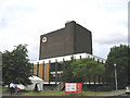
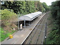
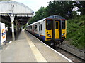
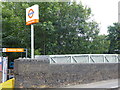
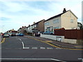
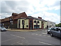
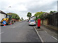
Photos of RM12 4XY


Area Information
Living in RM12 4XY defines a specific residential experience within the London postcode cluster. This area covers 1,545 square metres and supports a population of 1,981 people. The density reaches 1,282,012 people per square kilometre, creating a compact, high-intensity living environment. Residents navigate a small cluster of homes where daily life moves quickly. The postcode serves as a distinct node in the wider Hornchurch and Upminster corridor. You will find a community anchored by flats rather than detached houses. This demographic structure influences the sound levels and neighbour interactions significantly. The location offers direct access to major rail and metro networks. Emerson Park, Upminster, and Gidea Park stations sit nearby. Retail choices like Iceland and Sainsburys provide immediate convenience. You will not find open green spaces or wetland sites here. The land lacks protected woodland or areas of outstanding natural beauty. Safety assessments indicate specific concerns regarding crime rates. Flood risk remains low according to local records. Ramsar sites do not affect planning in this zone. The area remains a functional, accessible part of Greater London without natural conservation constraints.
- Area Type
- Postcode
- Area Size
- 1545 m²
- Population
- 1981
- Population Density
- 5454 people/km²
The property market in RM12 4XY revolves almost entirely around flat ownership. Accommodation type data confirms that flats dominate the housing stock in this postcode. Only 49 per cent of residents own their homes. This percentage signals a balanced market where renting and owning compete equally. You will find fewer detached or semi-detached villas than you expect in the wider London boroughs. The 1,545 square metre footprint limits the availability of spacious single-family properties. Buyers seeking luxury or large gardens will find little here. Instead, the market offers compact, efficient living spaces suited to the high density of 1,282,012 people per square kilometre. The 49 per cent ownership figure indicates that new owners join existing residents often. Investors may find opportunities in the rental segment given the accommodation mix. Flats near Hornchurch or Upminster stations fit the commuter profile well. Prices will reflect the lack of natural planning constraints like AONBs. You should prepare for a market driven by transport links rather than garden space. The presence of Langtons Junior Academy and nearby schools supports family-buyer interest. However, the flat-centric nature means average room sizes will be smaller than the national average.
House Prices in RM12 4XY
Showing 3 properties
| Address | Type | Beds | Baths | Last Sale Price | Last Sale Date | |
|---|---|---|---|---|---|---|
| First Floor, Capital House, Appleton Way, Hornchurch, RM12 4XY | Office | - | - | - | - | |
| Pt Ground Floor Back Office, Capital House, Appleton Way, Hornchurch, RM12 4XY | Office | - | - | - | - | |
| Pt Ground Floor, Capital House, Appleton Way, Hornchurch, RM12 4XY | Office | - | - | - | - |
Energy Efficiency in RM12 4XY
Residents of RM12 4XY enjoy immediate access to major retail and transport hubs. Iceland Hornchurch, Sainsburys Hornchurch, and Lidl Hornchurch dominate the retail landscape. These three supermarkets serve the neighbourhood's food needs. Five retail locations operate within a short walk or drive. Public transport options include five rail stations and five metro stops. Emerson Park Station and Gidea Park Station offer rail connections. Elm Park Station and Upminster Bridge Station extend metro access. This transport density places the area firmly in the commuter belt. You can reach London centrally without driving. Dining options exist surrounding the main retail providers. The 1981 population supports a steady stream of weekday shoppers. Leisure facilities sit nearby but not within the immediate postcode boundary. Parks and green spaces remain limited due to the high density of 1,282,012 people per square kilometre. The lifestyle revolves around convenience and network connectivity. Shopping trips feel local rather than a major excursion. Rail commuters enjoy seamless transfers between metro and regional services. The presence of Iceland and Sainsburys anchors the community's daily rhythm. Residents need not travel far for groceries or essentials.
Amenities
Schools
Families in RM12 4XY benefit from several educational institutions nearby. Langtons Infant School and Nursery holds a Good Ofsted rating. This primary school serves the younger age group effectively. Langtons Junior School also carries a Good rating. It complements the infant school to provide continuous primary education. Langtons Junior Academy operates as an academy with a Good Ofsted rating. This secondary or tertiary primary option supports older children. The mix of state and academy provision offers choice for parents. You will not find private schools listed in the immediate data. The three named schools create a strong educational cluster. Living in RM12 4XY places you within practical reach of this network. The proximity to Langtons Junior School simplifies drop-off and collection routines. Good Ofsted ratings for both the infant and junior academy suggest robust teaching standards. Parents focusing on schools near RM12 4XY have access to reliable options. The density of schools indicates a demand for education services in the zone. Children aged 3 to 16 find local coverage for these years. No institutions with lower ratings appear in the provided list. This concentration of Good-rated schools supports the community's investment in education.
| Rank | School | Type | Entry gender | Ages |
|---|
Explore more schools in this area
Go to Schools tabDemographics
The community in RM12 4XY skews towards middle-aged adults living in flats. The median age stands at 47 years. Most residents fall into the 30 to 64 year range. This age profile suggests a population that balances career focus with family considerations. Home ownership rates sit at 49 per cent. This figure indicates an almost equal split between mortgage holders and tenants. The majority of accommodation consists of flats rather than standalone houses. This configuration reinforces the high-density nature of the postcode. The predominant ethnic group is White. You will encounter a mix of backgrounds, though White residents form the majority. Deprivation data is not included in the available records. You cannot assess economic hardship levels directly from current figures. The population density of 1,282,012 people per square kilometre creates a close-knit atmosphere. When considering homes in RM12 4XY, you buy into a specific type of urban living. The age range supports services catering to working families. Older residents likely occupy the homes near these school clusters. The 49 per cent ownership rate means stable long-term residents coexist with transient tenants.
Household Size
Accommodation Type
Tenure
Ethnic Group
Religion
Household Composition
Age
Household Deprivation
NS-SEC
Explore more demographic insights in this area
Go to Demographics tabPlanning
Planning Constraints
- Flood RiskPremium
- Ramsar Wetland SitesPremium
- Area of Outstanding Natural BeautyPremium
- Protected Nature ReservePremium
- Protected WoodlandPremium