Area Overview for RM12 4JA
Photos of RM12 4JA
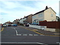
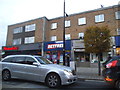
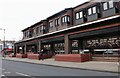
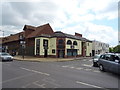
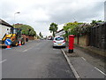
45 photos from this area
Area Information
Key information about the RM12 4JA including its size, population, and administrative classification.
- Area Type
- Postcode
- Area Size
- 7143 m²
- Population
- 1981
- Population Density
- 5454 people/km²
House Prices in RM12 4JA
15
Properties
£394,250
Average Sold Price
£225,000
Lowest Price
£615,000
Highest Price
Showing 15 properties
| Address | Type | Beds | Baths | Last Sale Price | Last Sale Date | |
|---|---|---|---|---|---|---|
| 7 Woodfield Way, Hornchurch, RM12 4JA | Semi-detached | 3 | 2 | £495,000 | May 2025 | |
| 8 Woodfield Way, Hornchurch, RM12 4JA | Terraced | 4 | 3 | £580,000 | Dec 2024 | |
| 10 Woodfield Way, Hornchurch, RM12 4JA | Terraced | 5 | - | £615,000 | Jul 2018 | |
| 9 Woodfield Way, Hornchurch, RM12 4JA | Semi-detached | 2 | 1 | £415,000 | Jun 2017 | |
| 16 Woodfield Way, Hornchurch, RM12 4JA | Terraced | 4 | 2 | £283,000 | Feb 2013 | |
| 1 Woodfield Way, Hornchurch, RM12 4JA | Bungalow | 3 | - | £302,500 | May 2012 | |
| 11 Woodfield Way, Hornchurch, RM12 4JA | Semi-detached | - | - | £225,000 | Jun 2010 | |
| 18 Woodfield Way, Hornchurch, RM12 4JA | Terraced | 4 | 2 | £238,500 | Apr 2005 | |
| 2 Woodfield Way, Hornchurch, RM12 4JA | Terraced | 4 | 2 | - | - | |
| 14 Woodfield Way, Hornchurch, RM12 4JA | Terraced | - | - | - | - |
Page 1 of 2
Energy Efficiency in RM12 4JA
Amenities
Schools
| Rank | School | Type | Entry gender | Ages |
|---|
Explore more schools in this area
Go to Schools tabDemographics
Household Size
One person
most common
Accommodation Type
Flats
most common
Tenure
49
majority
Ethnic Group
White
most common
Religion
N/A
most common
Household Composition
N/A
most common
Age
47
median
Adults (30-64 years)
most common
Household Deprivation
N/A
with no deprivation
NS-SEC
30
in Lower managerial occupations
Explore more demographic insights in this area
Go to Demographics tabPlanning
Planning Constraints
- Flood RiskPremium
- Ramsar Wetland SitesPremium
- Area of Outstanding Natural BeautyPremium
- Protected Nature ReservePremium
- Protected WoodlandPremium