Area Overview for RM12 4UH
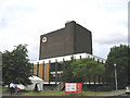
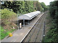
Photos of RM12 4UH
Area Information
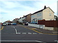
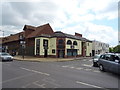
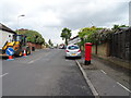
RM12 4UH is a small residential postcode cluster covering exactly one hectare. It serves a population of 1,981 people, resulting in a population density of 189 metres of people per square kilometre. This compact size means the area functions as an intimate residential unit rather than a sprawling neighbourhood. Daily life revolves around proximity, with residents living close to major transport hubs and essential services. The location integration of housing with transport links characterises the everyday experience for those calling this postcode home. You will find yourself in a tightly knit environment where distances to stations like Emerson Park and Upminster are manageable. This small footprint defines the character of the community, offering a concentrated living experience within the broader Hornchurch and Upminster corridor. The area does not sprawl; instead, it focuses on dense, accessible living arrangements. For someone seeking a specific postcode location with clear boundaries, this entry point into the Greater London fringe provides a definite sense of place. You are situated within a cluster where every household is relatively near to its neighbours and local hubs.
- Area Type
- Postcode
- Area Size
- 1.0 hectares
- Population
- 1981
- Population Density
- 5454 people/km²
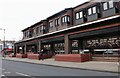
Homes in RM12 4UH are dominated by flats, reflecting the small area size of one hectare. This accommodation type dictates the nature of the property market, favouring urban-style living over detached suburban estates. Home ownership sits at 49 per cent, which means roughly half of the residents own their properties outright or with a mortgage, while the other half likely rents. This equilibrium creates a dynamic market where availability may fluctuate between sales and rentals depending on current market conditions. The 1981 population living in this specific postcode cluster implies a limited inventory of individual homes available for view at any one time. You should expect to look beyond just the RM12 4UH postcode if you require a specific property type, as the area itself is a small cluster. The prevalence of flats suggests that buyers are often individuals, couples, or small households rather than those requiring extensive family space. Living in this environment means accepting a flat-led inventory in exchange for the convenience of proximity to transport.
House Prices in RM12 4UH
Showing 16 properties
| Address | Type | Beds | Baths | Last Sale Price | Last Sale Date | |
|---|---|---|---|---|---|---|
| Perfect Smile Spa Ltd, 132A High Street, Hornchurch, RM12 4UH | Office | - | - | - | - | |
| 108A High Street, Hornchurch, RM12 4UH | Flat | - | - | - | - | |
| 116 High Street, Hornchurch, RM12 4UH | shop | - | - | - | - | |
| 130 High Street, Hornchurch, RM12 4UH | shop | - | - | - | - | |
| 104A High Street, Hornchurch, RM12 4UH | Flat | 3 | 1 | - | - | |
| 96A High Street, Hornchurch, RM12 4UH | Maisonette | - | - | - | - | |
| 106A High Street, Hornchurch, RM12 4UH | Maisonette | - | - | - | - | |
| 94A High Street, Hornchurch, RM12 4UH | Maisonette | - | - | - | - | |
| 88A High Street, Hornchurch, RM12 4UH | Flat | - | - | - | - | |
| 92A High Street, Hornchurch, RM12 4UH | Maisonette | - | - | - | - |
Energy Efficiency in RM12 4UH
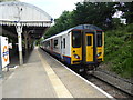
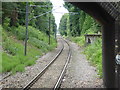
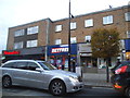
Residents of RM12 4UH benefit from a practical range of amenities within easy reach. Sainsburys Hornchurch, Iceland Hornchurch, and Lidl Hornchurch are among the notable retail outlets available for your convenience. These supermarkets provide standard grocery shopping without the need to travel to central London. Transport options are extensive, with five rail stations and five metro stations listed as being in practical reach for you. Emerson Park Station, Upminster Station, and Gidea Park Station are key rail hubs. Nearby metro destinations include Hornchurch, Upminster Bridge, and Elm Park Station. This density of transport links means you can access the wider city with minimal effort. However, you will not find specific parks, leisure centres, or dining venues named in the provided data. The lifestyle revolves heavily on retail utility and rapid transport connections rather than local green spaces or entertainment districts. You plan your day around these major stations and supermarkets which anchor the accessible lifestyle of this postcode.
Amenities
Schools
Families accessing RM12 4UH have access to a supplementary network of primary and academy education providers nearby. Langtons Infant School and Nursery holds a good Ofsted rating and operates as a primary institution. You can also find Langtons Junior School, which serves the primary age group directly in the vicinity. For students in later primary years, Langtons Junior Academy operates as an academy with a good Ofsted rating. This school type distinction is important as academies follow different governance structures than maintained schools. The presence of multiple schools with good ratings indicates a viable educational chain for local children. You will not find secondary school names listed in the immediate data for this specific postcode cluster, so families may need to look further afield for older students. The available options consolidate under the Langtons name, providing continuity for children moving from infant to junior stages. Living near these institutions means easy access to a reinforced primary education pathway without leaving the immediate Hornchurch region.
| Rank | School | Type | Entry gender | Ages |
|---|
Explore more schools in this area
Go to Schools tabDemographics
The community in RM12 4UH reflects an established local population with a median age of 47 years. The most common age range consists of adults between 30 and 64 years old. This demographic profile suggests a neighbourhood where residents are likely settled in their careers and family lives. Home ownership stands at 49 per cent, indicating nearly equal split between owner-occupiers and those renting or buying through other means. This balance suggests a mix of stability and transience within the housing stock. The predominant ethnic group is White, aligning with broader regional patterns in this part of East London and Essex. Accommodation types in the area are primarily flats, which suits the high-density nature of such a small one-hectare zone. You will find that the housing is tailored to individuals or smaller households rather than large family homes. The demographic data paints a picture of a mature, mixed-tenure community where the renter and owner populations are almost evenly represented. Living here means joining a community with a significant adult population and a varied tenancy structure.
Household Size
Accommodation Type
Tenure
Ethnic Group
Religion
Household Composition
Age
Household Deprivation
NS-SEC
Explore more demographic insights in this area
Go to Demographics tabPlanning
Planning Constraints
- Flood RiskPremium
- Ramsar Wetland SitesPremium
- Area of Outstanding Natural BeautyPremium
- Protected Nature ReservePremium
- Protected WoodlandPremium