Area Overview for RM12 4JE
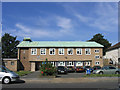
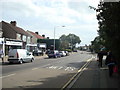
Photos of RM12 4JE


Area Information
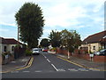
RM12 4JE is a specific residential cluster covering 1.3 hectares in East London, characterised by a relatively compact footprint and close-knit living environment. With a population of 1,480, this postcode represents a small, defined community where daily life moves at a manageable pace compared to larger urban centres. The area functions as a contained neighbourhood rather than a sprawling district, meaning residents interact frequently with immediate neighbours and local facilities. Living in RM12 4JE offers the benefit of spatial efficiency, where the limited number of homes creates an intimate atmosphere that larger towns simply cannot replicate. The high population density of 115,671 people per square kilometre indicates a built-up settlement focused on urban residence rather than open countryside. This concentration means infrastructure, such as roads and utilities, serves a concentrated group, which often results in well-maintained essential services despite the small scale. You can expect a setting where the distance to homes in RM12 4JE is short, fostering a sense of familiarity and rapid response to local needs. The area does not sprawl; instead, it remains a focused residential spot within a broader city context, ideal for those who prefer a defined living space over an expansive geographical spread.
- Area Type
- Postcode
- Area Size
- 1.3 hectares
- Population
- 1480
- Population Density
- 5968 people/km²
The housing market in RM12 4JE is distinctly characterised by a prevalence of houses, with no data indicating the presence of high-rise blocks or apartments in this specific postcode. This structure supports a market where individuals seek detached, semi-detached, or terraced properties suited for family living or downsizing. With 64% of residents owning their homes, the area functions primarily as an owner-occupied zone rather than a rental enclave. This dynamic implies that the supply of homes in RM12 4JE is relatively stable, driven by existing homeowners rather than a influx of landlords seeking short-term returns. Prospective buyers seeking a traditional house purchase will find this environment tailored to their needs, as the accommodation type is exclusively houses. The small area size of 1.3 hectares further restricts development potential, meaning the current housing stock is likely fixed and not subject to rapid speculative changes. For those considering moving to this location, the focus remains on acquiring a house within an established footprint. The lack of rental pressure often allows agreed prices to reflect the intrinsic value of specific property types without the volatility seen in high-demand rental districts. Understanding this market mix helps you evaluate whether RM12 4JE aligns with your preference for buying into a permanent residential asset.
House Prices in RM12 4JE
Showing 36 properties
| Address | Type | Beds | Baths | Last Sale Price | Last Sale Date | |
|---|---|---|---|---|---|---|
| 52 Bruce Avenue, Hornchurch, RM12 4JE | Semi-detached | 3 | 1 | £550,000 | May 2023 | |
| 4 Bruce Avenue, Hornchurch, RM12 4JE | Bungalow | 2 | 1 | £425,000 | Jul 2022 | |
| 12 Bruce Avenue, Hornchurch, RM12 4JE | Terraced | 3 | - | £398,000 | Oct 2020 | |
| 72 Bruce Avenue, Hornchurch, RM12 4JE | Semi-detached | 4 | 2 | £600,000 | Oct 2020 | |
| 70 Bruce Avenue, Hornchurch, RM12 4JE | house | - | - | £500,000 | Aug 2020 | |
| 32 Bruce Avenue, Hornchurch, RM12 4JE | Semi-detached | 2 | 1 | £365,000 | Jul 2019 | |
| 42 Bruce Avenue, Hornchurch, RM12 4JE | Bungalow | - | - | £327,500 | Sep 2018 | |
| 30 Bruce Avenue, Hornchurch, RM12 4JE | Semi-detached | 2 | - | £280,000 | Jul 2014 | |
| 26 Bruce Avenue, Hornchurch, RM12 4JE | Bungalow | 3 | - | £390,000 | Jul 2014 | |
| 8 Bruce Avenue, Hornchurch, RM12 4JE | Bungalow | 2 | - | £300,000 | Apr 2014 |
Energy Efficiency in RM12 4JE
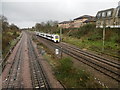
Daily life for residents in RM12 4JE is supported by a practical network of amenities located within practical reach. Retail needs are met by five nearby options, including Lidl Hornchurch, Sainsburys Hornchurch, and Iceland Hornchurch, which provide essentials without requiring long drives. For those prioritising connectivity, five metro stations offer access, highlighting major hubs like Hornchurch and Elm Park Station. Rail enthusiasts will find five key connections nearby, with stations including Emerson Park Station, Gidea Park Station, and Upminster Station completing the public transport loop. These facilities mean that you do not need to travel far for groceries or round-trip tickets to get to work. The concentration of retail and transport hubs creates a lifestyle where convenience is the primary focus, allowing for quick errands and efficient commutes. In this environment, the distance to shops or stations is manageable, supporting a balance between home comfort and urban accessibility. Whether you prefer a quick trip to Lidl Hornchurch or a longer journey starting from Upminster Station, the infrastructure supports a varied routine. Living in RM12 4JE ensures that essential services remain a short, stress-free journey away.
Amenities
Schools
| Rank | School | Type | Entry gender | Ages |
|---|
Explore more schools in this area
Go to Schools tabDemographics
The community profile in RM12 4JE reflects a mature demographic structure centred on adults between the ages of 30 and 64 years. Data indicates a median age of 47, suggesting that families often include school-age children or that the area attracts professionals in mid-career stages. This age distribution aligns with a strong preference for home ownership, where 64% of residents own their properties outright or with a mortgage. Such a high ownership rate typically correlates with long-term residents who have established roots rather than transient tenants. The predominant ethnic group is White, and the housing stock consists almost entirely of houses, confirming that this is not a high-rise or flat-dominated zone. The specific accommodation type means that living in RM12 4JE involves a diverse range of house sizes, likely catering to various family configurations within a single estate. These demographic facts paint a picture of a stable neighbourhood where adults form the backbone of the community fabric. The combination of a median age of 47 and high home ownership suggests a settled population less likely to move frequently. Consequently, the social environment is built on enduring neighbourly connections rather than the changing faces of a rental market.
Household Size
Accommodation Type
Tenure
Ethnic Group
Religion
Household Composition
Age
Household Deprivation
NS-SEC
Explore more demographic insights in this area
Go to Demographics tabPlanning
Planning Constraints
- Flood RiskPremium
- Ramsar Wetland SitesPremium
- Area of Outstanding Natural BeautyPremium
- Protected Nature ReservePremium
- Protected WoodlandPremium