Area Overview for RM12 4XW
Photos of RM12 4XW
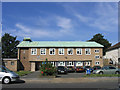
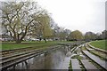
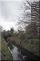
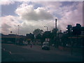
48 photos from this area
Area Information
Key information about the RM12 4XW including its size, population, and administrative classification.
- Area Type
- Postcode
- Area Size
- 1.5 hectares
- Population
- 1981
- Population Density
- 5454 people/km²
House Prices in RM12 4XW
37
Properties
£286,721
Average Sold Price
£96,500
Lowest Price
£565,000
Highest Price
Showing 37 properties
| Address | Type | Beds | Baths | Last Sale Price | Last Sale Date | |
|---|---|---|---|---|---|---|
| 57 Abbs Cross Lane, Hornchurch, RM12 4XW | Terraced | 3 | 1 | £392,500 | Oct 2023 | |
| 72 Abbs Cross Lane, Hornchurch, RM12 4XW | Terraced | 2 | 1 | £401,000 | Feb 2023 | |
| 73 Abbs Cross Lane, Hornchurch, RM12 4XW | Bungalow | 3 | 2 | £495,000 | Aug 2022 | |
| 86 Abbs Cross Lane, Hornchurch, RM12 4XW | Semi-detached | 3 | 1 | £385,000 | Sep 2021 | |
| 70 Abbs Cross Lane, Hornchurch, RM12 4XW | Terraced | 2 | 1 | £335,000 | Apr 2021 | |
| 59 Abbs Cross Lane, Hornchurch, RM12 4XW | Terraced | 3 | - | £395,000 | Feb 2021 | |
| 64 Abbs Cross Lane, Hornchurch, RM12 4XW | house | - | - | £343,500 | Dec 2020 | |
| 53 Abbs Cross Lane, Hornchurch, RM12 4XW | house | - | - | £350,000 | Dec 2020 | |
| 80 Abbs Cross Lane, Hornchurch, RM12 4XW | house | - | - | £400,000 | Nov 2018 | |
| 67 Abbs Cross Lane, Hornchurch, RM12 4XW | Bungalow | 3 | 1 | £565,000 | Oct 2018 |
Page 1 of 4
Energy Efficiency in RM12 4XW
Amenities
Schools
| Rank | School | Type | Entry gender | Ages |
|---|
Explore more schools in this area
Go to Schools tabDemographics
Household Size
One person
most common
Accommodation Type
Flats
most common
Tenure
49
majority
Ethnic Group
White
most common
Religion
N/A
most common
Household Composition
N/A
most common
Age
47
median
Adults (30-64 years)
most common
Household Deprivation
N/A
with no deprivation
NS-SEC
30
in Lower managerial occupations
Explore more demographic insights in this area
Go to Demographics tabPlanning
Planning Constraints
- Flood RiskPremium
- Ramsar Wetland SitesPremium
- Area of Outstanding Natural BeautyPremium
- Protected Nature ReservePremium
- Protected WoodlandPremium