Area Overview for RM12 4XJ
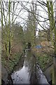
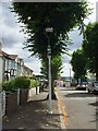
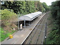
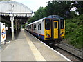
Photos of RM12 4XJ


Area Information
Living in RM12 4XJ means residing in a compact residential cluster defined by a specific postcode. This area covers just 1.5 hectares and houses a population of 1480 people. The density reaches an extraordinary 99,376 people per square kilometre, indicating a tightly packed neighbourhood where properties sit close together. Residents navigate a space where daily commutes are a matter of metres rather than miles. Life here is centred on the immediate proximity to Hornchurch and the wider East London corridor. You are situated within a zone designed for high-density living, typical of the borough's post-war planning. The size of the area limits large open green spaces within the immediate boundary, focusing community interaction on shared housing estates and local streets. This environment suits those who prefer the convenience of being surrounded by neighbours and established infrastructure. The cluster acts as a functional node within the larger Hornchurch and Upminster region, providing a quiet residential backdrop against a backdrop of significant transport links. Your location offers a direct connection to the Hornchurch town centre and major rail hubs that define daily life for homeowners in this specific postal sector.
- Area Type
- Postcode
- Area Size
- 1.5 hectares
- Population
- 1480
- Population Density
- 5968 people/km²
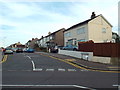
Homes in RM12 4XJ reflect a market primarily driven by ownership rather than renting. With a home ownership rate of 64 per cent, the property landscape is populated by long-term residents who have invested in the local real estate. The predominant accommodation type is houses, distinguishing this area from urban flats or apartment blocks common in other boroughs. For buyers looking at this small area, the stock consists mainly of detached, semi-detached, or terraced houses typical of the Hornchurch postcode districts. This high ownership ratio suggests that resale markets may involve existing families who are accustomed to current neighbourhood features. There is no indication of a significant rental sector within this specific 1.5-hectare cluster, implying a low turnover of properties compared to high-density rental zones. Prospective purchasers can expect to enter an established environment where neighbours have likely lived in their homes for decades. The lack of rental data for this specific postcode reinforces the idea that this is a private residential enclave focused on family stability and asset retention rather than investment yields.
House Prices in RM12 4XJ
Showing 48 properties
| Address | Type | Beds | Baths | Last Sale Price | Last Sale Date | |
|---|---|---|---|---|---|---|
| 8 Abbs Cross Gardens, Hornchurch, RM12 4XJ | Retail | 3 | 1 | £425,000 | Jul 2022 | |
| 68 Abbs Cross Gardens, Hornchurch, RM12 4XJ | Flat | 2 | 1 | £280,000 | Mar 2022 | |
| 74 Abbs Cross Gardens, Hornchurch, RM12 4XJ | Flat | - | - | £242,000 | Mar 2021 | |
| 11 Abbs Cross Gardens, Hornchurch, RM12 4XJ | Terraced | 3 | 1 | £405,000 | Feb 2020 | |
| 18 Abbs Cross Gardens, Hornchurch, RM12 4XJ | Terraced | 3 | 1 | £355,000 | Mar 2018 | |
| 9 Abbs Cross Gardens, Hornchurch, RM12 4XJ | Terraced | 3 | 1 | £380,000 | Sep 2017 | |
| 6 Abbs Cross Gardens, Hornchurch, RM12 4XJ | Terraced | 3 | 1 | £365,000 | Jun 2017 | |
| 62 Abbs Cross Gardens, Hornchurch, RM12 4XJ | Flat | - | - | £205,000 | Jul 2016 | |
| 14 Abbs Cross Gardens, Hornchurch, RM12 4XJ | Semi-detached | 3 | - | £298,000 | Jan 2016 | |
| 2 Abbs Cross Gardens, Hornchurch, RM12 4XJ | Maisonette | 2 | 1 | £250,000 | Oct 2015 |
Energy Efficiency in RM12 4XJ
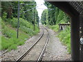
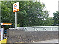
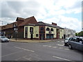
Your daily life in RM12 4XJ benefits from immediate access to major retailers and transport hubs within practical reach. Supermarkets such as Lidl Hornchurch, Sainsburys Hornchurch, and Iceland Hornchurch are located nearby, providing all essential grocery shopping needs. You are also positioned close to key metro stations including Hornchurch, Elm Park Station, and Upminster Bridge. Rail access is equally convenient via Emerson Park Station, Gidea Park Station, and Upminster Station. These stations offer regular commuter links to central London and other major destinations outside the east end. The concentration of amenities within walking or short driving distance reduces the need for long car journeys for routine errands. Residents can combine a quick stop for groceries at a supermarket with a train catch at a nearby station without significant travel time. This integration of retail and rail networks creates a functional lifestyle where work, leisure, and daily necessities are easily accessible.
Amenities
Schools
| Rank | School | Type | Entry gender | Ages |
|---|
Explore more schools in this area
Go to Schools tabDemographics
The community in RM12 4XJ is dominated by adults aged between 30 and 64 years. This age range constitutes the most common demographic group within the cluster. The median age for residents is 47, reflecting a mature population that values stability and established local knowledge. Home ownership stands at 64 per cent, meaning nearly two out of three households have purchased their property outright or have a substantial equity stake. The majority of accommodation consists of houses, which aligns with the ownership figures and suggests a preference for detached or semi-detached living arrangements over flats. The predominant ethnic group is White, making up the bulk of the resident population. There is no data on specific deprivation indices or income levels provided for this specific postcode, so characterisation focuses strictly on ownership and accommodation type. The high percentage of homeowners indicates a settled community with long-term residents who have put down roots in the area. Families and professionals in their middle years form the backbone of this neighbourhood, contributing to a stable social fabric where local schools and services are permanent fixtures rather than transient amenities.
Household Size
Accommodation Type
Tenure
Ethnic Group
Religion
Household Composition
Age
Household Deprivation
NS-SEC
Explore more demographic insights in this area
Go to Demographics tabPlanning
Planning Constraints
- Flood RiskPremium
- Ramsar Wetland SitesPremium
- Area of Outstanding Natural BeautyPremium
- Protected Nature ReservePremium
- Protected WoodlandPremium