Area Overview for RM12 4JJ
Photos of RM12 4JJ
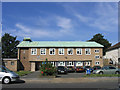
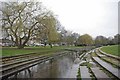
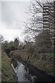
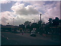
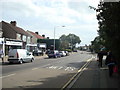
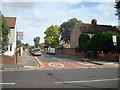
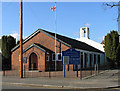
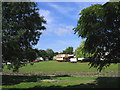
48 photos from this area
Area Information
Key information about the RM12 4JJ including its size, population, and administrative classification.
- Area Type
- Postcode
- Area Size
- 1.4 hectares
- Population
- 1981
- Population Density
- 5454 people/km²
House Prices in RM12 4JJ
39
Properties
£318,594
Average Sold Price
£100,000
Lowest Price
£670,000
Highest Price
Showing 39 properties
| Address | Type | Beds | Baths | Last Sale Price | Last Sale Date | |
|---|---|---|---|---|---|---|
| 41 The Avenue, Hornchurch, RM12 4JJ | Semi-detached | 4 | 3 | £670,000 | Apr 2025 | |
| 61 The Avenue, Hornchurch, RM12 4JJ | Bungalow | 2 | 1 | £415,000 | Feb 2024 | |
| 40 The Avenue, Hornchurch, RM12 4JJ | house | - | - | £329,375 | Jan 2024 | |
| 57 The Avenue, Hornchurch, RM12 4JJ | Retail | 2 | 1 | £425,000 | May 2022 | |
| 46 The Avenue, Hornchurch, RM12 4JJ | house | - | - | £582,000 | Apr 2021 | |
| 59 The Avenue, Hornchurch, RM12 4JJ | Bungalow | 2 | 1 | £427,500 | Apr 2019 | |
| 51 The Avenue, Hornchurch, RM12 4JJ | Bungalow | - | - | £395,000 | Nov 2018 | |
| 60 The Avenue, Hornchurch, RM12 4JJ | Terraced | 3 | 1 | £465,000 | Oct 2018 | |
| 55 The Avenue, Hornchurch, RM12 4JJ | Bungalow | - | - | £405,000 | Oct 2017 | |
| 48 The Avenue, Hornchurch, RM12 4JJ | house | - | - | £430,000 | Feb 2016 |
Page 1 of 4
Energy Efficiency in RM12 4JJ
Amenities
Schools
| Rank | School | Type | Entry gender | Ages |
|---|
Explore more schools in this area
Go to Schools tabDemographics
Household Size
One person
most common
Accommodation Type
Flats
most common
Tenure
49
majority
Ethnic Group
White
most common
Religion
N/A
most common
Household Composition
N/A
most common
Age
47
median
Adults (30-64 years)
most common
Household Deprivation
N/A
with no deprivation
NS-SEC
30
in Lower managerial occupations
Explore more demographic insights in this area
Go to Demographics tabPlanning
Planning Constraints
- Flood RiskPremium
- Ramsar Wetland SitesPremium
- Area of Outstanding Natural BeautyPremium
- Protected Nature ReservePremium
- Protected WoodlandPremium