Area Overview for RM12 4HY
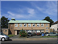
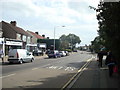
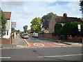
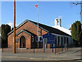
Photos of RM12 4HY


Area Information
Living in RM12 4HY means residing in a very compact residential cluster defined by a specific postcode. This area covers just 9,912 square metres and houses a population of 1,981 residents, resulting in a population density of 199,858 people per square kilometre. Such high density reflects a tightly packed environment rather than a sprawling suburb. You will find yourself in a small, concentrated neighbourhood where the infrastructure must serve a close-knit community within a limited footprint. The character of this cluster is distinct due to its sheer intensity of occupancy per square unit of land. Daily life here is shaped by proximity, as the small physical size means amenities and services are almost always nearby. Residents navigate a space where every square metre is utilised, creating an urban-like feel within the larger Hornchurch framework. This specific postcode represents a microcosm of Greater London living, prioritising location and density over vast green spaces. When considering homes in RM12 4HY, you are buying into a historic settlement pattern that has evolved to maximise land use. The area serves as a practical residential option for those seeking established housing without extensive travel times to central London. Understanding the scale of this postcode is essential for managing expectations about what living in this specific location entails.
- Area Type
- Postcode
- Area Size
- 9912 m²
- Population
- 1981
- Population Density
- 5454 people/km²
The housing stock in RM12 4HY is dominated by flats, reflecting the limited land availability and high ground density of the postcode. With home ownership at 49 per cent, the market presents a near-even balance between owners and tenants. This statistic indicates that nearly half of the residents purchase their property outright or via mortgage, while the other half rent. Such a split often creates a dynamic market with significant competition for privately owned units. Prospective buyers should be prepared to face a competitive landscape for available flats, given the restricted supply within this small area. The prevalence of flat-style accommodation means that residents are accustomed to living in multi-unit buildings or converted properties typical of high-density zones. Whether you look at homes in RM12 4HY or the surrounding clusters, the expectation of vertical living is strong. This configuration limits the availability of single-family detached homes within the specific boundaries of this postcode. You might find single homes in adjacent neighbourhoods, but the core of RM12 4HY remains specialised for apartment living. The 49 per cent ownership rate suggests a stable, long-term market where property values are influenced by both rental yields and owner succession. Buyers entering this market must understand that demand for flats is high relative to the tiny land footprint.
House Prices in RM12 4HY
Showing 24 properties
| Address | Type | Beds | Baths | Last Sale Price | Last Sale Date | |
|---|---|---|---|---|---|---|
| 122 Bruce Avenue, Hornchurch, RM12 4HY | Terraced | 3 | 2 | £475,000 | Oct 2025 | |
| 132 Bruce Avenue, Hornchurch, RM12 4HY | Terraced | 3 | 1 | £412,000 | Jul 2025 | |
| 116 Bruce Avenue, Hornchurch, RM12 4HY | Bungalow | 5 | 1 | £395,000 | Jul 2024 | |
| 133 Bruce Avenue, Hornchurch, RM12 4HY | Terraced | 4 | 2 | £555,000 | Mar 2024 | |
| 134 Bruce Avenue, Hornchurch, RM12 4HY | Semi-detached | 3 | 1 | £490,000 | Dec 2021 | |
| 135 Bruce Avenue, Hornchurch, RM12 4HY | Terraced | 3 | - | £476,595 | Nov 2021 | |
| 143 Bruce Avenue, Hornchurch, RM12 4HY | Bungalow | - | - | £415,000 | Sep 2021 | |
| 145 Bruce Avenue, Hornchurch, RM12 4HY | house | 4 | - | £610,000 | Feb 2021 | |
| 137 Bruce Avenue, Hornchurch, RM12 4HY | Semi-detached | 3 | 1 | £405,000 | Dec 2019 | |
| 122A Bruce Avenue, Hornchurch, RM12 4HY | Bungalow | 3 | 1 | £485,000 | Jan 2018 |
Energy Efficiency in RM12 4HY
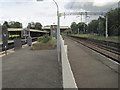
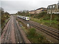
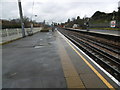
Residents of RM12 4HY enjoy access to a variety of retail and transport hubs within practical reach. The retail sector near the postcode includes five key venues, with notable options such as Sainsburys Hornchurch, Iceland Hornchurch, and Lidl Hornchurch. These stores provide essential groceries and household goods without requiring extensive travel. For commuting, there are five nearby metro stations, including Hornchurch, Upminster Bridge, and Elm Park Station. Additionally, five rail stations offer access via Emerson Park Station, Upminster Station, and Gidea Park Station. This concentration of rail and metro links places Hornchurch stations within close proximity, allowing quick journeys to central London. The custom of living in RM12 4HY includes making easy use of these transport links for work and leisure. You can quickly reach shopping destinations or destinations beyond the postcode border using nearby rail services. The combination of supermarkets and multiple tube stations creates a convenient lifestyle for daily errands and commutes. Living here means integrating seamlessly with the wider Hornchurch transport network while staying within a dense residential cluster.
Amenities
Schools
Families residing in RM12 4HY have access to a focused selection of educational institutions nearby. Langtons Infant School and Nursery operates as a primary school and holds a Good Ofsted rating. Adjacent to it or serving the same catchment is Langtons Junior School, which also carries a Good rating. Further along the academic continuum, Langtons Junior Academy functions as an academy within the cluster. Having three schools with Good ratings in such a small postcode area provides a robust educational foundation for local children. This concentration of well-rated institutions means that students benefit from consistent educational standards without needing to travel far for schooling. For parents moving into the area, these specific names offer a clear picture of the academic environment. The mix of infant, junior, and academy designations ensures that children can progress through the education system within the same general locality. Schools near RM12 4HY are therefore a key selling point for families evaluating the area. You do not need to look further afield for accredited education options in this postcode. The presence of these specific schools with positive Ofsted outcomes creates a supportive environment for student development.
| Rank | School | Type | Entry gender | Ages |
|---|
Explore more schools in this area
Go to Schools tabDemographics
The community in RM12 4HY is defined by a mature demographic profile with a median age of 47 years. Most commonly, the area is inhabited by adults aged between 30 and 64 years. This age distribution suggests a neighbourhood established by families and professionals rather than young students or retirees. Home ownership stands at 49 per cent, indicating a balanced mix between owner-occupiers and those living in rental properties. The predominant accommodation type consists of flats, which aligns with the high population density of the postcode. Demographically, the white ethnic group forms the majority population within this cluster. You are looking at an area where stability is likely high due to the preponderance of long-term residents. The absence of younger children in the primary age range hints that schools serve a local student population rather than a community dominated by young families raising infants. Living in RM12 4HY means joining a society where the demographic weighting leans heavily towards middle adulthood. This profile often correlates with a demand for quality services and reliable transport links over extensive playgrounds within the immediate vicinity.
Household Size
Accommodation Type
Tenure
Ethnic Group
Religion
Household Composition
Age
Household Deprivation
NS-SEC
Explore more demographic insights in this area
Go to Demographics tabPlanning
Planning Constraints
- Flood RiskPremium
- Ramsar Wetland SitesPremium
- Area of Outstanding Natural BeautyPremium
- Protected Nature ReservePremium
- Protected WoodlandPremium