Area Overview for E17 6QT
Photos of E17 6QT
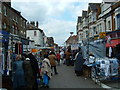

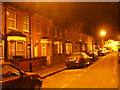
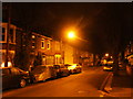
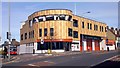

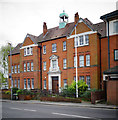
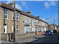
100 photos from this area
Area Information
Key information about the E17 6QT including its size, population, and administrative classification.
- Area Type
- Postcode
- Area Size
- 1.3 hectares
- Population
- 2355
- Population Density
- 17509 people/km²
House Prices in E17 6QT
62
Properties
£325,439
Average Sold Price
£79,500
Lowest Price
£1,050,000
Highest Price
Showing 62 properties
| Address | Type | Beds | Baths | Last Sale Price | Last Sale Date | |
|---|---|---|---|---|---|---|
| 46 Melville Road, Walthamstow, E17 6QT | Semi-detached | 3 | - | £646,000 | Aug 2025 | |
| 69 Melville Road, Walthamstow, E17 6QT | Flat | - | - | £601,460 | Jan 2024 | |
| 36 Melville Road, Walthamstow, E17 6QT | Semi-detached | 4 | 2 | £1,050,000 | May 2023 | |
| 48 Melville Road, Walthamstow, E17 6QT | house | - | - | £215,325 | Aug 2016 | |
| 77 Melville Road, Walthamstow, E17 6QT | Terraced | 3 | 1 | £472,500 | Sep 2013 | |
| 93 Melville Road, Walthamstow, E17 6QT | Terraced | 3 | 2 | £335,000 | May 2011 | |
| 59 Melville Road, Walthamstow, E17 6QT | Detached | 4 | 3 | £350,000 | Jun 2010 | |
| 75 Melville Road, Walthamstow, E17 6QT | house | - | - | £399,995 | Mar 2010 | |
| 89 Melville Road, Walthamstow, E17 6QT | house | - | - | £175,000 | Oct 2009 | |
| 83 Melville Road, Walthamstow, E17 6QT | Terraced | - | - | £375,000 | Aug 2006 |
Page 1 of 7
Energy Efficiency in E17 6QT
Amenities
Schools
| Rank | School | Type | Entry gender | Ages |
|---|
Explore more schools in this area
Go to Schools tabDemographics
Household Size
Family (3-5 people)
most common
Accommodation Type
Flats
most common
Tenure
51
majority
Ethnic Group
White
most common
Religion
N/A
most common
Household Composition
N/A
most common
Age
47
median
Adults (30-64 years)
most common
Household Deprivation
N/A
with no deprivation
NS-SEC
42
in Lower managerial occupations
Explore more demographic insights in this area
Go to Demographics tabPlanning
Planning Constraints
- Flood RiskPremium
- Ramsar Wetland SitesPremium
- Area of Outstanding Natural BeautyPremium
- Protected Nature ReservePremium
- Protected WoodlandPremium