Area Overview for E17 6RE
Photos of E17 6RE
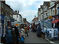

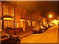
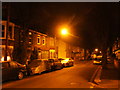
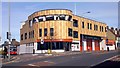
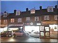
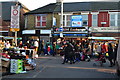
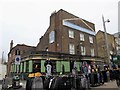
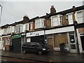

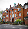
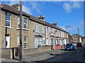
100 photos from this area
Area Information
Key information about the E17 6RE including its size, population, and administrative classification.
- Area Type
- Postcode
- Area Size
- 9945 m²
- Population
- 1907
- Population Density
- 15580 people/km²
House Prices in E17 6RE
59
Properties
£410,774
Average Sold Price
£70,000
Lowest Price
£975,000
Highest Price
Showing 59 properties
| Address | Type | Beds | Baths | Last Sale Price | Last Sale Date | |
|---|---|---|---|---|---|---|
| 12 Wolsey Avenue, Walthamstow, E17 6RE | Terraced | 3 | 1 | £876,000 | Oct 2024 | |
| 9 Wolsey Avenue, Walthamstow, E17 6RE | Terraced | 3 | 1 | £975,000 | Oct 2023 | |
| 35 Wolsey Avenue, Walthamstow, E17 6RE | Terraced | 4 | 2 | £970,000 | Aug 2023 | |
| 26 Wolsey Avenue, Walthamstow, E17 6RE | Terraced | 3 | 2 | £718,500 | Apr 2023 | |
| 22 Wolsey Avenue, Walthamstow, E17 6RE | Terraced | 1 | 1 | £725,000 | Dec 2022 | |
| 41 Wolsey Avenue, Walthamstow, E17 6RE | Terraced | 5 | 2 | £750,000 | Sep 2022 | |
| 40 Wolsey Avenue, Walthamstow, E17 6RE | house | - | - | £570,000 | Oct 2021 | |
| 49 Wolsey Avenue, Walthamstow, E17 6RE | house | 3 | - | £675,000 | Aug 2021 | |
| 51 Wolsey Avenue, Walthamstow, E17 6RE | house | - | - | £580,550 | Jun 2021 | |
| 2 Wolsey Avenue, Walthamstow, E17 6RE | Terraced | 3 | 1 | £620,000 | Apr 2017 |
Page 1 of 6
Energy Efficiency in E17 6RE
Amenities
Schools
| Rank | School | Type | Entry gender | Ages |
|---|
Explore more schools in this area
Go to Schools tabDemographics
Household Size
Two person
most common
Accommodation Type
Flats
most common
Tenure
55
majority
Ethnic Group
White
most common
Religion
N/A
most common
Household Composition
N/A
most common
Age
47
median
Adults (30-64 years)
most common
Household Deprivation
N/A
with no deprivation
NS-SEC
47
in Lower managerial occupations
Explore more demographic insights in this area
Go to Demographics tabPlanning
Planning Constraints
- Flood RiskPremium
- Ramsar Wetland SitesPremium
- Area of Outstanding Natural BeautyPremium
- Protected Nature ReservePremium
- Protected WoodlandPremium