Area Overview for E17 6QP
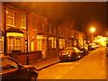
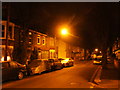
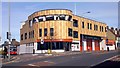
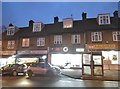
Photos of E17 6QP


Area Information
Living in E17 6QP means residing in a compact residential cluster defined by postcode E17 6QP in England. This specific location covers an area of only 638 m² yet supports a community of 2,355 people. The high density suggests a focused living environment where proximity to neighbours is a defining feature of daily existence. You are purchasing a slice of a tightly knit neighbourhood where every plot counts toward the collective character of the zone. The population density creates a lively street scene but implies limited independent building space compared to sprawling suburbs. Prospective buyers should understand that homes in E17 6QP exist within a very small footprint, making each property a significant part of the local fabric. This postcode area represents a microcosm of wider East London living, characterised by efficient land use rather than expansive gardens. When considering properties near E17 6QP, you are engaging with a space where residents value convenience and close community ties over separation. The design of the neighbourhood maximises what is available on the ground, creating a distinct sense of place that differs from larger districts.
- Area Type
- Postcode
- Area Size
- 638 m²
- Population
- 2355
- Population Density
- 17509 people/km²
The housing stock in E17 6QP is defined by a predominance of flats, which aligns with the area's small total size of 638 m². Home ownership stands at 51%, creating a balanced market where neither buyers nor renters completely dominate the landscape. This 51% figure suggests that roughly every second resident possesses an equity stake in their dwelling. While single-detached houses clearly do not constitute the main housing type in this small postcode, larger flats or converted units likely fill the space efficiently. Buyers seeking homes in E17 6QP should expect compact living arrangements that maximise internal space rather than external plots. The high home ownership rate implies that established families and professionals have successfully navigated the local property ladder to found permanent residences here. Rental properties exist, but they do not outnumber owner-occupied units in this specific cluster. Understanding this 51/49 split helps you gauge market competition; you are entering a market where selling a flat is common among current owners looking to downsize or move up. The housing mix supports a diverse range of tenures, from first-time buyer flats to owner-occupied conversions, catering to different stages of life within the 30-64 age demographic.
House Prices in E17 6QP
No properties found in this postcode.
Energy Efficiency in E17 6QP
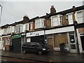
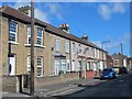
Residents of E17 6QP enjoy extensive access to major retail chains and transport hubs within practical reach. You have Lidl The, Tesco Walthamstow, and Asda Walthamstow nearby for all your shopping needs, ensuring no significant trip is required for groceries or household essentials. Transport connectivity is exceptional with five nearby railway stations including Walthamstow Central Station, Walthamstow Queens Road Station, and St James Street Station. The Greater Anglia and c2c networks serve Leytonstone Station, Snaresbrook Station, and South Woodford, offering direct links to London financial districts and Essex coastlines. Five bus routes pass through the critical Whipps Cross Bus Interchange, providing flexibility for those without rail access. Furthermore, five ferry options including East India Pier and Canary Wharf Pier connect you to the Docklands and riverfront leisure spots. This wealth of amenities within close proximity defines the everyday rhythm of life in E17 6QP. You do not need to travel far to reach shops, schools near E17 6QP, or leisure activities, making daily errands quick and convenient.
Amenities
Schools
| Rank | School | Type | Entry gender | Ages |
|---|
Explore more schools in this area
Go to Schools tabDemographics
The community within E17 6QP is dominated by adults between 30 and 64 years old. The median age here is 47, which indicates a mature population seeking stability rather than young families building their first homes. Home ownership accounts for 51% of residents, revealing a market where roughly half the population owns their property outright or with a mortgage. The remaining residents comprise those renting or living in shared accommodation. Flats form the primary accommodation type in this postcode, suggesting an urban living style suited to the limited space available. White residents remain the predominant ethnic group, reflecting traditional settlement patterns in this specific cluster. The demographic profile of 2,355 residents indicates a stable, established community rather than a rapidly shifting development zone. You will find a neighbourhood where long-term residents have likely shaped local institutions and social networks over many years. This age concentration means local businesses often cater to householders with established careers and financial security.
Household Size
Accommodation Type
Tenure
Ethnic Group
Religion
Household Composition
Age
Household Deprivation
NS-SEC
Explore more demographic insights in this area
Go to Demographics tabPlanning
Planning Constraints
- Flood RiskPremium
- Ramsar Wetland SitesPremium
- Area of Outstanding Natural BeautyPremium
- Protected Nature ReservePremium
- Protected WoodlandPremium