Area Overview for E17 6RP
Photos of E17 6RP
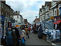

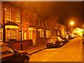
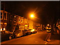
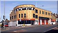
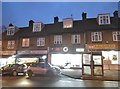
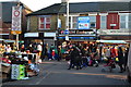
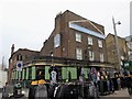
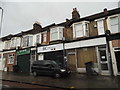

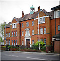
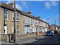
100 photos from this area
Area Information
Key information about the E17 6RP including its size, population, and administrative classification.
- Area Type
- Postcode
- Area Size
- 1.0 hectares
- Population
- 2355
- Population Density
- 17509 people/km²
House Prices in E17 6RP
52
Properties
£455,726
Average Sold Price
£34,500
Lowest Price
£1,085,000
Highest Price
Showing 52 properties
| Address | Type | Beds | Baths | Last Sale Price | Last Sale Date | |
|---|---|---|---|---|---|---|
| 39 Cottenham Road, Walthamstow, E17 6RP | Terraced | 3 | 1 | £960,000 | Dec 2024 | |
| 35 Cottenham Road, Walthamstow, E17 6RP | Terraced | 3 | 2 | £1,085,000 | Jul 2024 | |
| 57 Cottenham Road, Walthamstow, E17 6RP | Terraced | 3 | 1 | £1,050,000 | Mar 2023 | |
| 43B Cottenham Road, Walthamstow, E17 6RP | Flat | - | - | £465,000 | Jan 2023 | |
| 63 Cottenham Road, Walthamstow, E17 6RP | Retail | 4 | 2 | £1,050,222 | Jul 2022 | |
| 3 Cottenham Road, Walthamstow, E17 6RP | Terraced | 4 | 2 | £805,000 | Apr 2022 | |
| 53A Cottenham Road, Walthamstow, E17 6RP | Flat | - | - | £470,000 | Jan 2021 | |
| 67 Cottenham Road, Walthamstow, E17 6RP | Terraced | 3 | 1 | £520,000 | Nov 2015 | |
| 17A Cottenham Road, Walthamstow, E17 6RP | Flat | - | - | £212,000 | Apr 2013 | |
| 47 Cottenham Road, Walthamstow, E17 6RP | Flat | - | - | £200,000 | Feb 2013 |
Page 1 of 6
Energy Efficiency in E17 6RP
Amenities
Schools
| Rank | School | Type | Entry gender | Ages |
|---|
Explore more schools in this area
Go to Schools tabDemographics
Household Size
Family (3-5 people)
most common
Accommodation Type
Flats
most common
Tenure
51
majority
Ethnic Group
White
most common
Religion
N/A
most common
Household Composition
N/A
most common
Age
47
median
Adults (30-64 years)
most common
Household Deprivation
N/A
with no deprivation
NS-SEC
42
in Lower managerial occupations
Explore more demographic insights in this area
Go to Demographics tabPlanning
Planning Constraints
- Flood RiskPremium
- Ramsar Wetland SitesPremium
- Area of Outstanding Natural BeautyPremium
- Protected Nature ReservePremium
- Protected WoodlandPremium