Area Overview for E13 0AA
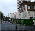
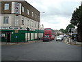
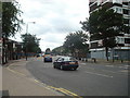
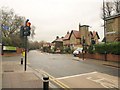
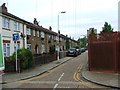
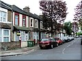
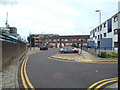
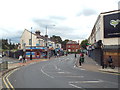
Photos of E13 0AA


Area Information
Living in E13 0AA means inhabiting a compact residential cluster in east London, where 1,810 people reside across 1,317 square metres. The area’s high population density of 1,374,422 people per square kilometre reflects its tightly packed nature, typical of urban zones. Daily life here is shaped by proximity to transport hubs and retail centres, with residents enjoying easy access to shops, schools, and public transport. The area’s small footprint means a tightly knit community, though its character is defined by practicality over space. E13 0AA sits near major infrastructure like the DLR and London City Airport, making it a convenient choice for commuters. While the area lacks natural landscapes, its connectivity and amenities compensate, offering a functional base for those prioritising accessibility over open spaces. The presence of independent and state schools suggests a mix of family needs, though the predominantly flat-based housing stock indicates a rental-heavy market. For buyers seeking a compact, well-served urban location, E13 0AA presents a pragmatic option.
- Area Type
- Postcode
- Area Size
- 1317 m²
- Population
- 1810
- Population Density
- 19568 people/km²
E13 0AA’s property market is characterised by a low home ownership rate of 24%, indicating a rental-heavy environment. The accommodation type is predominantly flats, a logical fit for the area’s high population density and compact size. This suggests limited scope for larger homes or family-oriented properties, making the area more suited to single occupants or couples without children. The small footprint of E13 0AA means buyers must consider proximity to amenities and transport rather than property size. With no data on property prices or recent developments, the market remains opaque, but the flat-based stock implies a focus on affordability over luxury. For buyers seeking a low-maintenance, accessible urban location, E13 0AA offers a practical, if limited, selection of homes. The rental market’s dominance may also mean competition for available properties, particularly in desirable locations near transport links.
House Prices in E13 0AA
Showing 2 properties
| Address | Type | Beds | Baths | Last Sale Price | Last Sale Date | |
|---|---|---|---|---|---|---|
| 86 High Street, Plaistow, London, E13 0AA | Flat | 3 | 2 | - | - | |
| Royal Mail Sorting Office, 84-90 High Street, Plaistow, London, E13 0AA | Industrial | - | - | - | - |
Energy Efficiency in E13 0AA
Residents of E13 0AA have access to a range of amenities within practical reach. Retail options include Co-op Newham, Tesco Green Gate, and Iceland 480-482, providing everyday shopping needs. The area’s proximity to DLR and rail stations ensures easy access to London’s cultural and commercial hubs. While specific parks or leisure facilities are not listed, the presence of multiple transport links and retail centres suggests a focus on convenience over green spaces. The nearby Whipps Cross Bus Interchange and ferry piers enhance mobility, allowing residents to explore further afield. The area’s compact nature means amenities are concentrated, which can be both a benefit and a limitation. For those valuing accessibility over sprawling landscapes, E13 0AA offers a functional, if minimal, lifestyle with services prioritised for urban living.
Amenities
Schools
Residents of E13 0AA have access to a range of primary and independent schools. Curwen Primary and Nursery School, Curwen Infant School, and Curwen Primary School (rated outstanding by Ofsted) serve younger children, while JMU Islamic Institute Uk and Plaistow Jamia Islamia cater to independent education. The mix of state and independent options provides flexibility for families, though the data does not indicate secondary schools in the immediate vicinity. The presence of multiple primary schools suggests a focus on early education, but parents seeking comprehensive schooling may need to look beyond E13 0AA. The outstanding rating at Curwen Primary School is a notable asset, but the lack of secondary options could be a drawback for long-term family planning. Overall, the area’s schools reflect a practical approach to education, prioritising accessibility over breadth.
| Rank | School | Type | Entry gender | Ages |
|---|
Explore more schools in this area
Go to Schools tabDemographics
E13 0AA’s population skews towards adults aged 30–64, with a median age of 47. Only 24% of residents own their homes, reflecting a rental-dominated market. The area’s accommodation is almost entirely flats, a common feature in high-density urban settings. The predominant ethnic group is White, though the data does not specify further diversity metrics. The low home ownership rate suggests a transient population, possibly drawn by proximity to transport and employment opportunities. With 1,810 residents, the area is small enough to foster familiarity yet dense enough to feel anonymous. The lack of specific deprivation data means quality of life factors like local services or income levels remain unquantified, but the presence of multiple schools and amenities implies a baseline of provision. For those prioritising affordability over long-term investment, E13 0AA’s demographics align with a pragmatic, short-term living scenario.
Household Size
Accommodation Type
Tenure
Ethnic Group
Religion
Household Composition
Age
Household Deprivation
NS-SEC
Explore more demographic insights in this area
Go to Demographics tabPlanning
Planning Constraints
- Flood RiskPremium
- Ramsar Wetland SitesPremium
- Area of Outstanding Natural BeautyPremium
- Protected Nature ReservePremium
- Protected WoodlandPremium