Area Overview for E13 0UU
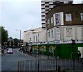
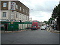
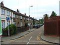
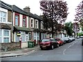
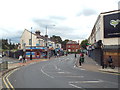
Photos of E13 0UU


Area Information
E13 0UU is a small residential cluster in east London with a population of 1810, characterised by a compact layout that blends proximity to urban amenities with a quieter, community-focused atmosphere. The area’s demographics suggest a mature population, with the majority of residents aged 30–64 years. This suggests a stable, established community with a focus on family living and long-term residency. The postcode’s limited size means it is tightly integrated with nearby hubs, offering easy access to transport networks, retail, and educational facilities. Daily life here is shaped by the availability of nearby schools, public transport, and local shops, making it a practical choice for those prioritising convenience. The area’s modest scale means it is not a sprawling suburb but a concentrated neighbourhood where residents are likely to know their neighbours. Its position within Newham ensures it is well-connected to the broader London infrastructure, though its small size means it is best suited for those seeking a manageable, well-served residential environment rather than a large, diverse city district.
- Area Type
- Postcode
- Area Size
- Not available
- Population
- 1810
- Population Density
- 19568 people/km²
The property market in E13 0UU is defined by its low home ownership rate of 24%, indicating that the majority of housing stock is rented rather than owned. The predominant accommodation type is flats, which is typical for smaller urban areas with limited space for larger homes. This suggests that the area is not a strong market for buyers seeking owner-occupied properties, but may appeal to renters looking for affordable, manageable housing in a well-connected location. The small size of the postcode means the housing stock is likely to be tightly clustered, with limited scope for expansion or development. For those considering property in the area, the focus would be on rental opportunities rather than long-term investment in ownership. The concentration of flats also implies a community-oriented living environment, where shared spaces and proximity to amenities are prioritised over private, standalone homes.
House Prices in E13 0UU
No properties found in this postcode.
Energy Efficiency in E13 0UU
E13 0UU offers a range of amenities within walking or short transport distance, supporting a practical lifestyle. Retail options include Co-op Newham, Tesco Green Gate, and Iceland 480-482, providing essential shopping and grocery needs. The area’s proximity to Plaistow, Upton Park, and Abbey Road DLR Stations ensures easy access to larger urban centres, while rail services at West Ham and Custom House Stations connect to broader London networks. Ferry piers such as East India Pier and Royal Wharf Pier add to the area’s transport diversity, and London City Airport is a notable nearby facility. The mix of retail, transport, and leisure options contributes to a convenient, well-served community. While the area’s small size means it lacks large-scale leisure facilities, its integration with surrounding hubs ensures residents can access a wide range of services without needing to travel far.
Amenities
Schools
E13 0UU is served by a mix of primary and independent schools, offering families a range of educational options. Curwen Primary and Nursery School, Curwen Infant School, and Curwen Primary School are all primary institutions, with the latter holding an Ofsted rating of outstanding. This suggests a strong local state education system, particularly for younger children. Independent schools such as JMU Islamic Institute Uk and Plaistow Jamia Islamia cater to specific educational preferences, likely serving families with particular religious or cultural needs. The presence of both state and independent schools provides flexibility for parents, whether they prioritise public education or seek alternative schooling. The outstanding rating at Curwen Primary School indicates a high standard of teaching and facilities, which could be a key factor for families evaluating the area’s suitability for their children’s education.
| Rank | School | Type | Entry gender | Ages |
|---|
Explore more schools in this area
Go to Schools tabDemographics
The population of E13 0UU has a median age of 47, with the most common age range being adults between 30 and 64 years. This indicates a community that is largely middle-aged, with a focus on established households and families. Home ownership in the area is low, at 24%, suggesting that the majority of residents are likely to be renting rather than owning their homes. The predominant accommodation type is flats, which aligns with the area’s compact nature and the typical housing stock in urban London. The predominant ethnic group is White, though no specific data on diversity or deprivation is provided. The low home ownership rate may reflect broader trends in London’s rental market, where flats are often more common in smaller, densely populated areas. For prospective buyers, this suggests that the area is not a strong candidate for property investment focused on owner-occupation, but may be more suited to renters seeking affordable, centrally located housing.
Household Size
Accommodation Type
Tenure
Ethnic Group
Religion
Household Composition
Age
Household Deprivation
NS-SEC
Explore more demographic insights in this area
Go to Demographics tabPlanning
Planning Constraints
- Flood RiskPremium
- Ramsar Wetland SitesPremium
- Area of Outstanding Natural BeautyPremium
- Protected Nature ReservePremium
- Protected WoodlandPremium