Area Overview for E13 0EU
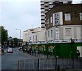
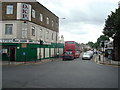
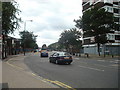
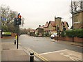
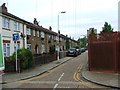
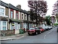
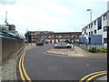
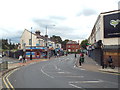
Photos of E13 0EU


Area Information
Living in E13 0EU means inhabiting a small, focused residential cluster in east London, where practicality meets proximity to major transport hubs. With a population of 1,810, this area is compact but well-served by amenities that cater to daily needs. The community benefits from its strategic location, with easy access to London City Airport and multiple rail, metro, and ferry connections. Daily life here is shaped by the mix of local shops, schools, and transport options, making it appealing to those prioritising convenience. While the area is modest in size, it offers a balance of residential tranquillity and urban connectivity. The presence of both state and independent schools ensures families have choices, while the low crime risk adds to the sense of security. For buyers, E13 0EU represents a niche market where property options are limited but the surrounding infrastructure is robust. Its character lies in its accessibility and the straightforwardness of its amenities, ideal for those seeking a base close to central London’s arteries.
- Area Type
- Postcode
- Area Size
- Not available
- Population
- 1810
- Population Density
- 19568 people/km²
The property market in E13 0EU is characterised by a low homeownership rate of 24%, suggesting that the area is largely occupied by renters rather than owner-occupiers. The accommodation type is predominantly flats, which aligns with the compact nature of the postcode and its focus on residential clusters. This configuration implies limited scope for larger family homes or detached properties, making it more suited to individuals or couples seeking manageable living spaces. The small size of the area means property availability is constrained, and buyers should consider the surrounding zones for broader options. Flats here are likely to be part of larger developments, with shared amenities and communal spaces. For those prioritising investment, the rental market may offer stability, though the low homeownership rate indicates a transient or economically diverse population.
House Prices in E13 0EU
No properties found in this postcode.
Energy Efficiency in E13 0EU
Residents of E13 0EU have access to a range of amenities within practical reach, from retail to transport. Local shops include Co-op Newham, Tesco Green Gate, and Iceland 480-482, providing everyday essentials. The area’s transport hubs—such as Plaistow DLR station and West Ham rail station—facilitate quick access to London’s broader network. While parks or leisure facilities are not explicitly named in the data, the proximity to ferry piers and the absence of environmental constraints suggest open spaces are limited. The mix of retail and transport options creates a functional lifestyle, ideal for those prioritising convenience over sprawling amenities. The area’s compact nature means residents must venture slightly beyond E13 0EU for larger leisure or cultural offerings, but the immediate vicinity offers sufficient practicality for daily needs.
Amenities
Schools
E13 0EU is served by a mix of primary and independent schools, offering families a range of educational choices. Curwen Primary and Nursery School, Curwen Infant School, and Curwen Primary School (rated outstanding by Ofsted) provide state education, while JMU Islamic Institute Uk and Plaistow Jamia Islamia cater to independent learning. The presence of both sectors ensures flexibility, whether parents seek state-funded education or faith-based institutions. The outstanding rating at Curwen Primary School underscores the quality of local state provision, which is rare in areas with limited resources. For families prioritising religious or cultural alignment, the independent schools offer tailored environments. However, the data does not specify catchment areas or pupil numbers, so prospective residents should verify admissions criteria. The diversity of school types reflects the community’s varied needs, though the absence of secondary schools nearby may require commuting for older students.
| Rank | School | Type | Entry gender | Ages |
|---|
Explore more schools in this area
Go to Schools tabDemographics
E13 0EU’s population of 1,810 is predominantly composed of adults aged 30–64, with a median age of 47. This suggests a mature, stable community where homeownership is relatively low at 24%, indicating a rental market with flats as the primary accommodation type. The demographic profile reflects a population that is neither young nor elderly, with no specific data on deprivation levels, but the age range implies a focus on working-age households. The predominant ethnic group is White, though the data does not specify further diversity metrics. The absence of detailed information on household composition or income brackets means the area’s socioeconomic profile remains partially opaque. However, the presence of independent schools like JMU Islamic Institute Uk and Plaistow Jamia Islamia hints at a community with varied cultural and educational priorities.
Household Size
Accommodation Type
Tenure
Ethnic Group
Religion
Household Composition
Age
Household Deprivation
NS-SEC
Explore more demographic insights in this area
Go to Demographics tabPlanning
Planning Constraints
- Flood RiskPremium
- Ramsar Wetland SitesPremium
- Area of Outstanding Natural BeautyPremium
- Protected Nature ReservePremium
- Protected WoodlandPremium