Area Overview for E13 0UP
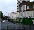
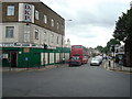
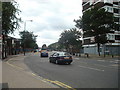
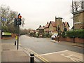
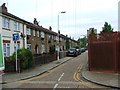
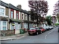
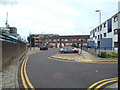
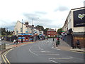
Photos of E13 0UP


Area Information
E13 0UP is a small, tightly knit residential postcode in east London with a population of 1810. It is a modest area characterised by a cluster of flats, reflecting its focus on rental properties rather than owner-occupied homes. The community is predominantly composed of adults aged 30–64, with a median age of 47, suggesting a mature, stable demographic. Daily life here is shaped by proximity to essential services, including multiple retail outlets, public transport hubs, and schools. The area’s compact size means residents can access amenities like Co-op Newham, Tesco Green Gate, and nearby DLR stations within walking distance. While it lacks the grandeur of larger urban centres, E13 0UP offers practical living with a blend of local shops, transport links, and educational institutions. Its appeal lies in its accessibility and the balance between affordability and connectivity, though its small footprint means it is best suited for those prioritising convenience over expansive space.
- Area Type
- Postcode
- Area Size
- Not available
- Population
- 1810
- Population Density
- 19568 people/km²
The property market in E13 0UP is dominated by rental flats, with only 24% of homes owned by residents. This suggests a strong presence of private landlords or investment properties, rather than owner-occupied residences. The prevalence of flats indicates a focus on smaller, more compact living spaces, which is typical for areas with limited land availability. Buyers considering this area should note that the housing stock is unlikely to include large detached homes or semi-detached properties. The small size of the postcode means the immediate surroundings may offer similar options, though the low home ownership rate implies competition for available properties. For those seeking a long-term home, the market may be more suited to renters or investors rather than first-time buyers looking for ownership. The area’s proximity to transport links and amenities may offset its limitations in property size and diversity.
House Prices in E13 0UP
No properties found in this postcode.
Energy Efficiency in E13 0UP
Living in E13 0UP offers a practical lifestyle with access to essential amenities within easy reach. The area is served by five retail outlets, including Co-op Newham, Tesco Green Gate, and Iceland, ensuring everyday shopping needs are met. Public transport is a key feature, with five DLR stations, five rail stations, and ferry piers providing seamless connections to London’s transport network. The proximity to London City Airport adds to the area’s accessibility, making it ideal for those with travel or business-related needs. Residents can also utilise the Whipps Cross Bus Interchange for further connectivity. While the area lacks expansive parks or leisure facilities, its compact design ensures that shops, transport hubs, and services are all within walking distance. This focus on convenience over space suits those who prioritise efficiency in daily life, though it may not appeal to those seeking larger recreational areas.
Amenities
Schools
E13 0UP is served by a range of primary and independent schools, offering families a choice of educational settings. Curwen Primary and Nursery School and Curwen Infant School provide state-funded primary education, while JMU Islamic Institute Uk and Plaistow Jamia Islamia are independent institutions catering to specific religious or cultural needs. The area also includes Curwen Primary School, which holds an outstanding Ofsted rating, a rare distinction that highlights its quality of education. This mix of school types allows families to select between state and independent options, depending on their priorities. The presence of multiple schools within proximity suggests a focus on education in the area, though the absence of secondary schools may require residents to travel further for older children’s schooling. The outstanding-rated primary school, in particular, could be a significant draw for families prioritising academic standards.
| Rank | School | Type | Entry gender | Ages |
|---|
Explore more schools in this area
Go to Schools tabDemographics
The population of E13 0UP is 1810, with a median age of 47, indicating a community skewed towards middle-aged adults. The most common age range is 30–64 years, reflecting a mature demographic profile. Home ownership in the area is low, with only 24% of residents owning their homes, suggesting a rental-dominated market. The predominant accommodation type is flats, which aligns with the area’s compact nature and limited space for larger properties. The predominant ethnic group is White, though specific data on diversity beyond this is not provided. The low home ownership rate may indicate a transient population or a focus on rental properties, which could influence the local housing market dynamics. The age profile suggests a community with established careers and families, though the absence of detailed data on deprivation or household composition means further insights are not available.
Household Size
Accommodation Type
Tenure
Ethnic Group
Religion
Household Composition
Age
Household Deprivation
NS-SEC
Explore more demographic insights in this area
Go to Demographics tabPlanning
Planning Constraints
- Flood RiskPremium
- Ramsar Wetland SitesPremium
- Area of Outstanding Natural BeautyPremium
- Protected Nature ReservePremium
- Protected WoodlandPremium